TopoQuest Logo
Do you find TopoQuest useful?
Help keep TopoQuest running and adding new maps/features by donating!
Bitcoin:  19c7KJd3qBynnjoSw5npx9KScwjBe4ifkT
Litecoin:  LXs6TkuXGGXo1vDsWCkWVdjQX94eUKd6ui
Home View Maps Find Maps Find Places Resources & Links


Tehachapi North, California Topographic Map

USGS Map Title: Tehachapi North, CA
USGS Map MRC: 35118B4
DRG (GeoTIFF) Download: o35118b4.tif


Neighboring USGS Topographic Map Quads:


  Oiler Peak, CA  
35118C5
 

  Loraine, CA  
35118C4
 

  Emerald Mountain, CA  
35118C3
 

  Keene, CA  
35118B5
 

  Tehachapi North, CA  
35118B4
 

  Tehachapi NE, CA  
35118B3
 

  Cummings Mountain, CA  
35118A5
 

  Tehachapi South, CA  
35118A4
 

  Monolith, CA  
35118A3


Map MRC Location:

N36°
W119°
N36°
W118°
H8 H7 H6 H5 H4 H3 H2 H1
G8 G7 G6 G5 G4 G3 G2 G1
F8 F7 F6 F5 F4 F3 F2 F1
E8 E7 E6 E5 E4 E3 E2 E1
D8 D7 D6 D5 D4 D3 D2 D1
C8 C7 C6 C5 C4 C3 C2 C1
B8 B7 B6 B5 B4 B3 B2 B1
A8 A7 A6 A5 A4 A3 A2 A1
N35°
W119°
N35°
W118°

Tehachapi North, CA USGS 1:24K Topographic Map Preview:
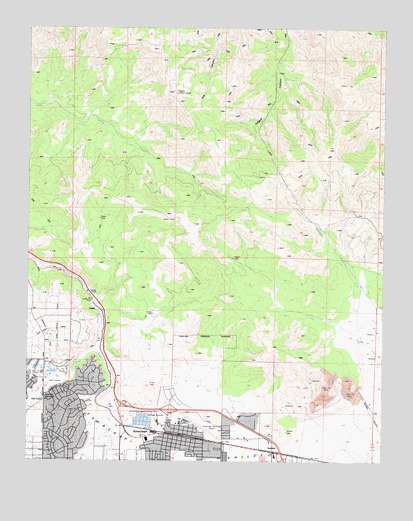
Tehachapi North, CA USGS Topographic Map
Click on map above to begin viewing in our Map Viewer.

This topographic map contains these locations and features:
Feature Name Type Latitude Longitude GNIS ID View Map
Apostolic Faith ChurchChurchN35.1283°W118.4504°1839400View Map
Brite CreekStreamN35.1575°W118.4762°239691View Map
CablePopulated PlaceN35.1691°W118.4762°1660403View Map
Church of ChristChurchN35.1291°W118.4531°1839401View Map
City of TehachapiCivilN35.1319°W118.4415°2412041View Map
College of the TehachapisSchoolN35.1339°W118.4493°1839402View Map
Community United Church of ChristChurchN35.1311°W118.4473°1839403View Map
Golden HillsPopulated PlaceN35.1425°W118.4904°1867025View Map
Golden Hills Elementary SchoolSchoolN35.1277°W118.4904°1839404View Map
Golden Hills Golf CourseLocaleN35.1489°W118.4940°1654653View Map
Good Shepherd Lutheran ChurchChurchN35.1297°W118.4531°1839405View Map
Hall RanchLocaleN35.1544°W118.4937°1682595View Map
Jacobsen Junior High SchoolSchoolN35.1300°W118.4379°1839406View Map
Kern County Sheriff's Office Tehachapi StationBuildingN35.1427°W118.4954°2756532View Map
Kingdom Hall of Jehovahs WitnessesChurchN35.1280°W118.4859°1839407View Map
Meadowbrook FarmLocaleN35.1355°W118.4793°1682601View Map
Meadowood ParkParkN35.1369°W118.4793°1839408View Map
Mision Asamblea de DiosChurchN35.1291°W118.4512°1839409View Map
Monroe Continuation High SchoolSchoolN35.1298°W118.4377°1839410View Map
Old TownPopulated PlaceN35.1427°W118.4948°252952View Map
Old Town State Historic LandmarkParkN35.1430°W118.4945°1839411View Map
Saint Malachys Catholic ChurchChurchN35.1308°W118.4490°1839412View Map
Saint Malachys SchoolSchoolN35.1316°W118.4531°248667View Map
Sullivan (historical)Populated PlaceN35.1264°W118.4054°1703105View Map
SummitPopulated PlaceN35.1277°W118.4140°252989View Map
Summit High SchoolSchoolN35.1266°W118.4381°1839464View Map
TehachapiPopulated PlaceN35.1322°W118.4490°1652798View Map
Tehachapi Branch Kern County LibraryBuildingN35.1314°W118.4529°1839413View Map
Tehachapi City HallBuildingN35.1311°W118.4462°1839414View Map
Tehachapi City ParkParkN35.1286°W118.4440°1839415View Map
Tehachapi High SchoolSchoolN35.1269°W118.4354°1839416View Map
Tehachapi HospitalHospitalN35.1304°W118.4488°2660946View Map
Tehachapi Municipal AirportAirportN35.1350°W118.4393°1654044View Map
Tehachapi Police DepartmentBuildingN35.1310°W118.4463°2756233View Map
Tehachapi Post OfficePost OfficeN35.1449°W118.4529°1839417View Map
Tehachapi Seventh Day Adventist ChurchChurchN35.1311°W118.4473°1839418View Map
Tehachapi Valley United Methodist ChurchChurchN35.1283°W118.4495°1839419View Map
The Kings Gathering ChurchChurchN35.1277°W118.4904°1839420View Map
Tollgate Lookout TowerTowerN35.2316°W118.4504°1654844View Map
Tom Sawyer LakeLakeN35.1508°W118.4925°250530View Map
Wells Elementary SchoolSchoolN35.1289°W118.4462°251303View Map
West ParkParkN35.1289°W118.4551°1839421View Map
Whiterock CreekStreamN35.1591°W118.3834°251497View Map

Note: Coordinates in the location and feature list above are referenced to NAD83 datum.


Copyright (C) 2008-2025 Ryan Niemi / Sunset Dynamics ... All Rights Reserved