TopoQuest Logo
Do you find TopoQuest useful?
Help keep TopoQuest running and adding new maps/features by donating!
Bitcoin:  19c7KJd3qBynnjoSw5npx9KScwjBe4ifkT
Litecoin:  LXs6TkuXGGXo1vDsWCkWVdjQX94eUKd6ui
Home View Maps Find Maps Find Places Resources & Links


Emerald Mountain, California Topographic Map

USGS Map Title: Emerald Mountain, CA
USGS Map MRC: 35118C3
DRG (GeoTIFF) Download: o35118c3.tif


Neighboring USGS Topographic Map Quads:


  Piute Peak, CA  
35118D4
 

  Claraville, CA  
35118D3
 

  Pinyon Mountain, CA  
35118D2
 

  Loraine, CA  
35118C4
 

  Emerald Mountain, CA  
35118C3
 

  Cross Mountain, CA  
35118C2
 

  Tehachapi North, CA  
35118B4
 

  Tehachapi NE, CA  
35118B3
 

  Cache Peak, CA  
35118B2


Map MRC Location:

N36°
W119°
N36°
W118°
H8 H7 H6 H5 H4 H3 H2 H1
G8 G7 G6 G5 G4 G3 G2 G1
F8 F7 F6 F5 F4 F3 F2 F1
E8 E7 E6 E5 E4 E3 E2 E1
D8 D7 D6 D5 D4 D3 D2 D1
C8 C7 C6 C5 C4 C3 C2 C1
B8 B7 B6 B5 B4 B3 B2 B1
A8 A7 A6 A5 A4 A3 A2 A1
N35°
W119°
N35°
W118°

Emerald Mountain, CA USGS 1:24K Topographic Map Preview:
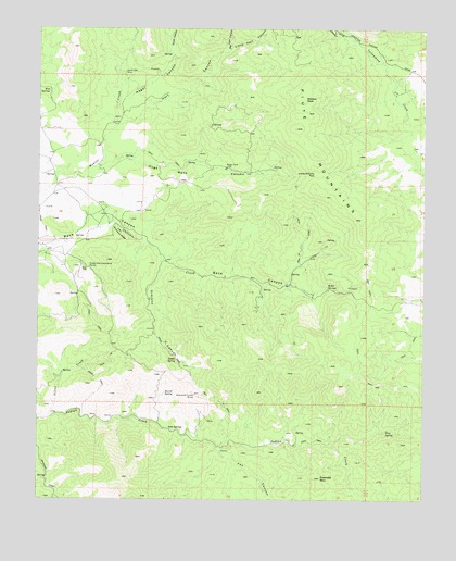
Emerald Mountain, CA USGS Topographic Map
Click on map above to begin viewing in our Map Viewer.

This topographic map contains these locations and features:
Feature Name Type Latitude Longitude GNIS ID View Map
Antimony RidgeRidgeN35.3205°W118.3490°238655View Map
Arnold RanchLocaleN35.2647°W118.2923°1670180View Map
Barrel SpringSpringN35.2782°W118.3346°239003View Map
Big Hart CanyonValleyN35.3686°W118.3148°269827View Map
Emerald MountainSummitN35.2558°W118.2840°241996View Map
Fox CanyonValleyN35.2636°W118.3176°242422View Map
Hamp Williams PassGapN35.3363°W118.2859°243159View Map
Hard Luck MineMineN35.3630°W118.3479°243211View Map
Hart CanyonValleyN35.3494°W118.3501°243258View Map
Hugh Mann CanyonValleyN35.3377°W118.3576°243720View Map
Little Hart CanyonValleyN35.3686°W118.3148°272091View Map
Mammoth Eureka MinesMineN35.2772°W118.3234°245421View Map
Miller Ranch (historical)LocaleN35.3050°W118.2837°1670185View Map
Miller SpringsSpringN35.3062°W118.2826°245936View Map
Mud SpringsSpringN35.3586°W118.3720°246332View Map
Nagel CanyonValleyN35.3552°W118.3501°246426View Map
Orejano CanyonValleyN35.3138°W118.3359°246956View Map
Pine SpringSpringN35.2686°W118.2626°247516View Map
Saddle SpringSpringN35.2869°W118.3308°248513View Map
Silver CreekStreamN35.2722°W118.3715°249470View Map
Smith CanyonValleyN35.3672°W118.3323°273760View Map
Soda SpringsSpringN35.2686°W118.3329°249640View Map
Weldon PeakSummitN35.3566°W118.2901°1656654View Map
Weldons RanchLocaleN35.3425°W118.2520°1703106View Map
Wooden Shoe Annies RanchLocaleN35.3122°W118.3595°251786View Map

Note: Coordinates in the location and feature list above are referenced to NAD83 datum.


Copyright (C) 2008-2024 Ryan Niemi / Sunset Dynamics ... All Rights Reserved