TopoQuest Logo
Do you find TopoQuest useful?
Help keep TopoQuest running and adding new maps/features by donating!
Bitcoin:  19c7KJd3qBynnjoSw5npx9KScwjBe4ifkT
Litecoin:  LXs6TkuXGGXo1vDsWCkWVdjQX94eUKd6ui
Home View Maps Find Maps Find Places Resources & Links


Temple Peak, Idaho Topographic Map

USGS Map Title: Temple Peak, ID
USGS Map MRC: 43111F4
DRG (GeoTIFF) Download: o43111f4.tif


Neighboring USGS Topographic Map Quads:


  White Owl Butte, ID  
43111G5
 

  Wright Creek, ID  
43111G4
 

  Packsaddle Lake, ID  
43111G3
 

  Hawley Gulch, ID  
43111F5
 

  Temple Peak, ID  
43111F4
 

  Garns Mountain, ID  
43111F3
 

  Heise SE, ID  
43111E5
 

  Wheaton Mountain, ID  
43111E4
 

  Stouts Mountain, ID  
43111E3


Map MRC Location:

N44°
W112°
N44°
W111°
H8 H7 H6 H5 H4 H3 H2 H1
G8 G7 G6 G5 G4 G3 G2 G1
F8 F7 F6 F5 F4 F3 F2 F1
E8 E7 E6 E5 E4 E3 E2 E1
D8 D7 D6 D5 D4 D3 D2 D1
C8 C7 C6 C5 C4 C3 C2 C1
B8 B7 B6 B5 B4 B3 B2 B1
A8 A7 A6 A5 A4 A3 A2 A1
N43°
W112°
N43°
W111°

Temple Peak, ID USGS 1:24K Topographic Map Preview:
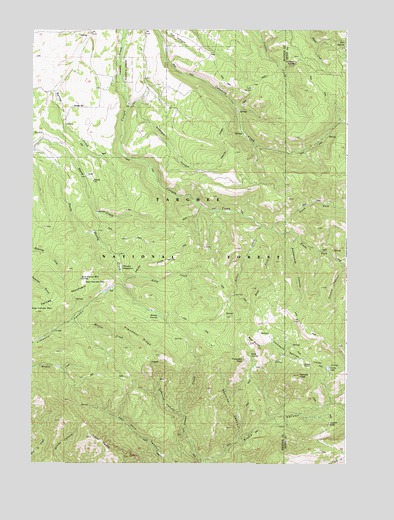
Temple Peak, ID USGS Topographic Map
Click on map above to begin viewing in our Map Viewer.

This topographic map contains these locations and features:
Feature Name Type Latitude Longitude GNIS ID View Map
Argument RidgeRidgeN43.6610°W111.4569°376707View Map
Beartrap CanyonValleyN43.6316°W111.4141°377219View Map
Bex SpringSpringN43.7465°W111.3763°377420View Map
Buck SpringSpringN43.6563°W111.4135°2785872View Map
Carlton Cutoff TrailTrailN43.7077°W111.4330°395178View Map
Castle LakeLakeN43.6525°W111.3826°379007View Map
Coalmine CanyonValleyN43.6396°W111.4411°379473View Map
Coalmine CreekStreamN43.6399°W111.4413°395228View Map
Crystal LakeLakeN43.6371°W111.3822°380135View Map
East Farnes MountainSummitN43.6766°W111.4755°397671View Map
East Farnes Mountain SpringSpringN43.6780°W111.4808°381034View Map
Farnes MountainSummitN43.6685°W111.4988°381600View Map
Flat HollowValleyN43.7496°W111.4500°381835View Map
Graham SpringSpringN43.7407°W111.3957°382496View Map
Hilton CreekStreamN43.6941°W111.4994°383215View Map
Kirkham HollowValleyN43.7299°W111.4588°384255View Map
Little Burns CanyonValleyN43.6269°W111.4277°384754View Map
Lost SpringSpringN43.7329°W111.4133°386185View Map
Marlow CreekStreamN43.6657°W111.4858°386474View Map
Moody MeadowFlatN43.6816°W111.4625°374004View Map
Moody SwampSwampN43.6680°W111.4508°387127View Map
North Fork Canyon CreekStreamN43.6930°W111.4050°387670View Map
Prospect PeakSummitN43.6555°W111.3755°398013View Map
Ruby CreekStreamN43.6794°W111.4633°389695View Map
Sheep CreekStreamN43.7152°W111.5000°390183View Map
South Fork Canyon CreekStreamN43.6902°W111.4050°390900View Map
Thousand Springs ValleyValleyN43.6569°W111.3997°392068View Map
Twin PeaksSummitN43.6330°W111.4766°398278View Map
West Farnes MountainSummitN43.6691°W111.4986°398335View Map

Note: Coordinates in the location and feature list above are referenced to NAD83 datum.


Copyright (C) 2008-2025 Ryan Niemi / Sunset Dynamics ... All Rights Reserved