TopoQuest Logo
Do you find TopoQuest useful?
Help keep TopoQuest running and adding new maps/features by donating!
Bitcoin:  19c7KJd3qBynnjoSw5npx9KScwjBe4ifkT
Litecoin:  LXs6TkuXGGXo1vDsWCkWVdjQX94eUKd6ui
Home View Maps Find Maps Find Places Resources & Links


Stouts Mountain, Idaho Topographic Map

USGS Map Title: Stouts Mountain, ID
USGS Map MRC: 43111E3
DRG (GeoTIFF) Download: o43111e3.tif


Neighboring USGS Topographic Map Quads:


  Temple Peak, ID  
43111F4
 

  Garns Mountain, ID  
43111F3
 

  Bates, ID  
43111F2
 

  Wheaton Mountain, ID  
43111E4
 

  Stouts Mountain, ID  
43111E3
 

  Fourth of July Peak, ID  
43111E2
 

  Conant Valley, ID  
43111D4
 

  Swan Valley, ID  
43111D3
 

  Thompson Peak, ID  
43111D2


Map MRC Location:

N44°
W112°
N44°
W111°
H8 H7 H6 H5 H4 H3 H2 H1
G8 G7 G6 G5 G4 G3 G2 G1
F8 F7 F6 F5 F4 F3 F2 F1
E8 E7 E6 E5 E4 E3 E2 E1
D8 D7 D6 D5 D4 D3 D2 D1
C8 C7 C6 C5 C4 C3 C2 C1
B8 B7 B6 B5 B4 B3 B2 B1
A8 A7 A6 A5 A4 A3 A2 A1
N43°
W112°
N43°
W111°

Stouts Mountain, ID USGS 1:24K Topographic Map Preview:
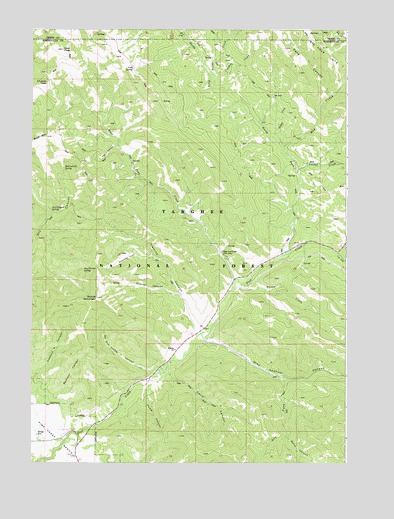
Stouts Mountain, ID USGS Topographic Map
Click on map above to begin viewing in our Map Viewer.

This topographic map contains these locations and features:
Feature Name Type Latitude Longitude GNIS ID View Map
Beckman CanyonValleyN43.5077°W111.3608°399437View Map
Burnt CanyonValleyN43.5080°W111.2724°378541View Map
Canal CanyonValleyN43.5285°W111.3205°378838View Map
Cave CanyonValleyN43.6057°W111.2569°379056View Map
Chicken CreekStreamN43.6113°W111.3019°379258View Map
Chicken PeakSummitN43.6096°W111.3688°397546View Map
Cold SpringSpringN43.6136°W111.3353°379528View Map
Corral CreekStreamN43.5844°W111.2691°379787View Map
Dry Canyon SpringSpringN43.5725°W111.3672°380802View Map
Dry ForkValleyN43.5255°W111.2752°380847View Map
Fleming CanyonValleyN43.5374°W111.3094°381855View Map
Flume CanyonValleyN43.5244°W111.3277°381878View Map
Gopher CanyonValleyN43.5485°W111.3147°382454View Map
Gopher CreekStreamN43.5485°W111.3158°399049View Map
Holter CreekStreamN43.6085°W111.3030°396659View Map
Liars PeakSummitN43.6191°W111.3627°397853View Map
Lookingglass CreekStreamN43.6235°W111.3141°386103View Map
McCoullock SpringSpringN43.5849°W111.3625°386586View Map
Mike Spencer CanyonValleyN43.5374°W111.3069°386890View Map
No Cut Timber CanyonValleyN43.5269°W111.3280°399142View Map
No Cut Timber CreekStreamN43.5269°W111.3249°399143View Map
North Fork Pine CreekStreamN43.5602°W111.2747°387752View Map
Number Cut Timber CanyonValleyN43.5269°W111.3249°387888View Map
Pine Basin Ski AreaLocaleN43.5316°W111.3272°399185View Map
Poison CreekStreamN43.5527°W111.2922°388633View Map
Red CreekStreamN43.5913°W111.2747°389189View Map
Roy Farnes SpringSpringN43.5556°W111.3547°389686View Map
Snowslide GulchValleyN43.5602°W111.3266°390782View Map
Station CreekStreamN43.5935°W111.2763°391373View Map
Stouts MountainSummitN43.5477°W111.3486°398192View Map
Tie CanyonValleyN43.5610°W111.2533°392124View Map
Trail CanyonValleyN43.5916°W111.3405°392263View Map
West Pine CreekStreamN43.5532°W111.2938°393239View Map
West Pine Creek Girls CampLocaleN43.5607°W111.2988°393241View Map
Wolf CreekStreamN43.5013°W111.3711°399714View Map

Note: Coordinates in the location and feature list above are referenced to NAD83 datum.


Copyright (C) 2008-2025 Ryan Niemi / Sunset Dynamics ... All Rights Reserved