TopoQuest Logo
Do you find TopoQuest useful?
Help keep TopoQuest running and adding new maps/features by donating!
Bitcoin:  19c7KJd3qBynnjoSw5npx9KScwjBe4ifkT
Litecoin:  LXs6TkuXGGXo1vDsWCkWVdjQX94eUKd6ui
Home View Maps Find Maps Find Places Resources & Links


Tennant, California Topographic Map

USGS Map Title: Tennant, CA
USGS Map MRC: 41121E8
DRG (GeoTIFF) Download: o41121e8.tif


Neighboring USGS Topographic Map Quads:


  Penoyar, CA  
41122F1
 

  Bray, CA  
41121F8
 

  Sharp Mountain, CA  
41121F7
 

  West Haight Mountain, CA  
41122E1
 

  Tennant, CA  
41121E8
 

  Garner Mountain, CA  
41121E7
 

  Ash Creek Butte, CA  
41122D1
 

  Rainbow Mountain, CA  
41121D8
 

  Horse Peak, CA  
41121D7


Map MRC Location:

N42°
W122°
N42°
W121°
H8 H7 H6 H5 H4 H3 H2 H1
G8 G7 G6 G5 G4 G3 G2 G1
F8 F7 F6 F5 F4 F3 F2 F1
E8 E7 E6 E5 E4 E3 E2 E1
D8 D7 D6 D5 D4 D3 D2 D1
C8 C7 C6 C5 C4 C3 C2 C1
B8 B7 B6 B5 B4 B3 B2 B1
A8 A7 A6 A5 A4 A3 A2 A1
N41°
W122°
N41°
W121°

Tennant, CA USGS 1:24K Topographic Map Preview:
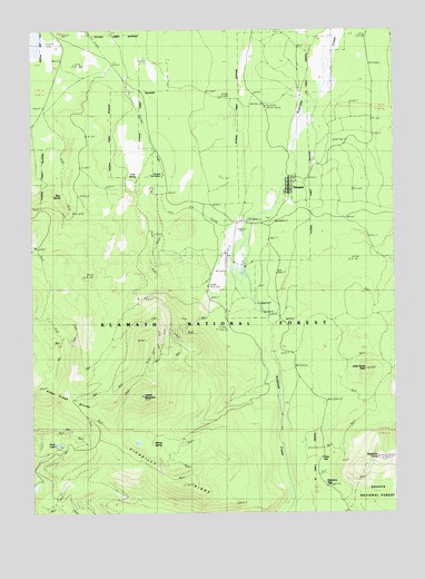
Tennant, CA USGS Topographic Map
Click on map above to begin viewing in our Map Viewer.

This topographic map contains these locations and features:
Feature Name Type Latitude Longitude GNIS ID View Map
Bishop SpringSpringN41.5178°W121.9597°1657749View Map
Blue SpringSpringN41.5820°W121.9907°277065View Map
Cold SpringSpringN41.5907°W121.9644°221334View Map
Duck LakeLakeN41.5176°W121.9925°222686View Map
False GapGapN41.5124°W121.9036°223378View Map
Haight MountainSummitN41.5299°W121.9642°224782View Map
Little Horse PeakSummitN41.5365°W121.8869°227276View Map
Picadilly RidgeRidgeN41.5249°W121.9733°253751View Map
Pollock FlatFlatN41.6138°W121.9589°230903View Map
Stephens ButteSummitN41.5140°W121.8819°277062View Map
Stephens PassGapN41.5057°W121.8975°235447View Map
TennantPopulated PlaceN41.5838°W121.9133°1659968View Map
Tennant CampgroundLocaleN41.5874°W121.9083°276440View Map
Tennant Census Designated PlaceCensusN41.5819°W121.9148°2410067View Map
Tennant Fire DepartmentBuildingN41.5822°W121.9125°2622117View Map
Tennant Forest Service StationLocaleN41.5871°W121.9550°277066View Map

Note: Coordinates in the location and feature list above are referenced to NAD83 datum.


Copyright (C) 2008-2025 Ryan Niemi / Sunset Dynamics ... All Rights Reserved