TopoQuest Logo
Do you find TopoQuest useful?
Help keep TopoQuest running and adding new maps/features by donating!
Bitcoin:  19c7KJd3qBynnjoSw5npx9KScwjBe4ifkT
Litecoin:  LXs6TkuXGGXo1vDsWCkWVdjQX94eUKd6ui
Home View Maps Find Maps Find Places Resources & Links


Tepee Butte NE, Montana Topographic Map

USGS Map Title: Tepee Butte NE, MT
USGS Map MRC: 46105B1
DRG (GeoTIFF) Download: o46105b1.tif


Neighboring USGS Topographic Map Quads:


  Red Knob, MT  
46105C2
 

  Knowlton, MT  
46105C1
 

  Foundation Spring, MT  
46104C8
 

  Pennock Creek, MT  
46105B2
 

  Tepee Butte NE, MT  
46105B1
 

  Hooky Dam, MT  
46104B8
 

  Bear Jaw Creek, MT  
46105A2
 

  Tepee Butte, MT  
46105A1
 

  North Fork Alkali Creek, MT  
46104A8


Map MRC Location:

N47°
W106°
N47°
W105°
H8 H7 H6 H5 H4 H3 H2 H1
G8 G7 G6 G5 G4 G3 G2 G1
F8 F7 F6 F5 F4 F3 F2 F1
E8 E7 E6 E5 E4 E3 E2 E1
D8 D7 D6 D5 D4 D3 D2 D1
C8 C7 C6 C5 C4 C3 C2 C1
B8 B7 B6 B5 B4 B3 B2 B1
A8 A7 A6 A5 A4 A3 A2 A1
N46°
W106°
N46°
W105°

Tepee Butte NE, MT USGS 1:24K Topographic Map Preview:
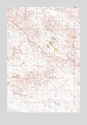
Tepee Butte NE, MT USGS Topographic Map
Click on map above to begin viewing in our Map Viewer.

This topographic map contains these locations and features:
Feature Name Type Latitude Longitude GNIS ID View Map
04N53E01BB__01 WellWellN46.1344°W105.0797°814155View Map
04N53E01BCAD01 WellWellN46.1319°W105.0711°814137View Map
04N53E02BBB_01 WellWellN46.1339°W105.0997°814151View Map
04N53E02BBDC01 WellWellN46.1333°W105.0980°814147View Map
05N53E17DAAA01 WellWellN46.1872°W105.0950°814481View Map
05N53E19AACB01 WellWellN46.1756°W105.1194°814406View Map
05N53E19BACA01 WellWellN46.1783°W105.1175°814430View Map
05N53E25BACC01 WellWellN46.1542°W105.0255°814279View Map
05N53E33ADAA01 WellWellN46.1472°W105.0736°814237View Map
05N53E35CCBD01 WellWellN46.1389°W105.0505°814179View Map
05N54E32CCC_01 WellWellN46.1381°W105.0136°814174View Map
06N53E33AAAA01 WellWellN46.2381°W105.0741°814724View Map
06N53E35AAAA01 WellWellN46.2381°W105.0327°814723View Map
Balsam Number 3 DamDamN46.1833°W105.0722°796901View Map
Foundation DrawValleyN46.2314°W105.0147°799484View Map
Lone Tree CreekStreamN46.1350°W105.0122°773593View Map
North Fork Sheep CreekStreamN46.2464°W105.0650°774807View Map
South Fork Sheep CreekStreamN46.2481°W105.0761°776872View Map
Straight CreekStreamN46.1356°W105.0641°777250View Map

Note: Coordinates in the location and feature list above are referenced to NAD83 datum.


Copyright (C) 2008-2025 Ryan Niemi / Sunset Dynamics ... All Rights Reserved