TopoQuest Logo
Do you find TopoQuest useful?
Help keep TopoQuest running and adding new maps/features by donating!
Bitcoin:  19c7KJd3qBynnjoSw5npx9KScwjBe4ifkT
Litecoin:  LXs6TkuXGGXo1vDsWCkWVdjQX94eUKd6ui
Home View Maps Find Maps Find Places Resources & Links


Terry, Mississippi Topographic Map

USGS Map Title: Terry, MS
USGS Map MRC: 32090A3
DRG (GeoTIFF) Download: o32090a3.tif


Neighboring USGS Topographic Map Quads:


  Terry NW, MS  
32090B4
 

  New Byram, MS  
32090B3
 

  Florence, MS  
32090B2
 

  Dabney Crossroads, MS  
32090A4
 

  Terry, MS  
32090A3
 

  Whites, MS  
32090A2
 

  Gallman, MS  
31090H4
 

  Crystal Springs, MS  
31090H3
 

  Hopewell, MS  
31090H2


Map MRC Location:

N33°
W91°
N33°
W90°
H8 H7 H6 H5 H4 H3 H2 H1
G8 G7 G6 G5 G4 G3 G2 G1
F8 F7 F6 F5 F4 F3 F2 F1
E8 E7 E6 E5 E4 E3 E2 E1
D8 D7 D6 D5 D4 D3 D2 D1
C8 C7 C6 C5 C4 C3 C2 C1
B8 B7 B6 B5 B4 B3 B2 B1
A8 A7 A6 A5 A4 A3 A2 A1
N32°
W91°
N32°
W90°

Terry, MS USGS 1:24K Topographic Map Preview:
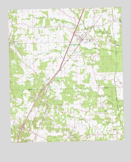
Terry, MS USGS Topographic Map
Click on map above to begin viewing in our Map Viewer.

This topographic map contains these locations and features:
Feature Name Type Latitude Longitude GNIS ID View Map
Beaverdam CreekStreamN32.0860°W90.3168°666729View Map
Benevolent Society CemeteryCemeteryN32.1063°W90.3009°666821View Map
BernardPopulated PlaceN32.1132°W90.2587°691699View Map
Berryhill Farms Airport (historical)AirportN32.0685°W90.3118°680331View Map
Christ Sanctified Holy ChurchChurchN32.0932°W90.3043°710199View Map
Clear Creek ChurchChurchN32.0135°W90.3665°668572View Map
Colils Hill Church of Christ HolinessChurchN32.0957°W90.2823°710204View Map
County Line Baptist ChurchChurchN32.0357°W90.3351°668869View Map
County Line CemeteryCemeteryN32.0363°W90.3348°708018View Map
Crystal Springs Lookout TowerTowerN32.0002°W90.3337°711224View Map
Crystal Springs Volunteer Fire DepartmentBuildingN32.0007°W90.3313°2667791View Map
Dixon Lake DamDamN32.0518°W90.3234°680990View Map
Dixon Pond DamDamN32.0618°W90.3218°680994View Map
Egypt HillPopulated PlaceN32.0102°W90.2623°669703View Map
Egypt Hill Baptist ChurchChurchN32.0099°W90.2648°686714View Map
Egypt Hill School (historical)SchoolN32.0093°W90.2620°686715View Map
Episcopal Church of the Good ShephardChurchN32.0952°W90.2959°710207View Map
Faith ChurchChurchN32.0046°W90.3395°669896View Map
First Baptist ChurchChurchN32.0982°W90.2962°710210View Map
George Lake DamDamN32.1118°W90.3234°681014View Map
Harris CreekStreamN32.1090°W90.2918°670975View Map
Interchange 72CrossingN32.0149°W90.3620°691415View Map
Interchange 78CrossingN32.1015°W90.3029°691416View Map
J A Parsons Lake DamDamN32.0385°W90.3168°680988View Map
Jesus Name ChurchChurchN32.0952°W90.2926°710219View Map
Kennedys Store Post Office (historical)Post OfficeN32.0085°W90.3404°712228View Map
La Bethel Methodist ChurchChurchN32.0993°W90.2940°710220View Map
McIntosh School (historical)SchoolN32.0646°W90.2823°688451View Map
MoncurePopulated PlaceN32.0554°W90.2595°692083View Map
Morgans StorePopulated PlaceN32.0935°W90.3723°673811View Map
Mount Pleasant ChurchChurchN32.0032°W90.3056°674225View Map
Perryman Elementary SchoolSchoolN32.0996°W90.3006°710230View Map
Pilgrim Rest Baptist ChurchChurchN32.0057°W90.3098°675770View Map
Pilgrims Rest ChurchChurchN32.0521°W90.2773°675771View Map
Pilgrims Rest School (historical)SchoolN32.0515°W90.2773°688541View Map
Rocky Spring ChurchChurchN32.0938°W90.3729°688574View Map
RosemaryPopulated PlaceN32.0882°W90.2598°676877View Map
Samuels Pond DamDamN32.0902°W90.3668°681007View Map
Sanctified Church (historical)ChurchN32.1074°W90.3268°688601View Map
Taylor Grove ChurchChurchN32.0424°W90.3723°678596View Map
TerryPopulated PlaceN32.0963°W90.2943°678644View Map
Terry AcademySchoolN32.1052°W90.2943°678645View Map
Terry CemeteryCemeteryN32.1026°W90.2990°678648View Map
Terry Grove Baptist ChurchChurchN32.1002°W90.2934°710240View Map
Terry High SchoolSchoolN32.0940°W90.2854°710241View Map
Terry Methodist ChurchChurchN32.0971°W90.2959°710242View Map
Terry Police DepartmentBuildingN32.0979°W90.2982°2754103View Map
Terry Post OfficePost OfficeN32.0991°W90.2982°712979View Map
Terry Sanctified ChurchChurchN32.0968°W90.2940°710243View Map
Terry Volunteer Fire DepartmentBuildingN32.0930°W90.3136°2667706View Map
Town of TerryCivilN32.1046°W90.2980°2406727View Map
Union Grove Church (historical)ChurchN32.1085°W90.3393°688652View Map
Warm Springs ChurchChurchN32.0346°W90.3181°679347View Map

Note: Coordinates in the location and feature list above are referenced to NAD83 datum.


Copyright (C) 2008-2025 Ryan Niemi / Sunset Dynamics ... All Rights Reserved