TopoQuest Logo
Do you find TopoQuest useful?
Help keep TopoQuest running and adding new maps/features by donating!
Bitcoin:  19c7KJd3qBynnjoSw5npx9KScwjBe4ifkT
Litecoin:  LXs6TkuXGGXo1vDsWCkWVdjQX94eUKd6ui
Home View Maps Find Maps Find Places Resources & Links


Teton Buttes, Montana Topographic Map

USGS Map Title: Teton Buttes, MT
USGS Map MRC: 47112G3
DRG (GeoTIFF) Download: o47112g3.tif


Neighboring USGS Topographic Map Quads:


  Bynum Reservoir, MT  
47112H4
 

  Bynum, MT  
47112H3
 

  Agawam South, MT  
47112H2
 

  Watson Flats, MT  
47112G4
 

  Teton Buttes, MT  
47112G3
 

  Choteau, MT  
47112G2
 

  Pishkun Reservoir, MT  
47112F4
 

  Nunemaker Hill, MT  
47112F3
 

  Sevenmile Hill, MT  
47112F2


Map MRC Location:

N48°
W113°
N48°
W112°
H8 H7 H6 H5 H4 H3 H2 H1
G8 G7 G6 G5 G4 G3 G2 G1
F8 F7 F6 F5 F4 F3 F2 F1
E8 E7 E6 E5 E4 E3 E2 E1
D8 D7 D6 D5 D4 D3 D2 D1
C8 C7 C6 C5 C4 C3 C2 C1
B8 B7 B6 B5 B4 B3 B2 B1
A8 A7 A6 A5 A4 A3 A2 A1
N47°
W113°
N47°
W112°

Teton Buttes, MT USGS 1:24K Topographic Map Preview:
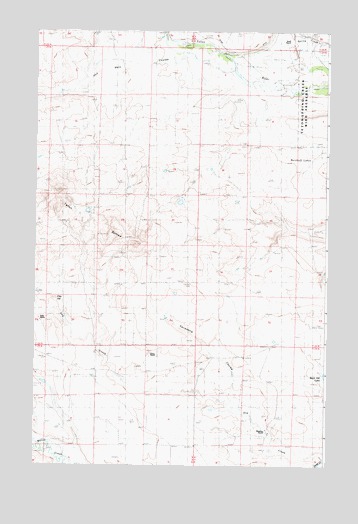
Teton Buttes, MT USGS Topographic Map
Click on map above to begin viewing in our Map Viewer.

This topographic map contains these locations and features:
Feature Name Type Latitude Longitude GNIS ID View Map
Blackfeet and Buffalo Historical MarkerParkN47.8611°W112.2800°1762024View Map
Clay HillSummitN47.7980°W112.3672°769913View Map
Gibson CouleeValleyN47.7786°W112.2578°1762028View Map
Greyn RanchLocaleN47.7813°W112.3275°771992View Map
Hod Main CouleeValleyN47.8611°W112.2845°772438View Map
Kalma Post Office (historical)Post OfficeN47.7713°W112.3342°1762068View Map
Klingensmith CouleeValleyN47.8550°W112.2772°1762046View Map
Knaff RanchLocaleN47.8705°W112.2659°773102View Map
Meadows RanchLocaleN47.7605°W112.2756°774068View Map
North Fork Klingensmith CouleeValleyN47.8350°W112.3000°1762040View Map
NW NW Section 11 MineMineN47.8044°W112.3245°803978View Map
Reickoff LakesLakeN47.8415°W112.2565°775696View Map
Ruebe RanchLocaleN47.7797°W112.3281°776008View Map
Sabo RanchLocaleN47.7925°W112.3734°776054View Map
SE NE Section 10 MineMineN47.8102°W112.3300°803977View Map
Sevenmile CouleeValleyN47.7538°W112.2725°776357View Map
South Fork Cashman CouleeValleyN47.8180°W112.2661°1762045View Map
South Fork Klingensmith CouleeValleyN47.8350°W112.3000°1762039View Map
SW NW Section 10 MineMineN47.8094°W112.3447°803979View Map
Teton ButtesSummitN47.8125°W112.3645°777479View Map

Note: Coordinates in the location and feature list above are referenced to NAD83 datum.


Copyright (C) 2008-2025 Ryan Niemi / Sunset Dynamics ... All Rights Reserved