TopoQuest Logo
Do you find TopoQuest useful?
Help keep TopoQuest running and adding new maps/features by donating!
Bitcoin:  19c7KJd3qBynnjoSw5npx9KScwjBe4ifkT
Litecoin:  LXs6TkuXGGXo1vDsWCkWVdjQX94eUKd6ui
Home View Maps Find Maps Find Places Resources & Links


Thatcher, Idaho Topographic Map

USGS Map Title: Thatcher, ID
USGS Map MRC: 42111D6
DRG (GeoTIFF) Download: o42111d6.tif


Neighboring USGS Topographic Map Quads:


  Grace Power Plant, ID  
42111E7
 

  Grace, ID  
42111E6
 

  Soda Peak, ID  
42111E5
 

  Thatcher Hill, ID  
42111D7
 

  Thatcher, ID  
42111D6
 

  North Canyon, ID  
42111D5
 

  Treasureton, ID  
42111C7
 

  Oneida Narrows Reservoir, ID  
42111C6
 

  Midnight Mountain, ID  
42111C5


Map MRC Location:

N43°
W112°
N43°
W111°
H8 H7 H6 H5 H4 H3 H2 H1
G8 G7 G6 G5 G4 G3 G2 G1
F8 F7 F6 F5 F4 F3 F2 F1
E8 E7 E6 E5 E4 E3 E2 E1
D8 D7 D6 D5 D4 D3 D2 D1
C8 C7 C6 C5 C4 C3 C2 C1
B8 B7 B6 B5 B4 B3 B2 B1
A8 A7 A6 A5 A4 A3 A2 A1
N42°
W112°
N42°
W111°

Thatcher, ID USGS 1:24K Topographic Map Preview:
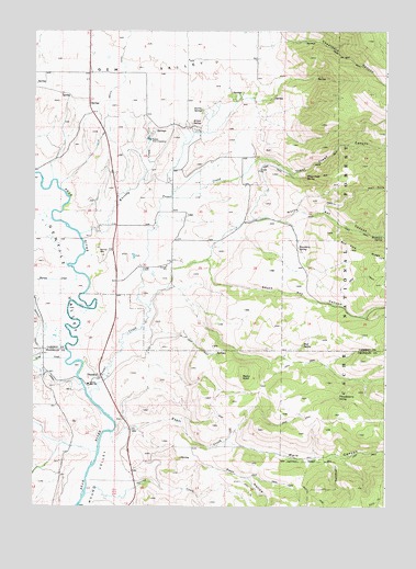
Thatcher, ID USGS Topographic Map
Click on map above to begin viewing in our Map Viewer.

This topographic map contains these locations and features:
Feature Name Type Latitude Longitude GNIS ID View Map
Bitton SpringSpringN42.4758°W111.6944°377715View Map
Boundary SpringSpringN42.4432°W111.6566°378126View Map
Burton CreekStreamN42.4360°W111.7355°378578View Map
Central High School (historical)SchoolN42.4074°W111.7308°401564View Map
Cheatbeck CanyonValleyN42.4974°W111.6633°379214View Map
Cheatbeck CreekStreamN42.4996°W111.6633°393926View Map
Gentile ValleyValleyN42.4102°W111.7358°382237View Map
Grace Fish HatcheryLocaleN42.4716°W111.7097°401364View Map
Harris SpringSpringN42.4793°W111.6910°382931View Map
Hell HoleValleyN42.4546°W111.6447°383063View Map
King CreekStreamN42.4138°W111.7377°384231View Map
Kuntz CreekStreamN42.3941°W111.7227°384316View Map
LagoPopulated PlaceN42.4513°W111.6966°397838View Map
Lago CemeteryCemeteryN42.4372°W111.7113°384336View Map
Main CanyonValleyN42.3916°W111.6797°386391View Map
Mickelson SpringSpringN42.4462°W111.6264°386776View Map
Mud SpringSpringN42.4177°W111.6548°387348View Map
North Ant CanyonValleyN42.4496°W111.6752°387612View Map
Post HollowValleyN42.3849°W111.6849°388800View Map
Rocky KnollSummitN42.4091°W111.6761°398064View Map
South Ant CanyonValleyN42.4396°W111.6886°390849View Map
Spring CreekStreamN42.3780°W111.7313°391194View Map
ThatcherPopulated PlaceN42.4088°W111.7269°398230View Map
Thatcher Elementary SchoolSchoolN42.4074°W111.7308°399254View Map
Thatcher Post OfficePost OfficeN42.4088°W111.7283°2781740View Map
Thimbleberry SpringSpringN42.4037°W111.6420°391997View Map
Trout CreekStreamN42.4035°W111.7294°392413View Map
Trout Creek CanyonValleyN42.4660°W111.6713°392422View Map
Trout Creek SpringSpringN42.4616°W111.6538°392426View Map
Trout SchoolSchoolN42.4396°W111.7013°399522View Map
Whiskey CreekStreamN42.4466°W111.7338°393286View Map

Note: Coordinates in the location and feature list above are referenced to NAD83 datum.


Copyright (C) 2008-2025 Ryan Niemi / Sunset Dynamics ... All Rights Reserved