TopoQuest Logo
Do you find TopoQuest useful?
Help keep TopoQuest running and adding new maps/features by donating!
Bitcoin:  19c7KJd3qBynnjoSw5npx9KScwjBe4ifkT
Litecoin:  LXs6TkuXGGXo1vDsWCkWVdjQX94eUKd6ui
Home View Maps Find Maps Find Places Resources & Links


North Canyon, Idaho Topographic Map

USGS Map Title: North Canyon, ID
USGS Map MRC: 42111D5
DRG (GeoTIFF) Download: o42111d5.tif


Neighboring USGS Topographic Map Quads:


  Grace, ID  
42111E6
 

  Soda Peak, ID  
42111E5
 

  Fossil Canyon, ID  
42111E4
 

  Thatcher, ID  
42111D6
 

  North Canyon, ID  
42111D5
 

  Nounan, ID  
42111D4
 

  Oneida Narrows Reservoir, ID  
42111C6
 

  Midnight Mountain, ID  
42111C5
 

  Ovid, ID  
42111C4


Map MRC Location:

N43°
W112°
N43°
W111°
H8 H7 H6 H5 H4 H3 H2 H1
G8 G7 G6 G5 G4 G3 G2 G1
F8 F7 F6 F5 F4 F3 F2 F1
E8 E7 E6 E5 E4 E3 E2 E1
D8 D7 D6 D5 D4 D3 D2 D1
C8 C7 C6 C5 C4 C3 C2 C1
B8 B7 B6 B5 B4 B3 B2 B1
A8 A7 A6 A5 A4 A3 A2 A1
N42°
W112°
N42°
W111°

North Canyon, ID USGS 1:24K Topographic Map Preview:
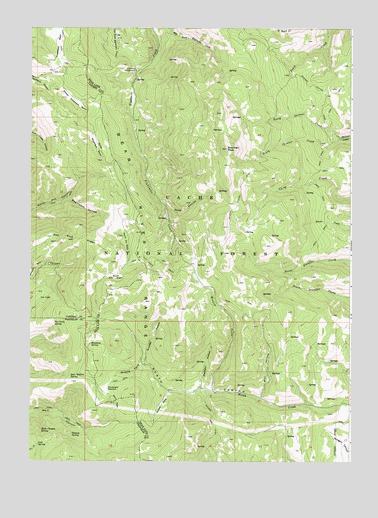
North Canyon, ID USGS Topographic Map
Click on map above to begin viewing in our Map Viewer.

This topographic map contains these locations and features:
Feature Name Type Latitude Longitude GNIS ID View Map
Balsam SpringSpringN42.3826°W111.6088°376923View Map
Bear Wallow SpringSpringN42.3994°W111.6094°377209View Map
Cheatbeck BasinBasinN42.4949°W111.6141°379213View Map
Deep HollowValleyN42.4499°W111.5736°380401View Map
Eightmile CampgroundLocaleN42.4877°W111.5847°381276View Map
Grunder HollowValleyN42.4035°W111.5802°382764View Map
Humberg SpringSpringN42.4086°W111.6017°383531View Map
Loa LakeLakeN42.4220°W111.6216°385017View Map
Lost SpringSpringN42.3798°W111.6219°386184View Map
Main Canyon SpringSpringN42.3838°W111.6208°386392View Map
Meadow CreekStreamN42.3949°W111.5530°386677View Map
Mercham HollowValleyN42.3966°W111.5583°386742View Map
Middle Fork North CanyonValleyN42.4030°W111.5827°386829View Map
Mill HollowValleyN42.3933°W111.5352°386958View Map
Moonlight MeadowFlatN42.3955°W111.5958°387139View Map
North Ant BasinBasinN42.4388°W111.5888°387611View Map
North Pearl CreekStreamN42.4999°W111.5236°387832View Map
North Skinner CreekStreamN42.4683°W111.5041°387840View Map
Red Pine RidgeRidgeN42.4396°W111.6194°389223View Map
Sherman PeakSummitN42.4652°W111.5491°390306View Map
South Ant BasinBasinN42.4277°W111.5922°390848View Map
South Cheatbeck BasinBasinN42.4669°W111.5997°390857View Map
South Fork North CanyonValleyN42.3946°W111.5711°390981View Map
South Skinner CreekStreamN42.4683°W111.5041°391075View Map
Swainston HollowValleyN42.4508°W111.6111°391699View Map
Tie Camp SpringSpringN42.4148°W111.6158°392123View Map

Note: Coordinates in the location and feature list above are referenced to NAD83 datum.


Copyright (C) 2008-2025 Ryan Niemi / Sunset Dynamics ... All Rights Reserved