TopoQuest Logo
Do you find TopoQuest useful?
Help keep TopoQuest running and adding new maps/features by donating!
Bitcoin:  19c7KJd3qBynnjoSw5npx9KScwjBe4ifkT
Litecoin:  LXs6TkuXGGXo1vDsWCkWVdjQX94eUKd6ui
Home View Maps Find Maps Find Places Resources & Links


The Dark Hole, California Topographic Map

USGS Map Title: The Dark Hole, CA
USGS Map MRC: 35120H3
DRG (GeoTIFF) Download: o35120h3.tif


Neighboring USGS Topographic Map Quads:


  Curry Mountain, CA  
36120A4
 

  Kreyenhagen Hills, CA  
36120A3
 

  Avenal, CA  
36120A2
 

  Parkfield, CA  
35120H4
 

  The Dark Hole, CA  
35120H3
 

  Garza Peak, CA  
35120H2
 

  Cholame Hills, CA  
35120G4
 

  Cholame Valley, CA  
35120G3
 

  Tent Hills, CA  
35120G2


Map MRC Location:

N36°
W121°
N36°
W120°
H8 H7 H6 H5 H4 H3 H2 H1
G8 G7 G6 G5 G4 G3 G2 G1
F8 F7 F6 F5 F4 F3 F2 F1
E8 E7 E6 E5 E4 E3 E2 E1
D8 D7 D6 D5 D4 D3 D2 D1
C8 C7 C6 C5 C4 C3 C2 C1
B8 B7 B6 B5 B4 B3 B2 B1
A8 A7 A6 A5 A4 A3 A2 A1
N35°
W121°
N35°
W120°

The Dark Hole, CA USGS 1:24K Topographic Map Preview:
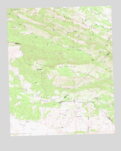
The Dark Hole, CA USGS Topographic Map
Click on map above to begin viewing in our Map Viewer.

This topographic map contains these locations and features:
Feature Name Type Latitude Longitude GNIS ID View Map
Black MountainRidgeN35.9402°W120.3210°239420View Map
Castle MountainSummitN35.9391°W120.3399°240332View Map
Cold SpringSpringN35.9579°W120.2931°240757View Map
Harlan Cabin (historical)BuildingN35.8755°W120.2824°1765913View Map
Kings MineMineN35.9094°W120.2713°244319View Map
La Jolla CreekStreamN35.9772°W120.2907°244413View Map
Merrill CabinLocaleN35.8880°W120.2613°245788View Map
Moore CabinLocaleN35.9900°W120.3213°246175View Map
Number Seven SpringSpringN35.9473°W120.2729°255673View Map
Nye Cabin (historical)BuildingN35.9716°W120.3418°1662221View Map
Oak FlatFlatN35.9813°W120.2660°246722View Map
Picacho RockSummitN35.9605°W120.2999°247439View Map
Pinoso House (historical)BuildingN35.9644°W120.3276°1662222View Map
Radcliff Cabin (historical)BuildingN35.8952°W120.2879°1765921View Map
Reedwater CanyonValleyN35.9986°W120.3626°248110View Map
Reef RidgeRidgeN35.9872°W120.3043°255710View Map
Reese CanyonValleyN35.9805°W120.2638°248112View Map
Riley CabinLocaleN35.9361°W120.3626°248187View Map
Riley Cabin (historical)BuildingN35.9491°W120.3668°1765922View Map
Shields Cabin (historical)BuildingN35.9369°W120.3060°1662223View Map
Spring in BushSpringN35.8924°W120.2905°254290View Map
Sugar Tail SpringSpringN35.8890°W120.2614°250013View Map
Table MountainRidgeN35.9061°W120.2760°252569View Map
Taylor CabinBuildingN35.9197°W120.2540°1662087View Map
Taylor CabinLocaleN35.9197°W120.2538°250268View Map
Taylor RanchLocaleN35.8894°W120.3524°250277View Map
The Dark HoleValleyN35.9258°W120.2715°250373View Map
Turkey FlatFlatN35.8816°W120.3546°250709View Map
Twentysix Camp (historical)LocaleN35.9541°W120.2832°1662224View Map
Vaquero SpringSpringN35.9028°W120.2581°250961View Map
White MineMineN35.9025°W120.2743°251476View Map
Yost CabinLocaleN35.9388°W120.2601°251877View Map

Note: Coordinates in the location and feature list above are referenced to NAD83 datum.


Copyright (C) 2008-2025 Ryan Niemi / Sunset Dynamics ... All Rights Reserved