TopoQuest Logo
Do you find TopoQuest useful?
Help keep TopoQuest running and adding new maps/features by donating!
Bitcoin:  19c7KJd3qBynnjoSw5npx9KScwjBe4ifkT
Litecoin:  LXs6TkuXGGXo1vDsWCkWVdjQX94eUKd6ui
Home View Maps Find Maps Find Places Resources & Links


Garza Peak, California Topographic Map

USGS Map Title: Garza Peak, CA
USGS Map MRC: 35120H2
DRG (GeoTIFF) Download: o35120h2.tif


Neighboring USGS Topographic Map Quads:


  Kreyenhagen Hills, CA  
36120A3
 

  Avenal, CA  
36120A2
 

  La Cima, CA  
36120A1
 

  The Dark Hole, CA  
35120H3
 

  Garza Peak, CA  
35120H2
 

  Kettleman Plain, CA  
35120H1
 

  Cholame Valley, CA  
35120G3
 

  Tent Hills, CA  
35120G2
 

  Pyramid Hills, CA  
35120G1


Map MRC Location:

N36°
W121°
N36°
W120°
H8 H7 H6 H5 H4 H3 H2 H1
G8 G7 G6 G5 G4 G3 G2 G1
F8 F7 F6 F5 F4 F3 F2 F1
E8 E7 E6 E5 E4 E3 E2 E1
D8 D7 D6 D5 D4 D3 D2 D1
C8 C7 C6 C5 C4 C3 C2 C1
B8 B7 B6 B5 B4 B3 B2 B1
A8 A7 A6 A5 A4 A3 A2 A1
N35°
W121°
N35°
W120°

Garza Peak, CA USGS 1:24K Topographic Map Preview:
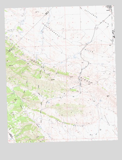
Garza Peak, CA USGS Topographic Map
Click on map above to begin viewing in our Map Viewer.

This topographic map contains these locations and features:
Feature Name Type Latitude Longitude GNIS ID View Map
Avenal Canyon MineMineN35.9166°W120.2346°238843View Map
Baby King CanyonValleyN35.9450°W120.2085°238868View Map
Baby King CreekStreamN35.9897°W120.1407°238869View Map
Big Tar CanyonValleyN35.9413°W120.1643°239314View Map
Boy Scout CampLocaleN35.9388°W120.1824°239630View Map
Bullpen CanyonValleyN35.9155°W120.2343°239830View Map
Chalk ButtesRangeN35.8925°W120.1804°1656456View Map
Clark RanchLocaleN35.9594°W120.2246°240665View Map
Dawson MineMineN35.9011°W120.2460°241293View Map
Dirty SpringSpringN35.9621°W120.2433°241506View Map
Double SpringSpringN35.8825°W120.2415°241582View Map
Falls CanyonValleyN35.8813°W120.2090°242161View Map
FlattopSummitN35.9283°W120.1551°242297View Map
Garza PeakSummitN35.9327°W120.2001°242641View Map
Hay FlatFlatN35.8813°W120.1479°243300View Map
Jones Ranch (historical)LocaleN35.9763°W120.2093°1662078View Map
Kreyenhagen RanchLocaleN35.9847°W120.2313°244370View Map
Poison Oak CanyonValleyN35.8830°W120.2057°247656View Map
Ragged TopSummitN35.9161°W120.1368°247911View Map
Rhodes Cabin (historical)BuildingN35.9008°W120.2449°1662085View Map
Roof SpringSpringN35.9121°W120.1452°248346View Map
RoundtopSummitN35.9386°W120.1946°1656612View Map
Segaser RanchLocaleN35.9252°W120.1688°249253View Map
Sulphur SpringSpringN35.9564°W120.2290°250054View Map
Sulphur Spring CanyonValleyN35.9061°W120.2107°250060View Map
Tar PeakSummitN35.9350°W120.1785°1656639View Map
The Turtle HoleBasinN35.9158°W120.2374°250414View Map
Tiger SpringSpringN35.8788°W120.2489°250491View Map
Tiger SpringSpringN35.8788°W120.2489°252398View Map
Wade Baxter SpringSpringN35.9533°W120.1736°251124View Map
Willow SpringSpringN35.9121°W120.2048°251642View Map
Willow SpringSpringN35.9771°W120.2350°251643View Map
Willow Spring CanyonValleyN35.8891°W120.2132°251654View Map
Zwang PeakSummitN35.9466°W120.2476°1662335View Map

Note: Coordinates in the location and feature list above are referenced to NAD83 datum.


Copyright (C) 2008-2025 Ryan Niemi / Sunset Dynamics ... All Rights Reserved