TopoQuest Logo
Do you find TopoQuest useful?
Help keep TopoQuest running and adding new maps/features by donating!
Bitcoin:  19c7KJd3qBynnjoSw5npx9KScwjBe4ifkT
Litecoin:  LXs6TkuXGGXo1vDsWCkWVdjQX94eUKd6ui
Home View Maps Find Maps Find Places Resources & Links


The Horseback, Maine Topographic Map

USGS Map Title: The Horseback, ME
USGS Map MRC: 44068H4
DRG (GeoTIFF) Download: o44068h4.tif


Neighboring USGS Topographic Map Quads:


  Olamon, ME  
45068A5
 

  Greenfield, ME  
45068A4
 

  Brandy Pond, ME  
45068A3
 

  Otter Chain Ponds, ME  
44068H5
 

  The Horseback, ME  
44068H4
 

  Great Pond, ME  
44068H3
 

  Chemo Pond, ME  
44068G5
 

  Hopkins Pond, ME  
44068G4
 

  Amherst, ME  
44068G3


Map MRC Location:

N45°
W69°
N45°
W68°
H8 H7 H6 H5 H4 H3 H2 H1
G8 G7 G6 G5 G4 G3 G2 G1
F8 F7 F6 F5 F4 F3 F2 F1
E8 E7 E6 E5 E4 E3 E2 E1
D8 D7 D6 D5 D4 D3 D2 D1
C8 C7 C6 C5 C4 C3 C2 C1
B8 B7 B6 B5 B4 B3 B2 B1
A8 A7 A6 A5 A4 A3 A2 A1
N44°
W69°
N44°
W68°

The Horseback, ME USGS 1:24K Topographic Map Preview:
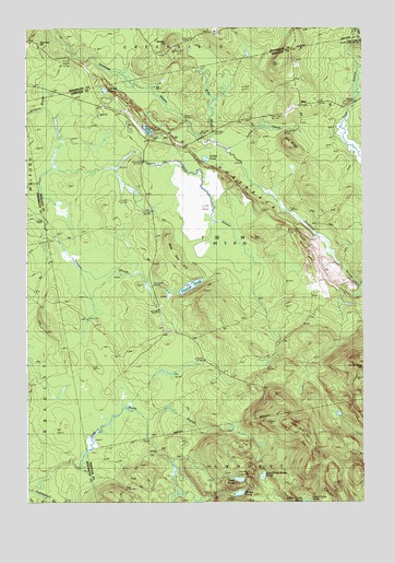
The Horseback, ME USGS Topographic Map
Click on map above to begin viewing in our Map Viewer.

This topographic map contains these locations and features:
Feature Name Type Latitude Longitude GNIS ID View Map
Bald Bluff MountainSummitN44.8941°W68.4005°561493View Map
Bear Den HillSummitN44.9453°W68.4480°561832View Map
Bragg CampLocaleN44.9006°W68.4414°562877View Map
Crocker PondLakeN44.9836°W68.4704°564527View Map
Dollar PondLakeN44.9655°W68.4331°565191View Map
East Great Works PondLakeN44.8821°W68.4123°565615View Map
Grassy PondLakeN44.8773°W68.4210°567085View Map
Indian BrookStreamN44.9659°W68.4209°568558View Map
Jackson CemeteryCemeteryN44.9909°W68.3986°568737View Map
Madden HillSummitN44.9960°W68.4463°570642View Map
MyraPopulated PlaceN44.9803°W68.3964°579547View Map
Oak RidgeRidgeN44.9701°W68.4020°572634View Map
Pickerel PondLakeN44.9733°W68.4546°573289View Map
Saddleback BrookStreamN44.8787°W68.4978°574659View Map
Simmons HillSummitN44.9956°W68.4961°575475View Map
T32 MD BPPCivilN44.9496°W68.4271°2748814View Map
Ten HillSummitN44.9903°W68.4058°576718View Map
The HorsebackRidgeN44.9631°W68.4297°576829View Map
Titcomb PondLakeN44.9321°W68.4389°577133View Map
Trout PondLakeN44.8810°W68.4211°577348View Map
Trout Pond MountainSummitN44.8826°W68.4162°577360View Map
Unorganized Territory of Northwest HancockCivilN44.9431°W68.4259°582639View Map
Wiley BrookStreamN44.9703°W68.4300°578485View Map

Note: Coordinates in the location and feature list above are referenced to NAD83 datum.


Copyright (C) 2008-2025 Ryan Niemi / Sunset Dynamics ... All Rights Reserved