TopoQuest Logo
Do you find TopoQuest useful?
Help keep TopoQuest running and adding new maps/features by donating!
Bitcoin:  19c7KJd3qBynnjoSw5npx9KScwjBe4ifkT
Litecoin:  LXs6TkuXGGXo1vDsWCkWVdjQX94eUKd6ui
Home View Maps Find Maps Find Places Resources & Links


The Notch, Wyoming Topographic Map

USGS Map Title: The Notch, WY
USGS Map MRC: 44104F3
DRG (GeoTIFF) Download: o44104f3.tif


Neighboring USGS Topographic Map Quads:


  Mona, WY  
44104G4
 

  Stoney Point, WY  
44104G3
 

  Kruger Lake, WY  
44104G2
 

  Alva, WY  
44104F4
 

  The Notch, WY  
44104F3
 

  Aladdin, WY  
44104F2
 

  Black Hills, WY  
44104E4
 

  Sugarloaf Mountain, WY  
44104E3
 

  Schoolmarm Butte, WY  
44104E2


Map MRC Location:

N45°
W105°
N45°
W104°
H8 H7 H6 H5 H4 H3 H2 H1
G8 G7 G6 G5 G4 G3 G2 G1
F8 F7 F6 F5 F4 F3 F2 F1
E8 E7 E6 E5 E4 E3 E2 E1
D8 D7 D6 D5 D4 D3 D2 D1
C8 C7 C6 C5 C4 C3 C2 C1
B8 B7 B6 B5 B4 B3 B2 B1
A8 A7 A6 A5 A4 A3 A2 A1
N44°
W105°
N44°
W104°

The Notch, WY USGS 1:24K Topographic Map Preview:
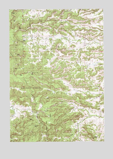
The Notch, WY USGS Topographic Map
Click on map above to begin viewing in our Map Viewer.

This topographic map contains these locations and features:
Feature Name Type Latitude Longitude GNIS ID View Map
Aikman SchoolSchoolN44.7072°W104.2827°1597694View Map
Basin DrawValleyN44.6678°W104.2547°1597951View Map
Basin SchoolSchoolN44.7244°W104.3155°1597954View Map
Bear Lodge CampgroundLocaleN44.6547°W104.3269°1598017View Map
Carlson SpringSpringN44.6878°W104.3616°1598637View Map
Cliff SpringSpringN44.6939°W104.3683°1598811View Map
Eothen SchoolSchoolN44.6558°W104.2547°1599627View Map
Geis SpringSpringN44.6892°W104.3466°1599920View Map
Geis TrailTrailN44.6855°W104.3274°1599921View Map
Gets DamDamN44.6717°W104.3188°1607636View Map
Gets ReservoirReservoirN44.6720°W104.3169°1607637View Map
J.C. Vieragutz Property MineMineN44.7178°W104.2602°1726384View Map
Kimball Family CemeteryCemeteryN44.7181°W104.2887°2774535View Map
Knoff SpringSpringN44.7367°W104.3638°1600752View Map
Little Beaver CreekStreamN44.6555°W104.3705°1600951View Map
Little Beaver SpringSpringN44.6398°W104.3432°1600952View Map
Little Table MountainSummitN44.6286°W104.2666°1601049View Map
Mitchell SpringSpringN44.7205°W104.3644°1601501View Map
Nilson TrailTrailN44.6680°W104.3349°1601700View Map
Oak Creek BasinBasinN44.7236°W104.3019°1601889View Map
Oak Creek MineMineN44.7172°W104.2644°1726244View Map
Pearson SpringSpringN44.6671°W104.3264°1602071View Map
Pine Creek SpringSpringN44.7464°W104.3680°1602155View Map
Ruland SpringSpringN44.6680°W104.3511°1602646View Map
Russell SpringSpringN44.7319°W104.3580°1602654View Map
The NotchSummitN44.7150°W104.3130°1603608View Map
Weaver SpringSpringN44.6461°W104.3486°1604017View Map
Williams SpringSpringN44.7078°W104.3658°1604189View Map

Note: Coordinates in the location and feature list above are referenced to NAD83 datum.


Copyright (C) 2008-2024 Ryan Niemi / Sunset Dynamics ... All Rights Reserved