TopoQuest Logo
Do you find TopoQuest useful?
Help keep TopoQuest running and adding new maps/features by donating!
Bitcoin:  19c7KJd3qBynnjoSw5npx9KScwjBe4ifkT
Litecoin:  LXs6TkuXGGXo1vDsWCkWVdjQX94eUKd6ui
Home View Maps Find Maps Find Places Resources & Links


The Temple, Nevada Topographic Map

USGS Map Title: The Temple, NV
USGS Map MRC: 36114A3
DRG (GeoTIFF) Download: o36114a3.tif


Neighboring USGS Topographic Map Quads:


  Middle Point, NV  
36114B4
 

  Garrett Butte, NV  
36114B3
 

  Jumbo Peak, NV  
36114B2
 

  Bonelli Bay, AZ  
36114A4
 

  The Temple, NV  
36114A3
 

  Hiller Mountains, NV  
36114A2
 

  Senator Mountain NW, AZ  
35114H4
 

  Senator Mountain NE, AZ  
35114H3
 

  Garnet Mountain NW, AZ  
35114H2


Map MRC Location:

N37°
W115°
N37°
W114°
H8 H7 H6 H5 H4 H3 H2 H1
G8 G7 G6 G5 G4 G3 G2 G1
F8 F7 F6 F5 F4 F3 F2 F1
E8 E7 E6 E5 E4 E3 E2 E1
D8 D7 D6 D5 D4 D3 D2 D1
C8 C7 C6 C5 C4 C3 C2 C1
B8 B7 B6 B5 B4 B3 B2 B1
A8 A7 A6 A5 A4 A3 A2 A1
N36°
W115°
N36°
W114°

The Temple, NV USGS 1:24K Topographic Map Preview:
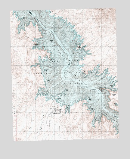
The Temple, NV USGS Topographic Map
Click on map above to begin viewing in our Map Viewer.

This topographic map contains these locations and features:
Feature Name Type Latitude Longitude GNIS ID View Map
Boat Wreck PointCapeN36.1022°W114.3375°43007View Map
Decision IslandIslandN36.0394°W114.2852°43012View Map
Delmar BayBayN36.0808°W114.2911°839997View Map
Delmar ButteSummitN36.0653°W114.2877°839998View Map
Gateway CoveBayN36.0178°W114.2775°4965View Map
Grebe BayBayN36.1097°W114.3625°5350View Map
Haystack BayBayN36.0942°W114.2922°840929View Map
Heron PointIslandN36.0475°W114.3122°5741View Map
Houseboat IslandIslandN36.0675°W114.3366°43008View Map
Ladder CoveBayN36.0322°W114.3119°43011View Map
Mesa CoveBayN36.0105°W114.2514°7896View Map
Monkey CoveBayN36.0397°W114.3311°8206View Map
Monkey Cove SpringSpringN36.0406°W114.3313°2707729View Map
Mushroom ReefBarN36.0945°W114.3278°8448View Map
Napoleons TombIslandN36.1192°W114.3583°8494View Map
Plane Crash IslandIslandN36.0572°W114.3333°43009View Map
Sawtooth BayBayN36.0292°W114.2811°43013View Map
Striper BayBayN36.0442°W114.2639°863771View Map
Teal CovesBayN36.0733°W114.3375°12211View Map
Temple BarBarN36.0367°W114.3225°43010View Map
Temple Bar (historical)BarN36.0628°W114.3100°863357View Map
Temple Bar AirportAirportN36.0228°W114.3343°45524View Map
Temple Bar Boat AnchorageHarborN36.0355°W114.3219°12238View Map
Temple Bar MarinaHarborN36.0258°W114.3191°12239View Map
Temple Bar Mill (historical)LocaleN36.0605°W114.3036°849514View Map
Temple BasinBasinN36.0508°W114.3150°12240View Map
Temple BasinBasinN36.0572°W114.3069°853948View Map
Temple BayBayN36.0564°W114.2730°844204View Map
Temple WashStreamN36.0367°W114.3358°12244View Map
The CampanilePillarN36.0936°W114.3489°12299View Map
The HaystacksSummitN36.0869°W114.2961°845701View Map
The HeadRidgeN36.0775°W114.3291°12328View Map
The JawboneCapeN36.1214°W114.3222°849352View Map
The TempleSummitN36.0472°W114.2697°844279View Map
Trail Rapids BayBayN36.0455°W114.3352°12672View Map
Trail Rapids WashStreamN36.0383°W114.3494°12673View Map
Virgin CanyonValleyN36.0274°W114.2656°13233View Map
Wild Burro BayBayN36.0505°W114.2591°849351View Map

Note: Coordinates in the location and feature list above are referenced to NAD83 datum.


Copyright (C) 2008-2024 Ryan Niemi / Sunset Dynamics ... All Rights Reserved