TopoQuest Logo
Do you find TopoQuest useful?
Help keep TopoQuest running and adding new maps/features by donating!
Bitcoin:  19c7KJd3qBynnjoSw5npx9KScwjBe4ifkT
Litecoin:  LXs6TkuXGGXo1vDsWCkWVdjQX94eUKd6ui
Home View Maps Find Maps Find Places Resources & Links


Thornton, Texas Topographic Map

USGS Map Title: Thornton, TX
USGS Map MRC: 31096D5
DRG (GeoTIFF) Download: o31096d5.tif


Neighboring USGS Topographic Map Quads:


  Ben Hur, TX  
31096E6
 

  Groesbeck, TX  
31096E5
 

  Fallon, TX  
31096E4
 

  Odds, TX  
31096D6
 

  Thornton, TX  
31096D5
 

  Box Church, TX  
31096D4
 

  Kosse West, TX  
31096C6
 

  Kosse East, TX  
31096C5
 

  Oletha, TX  
31096C4


Map MRC Location:

N32°
W97°
N32°
W96°
H8 H7 H6 H5 H4 H3 H2 H1
G8 G7 G6 G5 G4 G3 G2 G1
F8 F7 F6 F5 F4 F3 F2 F1
E8 E7 E6 E5 E4 E3 E2 E1
D8 D7 D6 D5 D4 D3 D2 D1
C8 C7 C6 C5 C4 C3 C2 C1
B8 B7 B6 B5 B4 B3 B2 B1
A8 A7 A6 A5 A4 A3 A2 A1
N31°
W97°
N31°
W96°

Thornton, TX USGS 1:24K Topographic Map Preview:
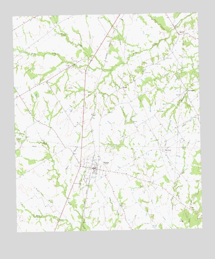
Thornton, TX USGS Topographic Map
Click on map above to begin viewing in our Map Viewer.

This topographic map contains these locations and features:
Feature Name Type Latitude Longitude GNIS ID View Map
Acuff BranchStreamN31.3932°W96.5897°1350864View Map
BeulahPopulated PlaceN31.4577°W96.5519°1379415View Map
Carroll CemeteryCemeteryN31.4657°W96.5367°1353876View Map
Cedar CreekStreamN31.4688°W96.5655°1373007View Map
Cobb CemeteryCemeteryN31.4368°W96.5455°1354710View Map
Davis ChurchChurchN31.4527°W96.5130°1355700View Map
Davis PrairiePopulated PlaceN31.4205°W96.5255°1379641View Map
Eaton BranchStreamN31.3988°W96.5922°1356777View Map
Frost CreekStreamN31.4893°W96.5189°1373781View Map
Keel CreekStreamN31.4252°W96.5522°1360508View Map
King CemeteryCemeteryN31.3835°W96.5355°1360656View Map
Phifer CemeteryCemeteryN31.4707°W96.5294°1365135View Map
Phifer CreekStreamN31.4702°W96.5050°1365136View Map
Pippin CemeteryCemeteryN31.4746°W96.5225°1365349View Map
Pleasant Grove CemeteryCemeteryN31.4027°W96.5811°1365401View Map
Red HillPopulated PlaceN31.4874°W96.5130°1380421View Map
Rocky CreekStreamN31.4893°W96.5189°1366780View Map
Scott BranchStreamN31.3763°W96.5091°1367877View Map
ThorntonPopulated PlaceN31.4110°W96.5722°1369866View Map
Thornton City OfficeBuildingN31.4112°W96.5720°2753809View Map
Thornton Post OfficePost OfficeN31.4114°W96.5726°2731919View Map
Tidwell CemeteryCemeteryN31.4291°W96.6239°1369921View Map
Town of ThorntonCivilN31.4111°W96.5739°2413386View Map
Twin BridgesLocaleN31.4552°W96.5091°1370338View Map
Vinson CemeteryCemeteryN31.3788°W96.5358°1370659View Map

Note: Coordinates in the location and feature list above are referenced to NAD83 datum.


Copyright (C) 2008-2024 Ryan Niemi / Sunset Dynamics ... All Rights Reserved