TopoQuest Logo
Do you find TopoQuest useful?
Help keep TopoQuest running and adding new maps/features by donating!
Bitcoin:  19c7KJd3qBynnjoSw5npx9KScwjBe4ifkT
Litecoin:  LXs6TkuXGGXo1vDsWCkWVdjQX94eUKd6ui
Home View Maps Find Maps Find Places Resources & Links


Box Church, Texas Topographic Map

USGS Map Title: Box Church, TX
USGS Map MRC: 31096D4
DRG (GeoTIFF) Download: o31096d4.tif


Neighboring USGS Topographic Map Quads:


  Groesbeck, TX  
31096E5
 

  Fallon, TX  
31096E4
 

  Teague South, TX  
31096E3
 

  Thornton, TX  
31096D5
 

  Box Church, TX  
31096D4
 

  Farrar, TX  
31096D3
 

  Kosse East, TX  
31096C5
 

  Oletha, TX  
31096C4
 

  Round Prairie, TX  
31096C3


Map MRC Location:

N32°
W97°
N32°
W96°
H8 H7 H6 H5 H4 H3 H2 H1
G8 G7 G6 G5 G4 G3 G2 G1
F8 F7 F6 F5 F4 F3 F2 F1
E8 E7 E6 E5 E4 E3 E2 E1
D8 D7 D6 D5 D4 D3 D2 D1
C8 C7 C6 C5 C4 C3 C2 C1
B8 B7 B6 B5 B4 B3 B2 B1
A8 A7 A6 A5 A4 A3 A2 A1
N31°
W97°
N31°
W96°

Box Church, TX USGS 1:24K Topographic Map Preview:
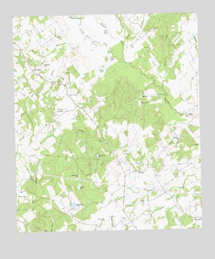
Box Church, TX USGS Topographic Map
Click on map above to begin viewing in our Map Viewer.

This topographic map contains these locations and features:
Feature Name Type Latitude Longitude GNIS ID View Map
Andrews HillSummitN31.4707°W96.4811°1351122View Map
Box ChurchPopulated PlaceN31.4677°W96.4875°2034746View Map
Box ChurchLocaleN31.4682°W96.4872°1352766View Map
Capps CemeteryCemeteryN31.4193°W96.4914°1353799View Map
Cedar MoundSummitN31.4902°W96.4372°1354134View Map
Clear LakeLakeN31.4530°W96.4025°1354637View Map
Cox CemeteryCemeteryN31.4091°W96.4211°1355248View Map
Faulkenberry CreekStreamN31.4980°W96.4539°1373707View Map
Grassy HollowValleyN31.4212°W96.4353°1358311View Map
Hogan CemeteryCemeteryN31.4666°W96.4655°1359378View Map
Hughes and Hyden CemeteryCemeteryN31.4538°W96.4630°1359795View Map
Jack Brown LakeReservoirN31.3900°W96.4614°1360079View Map
Jim Wright LakeLakeN31.4182°W96.4448°1360264View Map
Lenamon CemeteryCemeteryN31.4449°W96.4669°1361084View Map
Loftin CreekStreamN31.3991°W96.3905°1361612View Map
Masters CemeteryCemeteryN31.3963°W96.4986°1362268View Map
Middle CreekStreamN31.4860°W96.4236°1374912View Map
Montgomery CreekStreamN31.4863°W96.4511°1363061View Map
Mullen LakeLakeN31.4485°W96.4155°1363464View Map
Old Channel Navasota RiverStreamN31.4724°W96.4253°1375268View Map
Old UnionPopulated PlaceN31.4088°W96.4164°1380304View Map
Old Union ChurchChurchN31.4066°W96.4055°1364498View Map
Potter Shop CemeteryCemeteryN31.3814°W96.4414°1365684View Map
Rush LakeLakeN31.4676°W96.4407°1367020View Map
Sand BranchStreamN31.4832°W96.4622°1367560View Map
Sand LakeLakeN31.4522°W96.4146°1367624View Map
Simmon LakeLakeN31.4004°W96.4581°1368290View Map
Spring CreekStreamN31.4574°W96.4000°1376272View Map
Thornton DivisionCivilN31.4034°W96.4920°1939262View Map
Turkey CreekStreamN31.4832°W96.4255°1376522View Map
Water LakeLakeN31.4741°W96.4341°1370909View Map
Younkey Pen LakeLakeN31.4069°W96.4575°1372071View Map

Note: Coordinates in the location and feature list above are referenced to NAD83 datum.


Copyright (C) 2008-2025 Ryan Niemi / Sunset Dynamics ... All Rights Reserved