TopoQuest Logo
Do you find TopoQuest useful?
Help keep TopoQuest running and adding new maps/features by donating!
Bitcoin:  19c7KJd3qBynnjoSw5npx9KScwjBe4ifkT
Litecoin:  LXs6TkuXGGXo1vDsWCkWVdjQX94eUKd6ui
Home View Maps Find Maps Find Places Resources & Links


Three Lakes, Michigan Topographic Map

USGS Map Title: Three Lakes, MI
USGS Map MRC: 46088E2
DRG (GeoTIFF) Download: o46088e2.tif


Neighboring USGS Topographic Map Quads:


  Herman, MI  
46088F3
 

  Mount Curwood, MI  
46088F2
 

  Summit Lake, MI  
46088F1
 

  Nestoria, MI  
46088E3
 

  Three Lakes, MI  
46088E2
 

  Michigamme, MI  
46088E1
 

  Ned Lake, MI  
46088D3
 

  Nelson Lake, MI  
46088D2
 

  Witch Lake NE, MI  
46088D1


Map MRC Location:

N47°
W89°
N47°
W88°
H8 H7 H6 H5 H4 H3 H2 H1
G8 G7 G6 G5 G4 G3 G2 G1
F8 F7 F6 F5 F4 F3 F2 F1
E8 E7 E6 E5 E4 E3 E2 E1
D8 D7 D6 D5 D4 D3 D2 D1
C8 C7 C6 C5 C4 C3 C2 C1
B8 B7 B6 B5 B4 B3 B2 B1
A8 A7 A6 A5 A4 A3 A2 A1
N46°
W89°
N46°
W88°

Three Lakes, MI USGS 1:24K Topographic Map Preview:
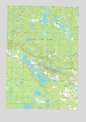
Three Lakes, MI USGS Topographic Map
Click on map above to begin viewing in our Map Viewer.

This topographic map contains these locations and features:
Feature Name Type Latitude Longitude GNIS ID View Map
Bass LakeLakeN46.5288°W88.1426°620714View Map
Beaufort LakeLakeN46.5377°W88.1877°620895View Map
Beaufort Lake State Forest CampgroundLocaleN46.5458°W88.1875°2129141View Map
Canal Town CreekStreamN46.5558°W88.2179°622681View Map
Coon LakeLakeN46.5486°W88.1589°623781View Map
Craig LakeLakeN46.6057°W88.1820°623951View Map
Craig Lake State ParkParkN46.6000°W88.1875°2104415View Map
Crooked LakeLakeN46.6027°W88.1557°624106View Map
Deer LakeLakeN46.5838°W88.2123°624486View Map
George LakeLakeN46.5491°W88.2036°626734View Map
Heart LakeLakeN46.5013°W88.2093°628038View Map
Imperial HeightsPopulated PlaceN46.5335°W88.1312°628947View Map
Knight LakeLakeN46.5927°W88.2384°629819View Map
Long LakeLakeN46.6116°W88.2349°630960View Map
Middle LakeLakeN46.5514°W88.1729°632267View Map
Nelligan CreekStreamN46.5366°W88.1374°633271View Map
Nelligan LakeLakeN46.5639°W88.1351°633272View Map
Nestoria CreekStreamN46.5616°W88.2221°633303View Map
Ohio MineMineN46.5377°W88.1712°633964View Map
Pea Soup LakeLakeN46.5312°W88.2271°634503View Map
Petticoat CreekStreamN46.5063°W88.1785°634735View Map
Petticoat LakeLakeN46.5194°W88.1952°634736View Map
Redruth Post Office (historical)Post OfficeN46.5542°W88.2031°2129279View Map
Redruth Station (historical)LeveeN46.5542°W88.2031°2129280View Map
Ruth LakeLakeN46.5592°W88.2159°636422View Map
Spruce LakeLakeN46.5068°W88.1761°638646View Map
Spurr Mountain Post Office (historical)Post OfficeN46.5383°W88.1300°2129276View Map
Spurr Mountain Station (historical)LocaleN46.5383°W88.1300°2129277View Map
Spurr RiverStreamN46.5285°W88.1318°638653View Map
Teddy LakeLakeN46.6012°W88.2042°1614654View Map
Three LakesPopulated PlaceN46.5544°W88.2012°1617894View Map
Three Lakes Lookout TowerTowerN46.5474°W88.1682°1623667View Map
Three Lakes StationLocaleN46.5542°W88.2008°2129278View Map
Township of SpurrCivilN46.5275°W88.2205°1627115View Map
Trout LakeLakeN46.5547°W88.1860°1615116View Map
Van LakeLakeN46.5982°W88.2266°1615480View Map

Note: Coordinates in the location and feature list above are referenced to NAD83 datum.


Copyright (C) 2008-2025 Ryan Niemi / Sunset Dynamics ... All Rights Reserved