TopoQuest Logo
Do you find TopoQuest useful?
Help keep TopoQuest running and adding new maps/features by donating!
Bitcoin:  19c7KJd3qBynnjoSw5npx9KScwjBe4ifkT
Litecoin:  LXs6TkuXGGXo1vDsWCkWVdjQX94eUKd6ui
Home View Maps Find Maps Find Places Resources & Links


Herman, Michigan Topographic Map

USGS Map Title: Herman, MI
USGS Map MRC: 46088F3
DRG (GeoTIFF) Download: o46088f3.tif


Neighboring USGS Topographic Map Quads:


  L'Anse, MI  
46088G4
 

  Aura, MI  
46088G3
 

  Skanee South, MI  
46088G2
 

  Alberta, MI  
46088F4
 

  Herman, MI  
46088F3
 

  Mount Curwood, MI  
46088F2
 

  Vermilac, MI  
46088E4
 

  Nestoria, MI  
46088E3
 

  Three Lakes, MI  
46088E2


Map MRC Location:

N47°
W89°
N47°
W88°
H8 H7 H6 H5 H4 H3 H2 H1
G8 G7 G6 G5 G4 G3 G2 G1
F8 F7 F6 F5 F4 F3 F2 F1
E8 E7 E6 E5 E4 E3 E2 E1
D8 D7 D6 D5 D4 D3 D2 D1
C8 C7 C6 C5 C4 C3 C2 C1
B8 B7 B6 B5 B4 B3 B2 B1
A8 A7 A6 A5 A4 A3 A2 A1
N46°
W89°
N46°
W88°

Herman, MI USGS 1:24K Topographic Map Preview:
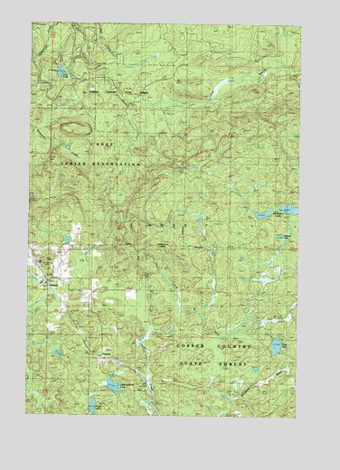
Herman, MI USGS Topographic Map
Click on map above to begin viewing in our Map Viewer.

This topographic map contains these locations and features:
Feature Name Type Latitude Longitude GNIS ID View Map
Baraga CountyCivilN46.6997°W88.3522°1622949View Map
Clear LakeLakeN46.6475°W88.2593°623427View Map
Dirkman LakeLakeN46.6911°W88.2537°624692View Map
Dirkwall LakeLakeN46.6823°W88.2585°2099890View Map
East Branch Silver RiverStreamN46.7249°W88.3307°625150View Map
Harley FallsFallsN46.6870°W88.3224°2117716View Map
HermanPopulated PlaceN46.6669°W88.3671°628133View Map
Herman CemeteryCemeteryN46.6645°W88.3496°628134View Map
Herman Lookout Tower Radio TowerTowerN46.6741°W88.3687°1623404View Map
Herman Post Office (historical)Post OfficeN46.6669°W88.3669°2129295View Map
Herman StationLocaleN46.6667°W88.3647°2129296View Map
Kortio LakeLakeN46.6278°W88.3441°629857View Map
Little Summit LakeLakeN46.6341°W88.3341°630785View Map
Lost LakeLakeN46.7343°W88.3610°631107View Map
SummitLocaleN46.6435°W88.3404°639056View Map
Township of L'AnseCivilN46.7190°W88.3032°1626587View Map
Upper Silver FallsFallsN46.6822°W88.3295°2117840View Map
Upper Silver River FallsFallsN46.6743°W88.3165°2117841View Map
WXNL-FM (Baraga)TowerN46.6630°W88.3460°1625346View Map

Note: Coordinates in the location and feature list above are referenced to NAD83 datum.


Copyright (C) 2008-2024 Ryan Niemi / Sunset Dynamics ... All Rights Reserved