TopoQuest Logo
Do you find TopoQuest useful?
Help keep TopoQuest running and adding new maps/features by donating!
Bitcoin:  19c7KJd3qBynnjoSw5npx9KScwjBe4ifkT
Litecoin:  LXs6TkuXGGXo1vDsWCkWVdjQX94eUKd6ui
Home View Maps Find Maps Find Places Resources & Links


Tickanetley, Georgia Topographic Map

USGS Map Title: Tickanetley, GA
USGS Map MRC: 34084F3
DRG (GeoTIFF) Download: o34084f3.tif


Neighboring USGS Topographic Map Quads:


  Cashes Valley, GA  
34084G4
 

  Blue Ridge, GA  
34084G3
 

  Wilscot, GA  
34084G2
 

  Ellijay, GA  
34084F4
 

  Tickanetley, GA  
34084F3
 

  Noontootla, GA  
34084F2
 

  Dyke, GA  
34084E4
 

  Amicalola, GA  
34084E3
 

  Nimblewill, GA  
34084E2


Map MRC Location:

N35°
W85°
N35°
W84°
H8 H7 H6 H5 H4 H3 H2 H1
G8 G7 G6 G5 G4 G3 G2 G1
F8 F7 F6 F5 F4 F3 F2 F1
E8 E7 E6 E5 E4 E3 E2 E1
D8 D7 D6 D5 D4 D3 D2 D1
C8 C7 C6 C5 C4 C3 C2 C1
B8 B7 B6 B5 B4 B3 B2 B1
A8 A7 A6 A5 A4 A3 A2 A1
N34°
W85°
N34°
W84°

Tickanetley, GA USGS 1:24K Topographic Map Preview:
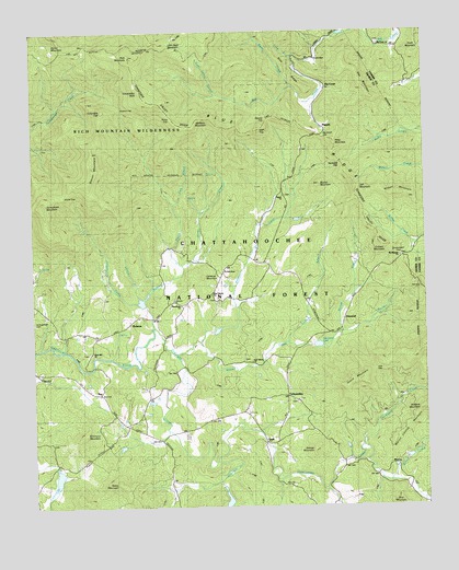
Tickanetley, GA USGS Topographic Map
Click on map above to begin viewing in our Map Viewer.

This topographic map contains these locations and features:
Feature Name Type Latitude Longitude GNIS ID View Map
Aaron MountainSummitN34.7470°W84.3694°330992View Map
Anderson CreekStreamN34.6790°W84.3402°326949View Map
Anderson CreekStreamN34.6370°W84.3169°326950View Map
Bearden CreekStreamN34.6712°W84.2769°327035View Map
Big CreekPopulated PlaceN34.7351°W84.2808°331160View Map
Big Creek ChurchChurchN34.7468°W84.2635°354719View Map
Big Creek GapGapN34.7229°W84.2824°327109View Map
Big Creek School (historical)SchoolN34.7345°W84.2805°352910View Map
Blue Ridge Church (historical)ChurchN34.6909°W84.2571°327172View Map
Blue Ridge School (historical)SchoolN34.6793°W84.2730°327177View Map
Bucktown School (historical)SchoolN34.6320°W84.2552°327276View Map
Butler CreekStreamN34.7359°W84.2913°327306View Map
Cartecay MountainSummitN34.6856°W84.3208°330602View Map
Cartecay River Watershed Structure Number Five DamDamN34.6668°W84.2866°336834View Map
Cartecay River Watershed Structure Number Six DamDamN34.6384°W84.2549°336836View Map
Cartecay Watershed Dam Number 10DamN34.6351°W84.3666°336842View Map
Cartecay Watershed Dam Number EightDamN34.6284°W84.3133°336840View Map
Cartecay Watershed Dam Number OneDamN34.6784°W84.3383°336830View Map
Cartecay Watershed Dam Number ThreeDamN34.6718°W84.3166°336832View Map
Christian ChurchChurchN34.6793°W84.3302°330736View Map
Clark MountainSummitN34.7437°W84.2527°331405View Map
Clarks Mill (historical)LocaleN34.7462°W84.2582°1704694View Map
Colbert MountainSummitN34.6943°W84.2646°331431View Map
Columbia TopSummitN34.7295°W84.3516°331442View Map
DiamondPopulated PlaceN34.6743°W84.2760°331545View Map
Diamond LakeReservoirN34.6676°W84.2844°330735View Map
Doublehead GapGapN34.6909°W84.2571°355529View Map
East Liberty ChurchChurchN34.6634°W84.3049°330734View Map
East New Hope Baptist Church CemeteryCemeteryN34.6632°W84.3063°2681104View Map
Fox MountainRidgeN34.7384°W84.2702°327870View Map
Garland LakeReservoirN34.6793°W84.3400°336831View Map
Garrett BranchStreamN34.6684°W84.2941°327917View Map
George MountainSummitN34.6409°W84.2852°331800View Map
Gilmer County Fire Department Station 4BuildingN34.6897°W84.3048°2604369View Map
Gould MountainSummitN34.6584°W84.2705°331844View Map
Hardslate GapGapN34.7156°W84.2763°328057View Map
High TopSummitN34.7243°W84.3027°331975View Map
Holden CreekStreamN34.6690°W84.3216°328193View Map
Jeff MountainSummitN34.7090°W84.2713°332091View Map
Kimmons MountainSummitN34.6440°W84.3588°332147View Map
Little Bald MountainSummitN34.7470°W84.3302°332225View Map
Long BranchStreamN34.7440°W84.2910°328614View Map
Low GapGapN34.6612°W84.2660°328658View Map
Lowman LakeReservoirN34.6714°W84.3164°336833View Map
Lowman LakeReservoirN34.6381°W84.2556°336837View Map
Macedonia Baptist Church CemeteryCemeteryN34.6797°W84.3297°352940View Map
Macedonia ChurchChurchN34.6776°W84.3271°328681View Map
MarionPopulated PlaceN34.6359°W84.2596°332318View Map
Marion Clayton MountainSummitN34.6462°W84.2563°332319View Map
Mathis Chapel School (historical)SchoolN34.7362°W84.2524°328726View Map
Mount Pleasant Baptist Church Cemetery Number 2CemeteryN34.6910°W84.2576°352942View Map
Mount Pleasant ChurchChurchN34.6909°W84.2571°330729View Map
New Liberty Baptist Church CemeteryCemeteryN34.6801°W84.3180°2681153View Map
New Liberty ChurchChurchN34.6809°W84.3177°329014View Map
Noblin LakeReservoirN34.6271°W84.3136°336841View Map
Oliver CreekStreamN34.6881°W84.3263°329096View Map
Pine RidgeRidgeN34.7415°W84.2944°329222View Map
Pink BranchStreamN34.7054°W84.3299°329238View Map
PisgahPopulated PlaceN34.7254°W84.2816°332696View Map
Pisgah ChurchChurchN34.7068°W84.2952°330730View Map
Pisgah ChurchChurchN34.7081°W84.2949°332695View Map
Pisgah Church of Christ CemeteryCemeteryN34.7069°W84.2944°352954View Map
Postell LakeReservoirN34.6335°W84.3673°336843View Map
ProtectionLocaleN34.6859°W84.3158°329330View Map
QuillPopulated PlaceN34.6429°W84.3002°332775View Map
Ramp GapGapN34.7273°W84.3296°329365View Map
Reese MountainSummitN34.6315°W84.3474°332822View Map
Rich MountainSummitN34.7437°W84.3430°332846View Map
Rich Mountain DivisionCivilN34.6886°W84.3288°1936496View Map
Rich Mountain WildernessReserveN34.7312°W84.3437°330848View Map
Rich Mountain Wildlife Management AreaParkN34.7295°W84.3508°330847View Map
Riley MountainSummitN34.7212°W84.2785°332856View Map
River Hill Baptist Church CemeteryCemeteryN34.6654°W84.3575°2681163View Map
River Hill ChurchChurchN34.6656°W84.3560°329444View Map
Roger Laurel BranchStreamN34.7337°W84.3160°329509View Map
RolstonPopulated PlaceN34.6737°W84.3444°332914View Map
Rolston CreekStreamN34.6723°W84.3360°329516View Map
Rolston GapGapN34.7304°W84.3463°329517View Map
Rolston School (historical)SchoolN34.6706°W84.3533°329518View Map
Round MountainSummitN34.7101°W84.2833°329537View Map
RoyPopulated PlaceN34.6551°W84.3533°332939View Map
Salem School (historical)SchoolN34.6312°W84.2958°345251View Map
Scrougetown Baptist Church CemeteryCemeteryN34.6737°W84.3746°329621View Map
Simons BranchStreamN34.6834°W84.3358°329711View Map
Stanley Mill (historical)Populated PlaceN34.7434°W84.2910°333112View Map
Steamy GapGapN34.7273°W84.2994°329819View Map
Stover CreekStreamN34.6687°W84.3216°329867View Map
Stover GapGapN34.7073°W84.3655°329868View Map
Stover MountainSummitN34.7145°W84.3555°333141View Map
TickanetleyPopulated PlaceN34.6540°W84.2938°333228View Map
Tickanetley BaldSummitN34.7340°W84.3388°333229View Map
Tickanetley CreekStreamN34.6723°W84.3360°329984View Map
Tickanetley Primitive Baptist ChurchChurchN34.6531°W84.2927°352967View Map
Tickanetley Primitive Baptist ChurchCemeteryN34.6527°W84.2914°2681180View Map
Turniptown MountainSummitN34.7056°W84.3716°333292View Map
Twiggs School (historical)SchoolN34.6579°W84.3180°330088View Map
Vandegriff CreekStreamN34.6409°W84.2705°330124View Map
Weaver CreekStreamN34.6320°W84.2616°330187View Map
Wolfpen MountainSummitN34.7276°W84.3216°330352View Map

Note: Coordinates in the location and feature list above are referenced to NAD83 datum.


Copyright (C) 2008-2024 Ryan Niemi / Sunset Dynamics ... All Rights Reserved