TopoQuest Logo
Do you find TopoQuest useful?
Help keep TopoQuest running and adding new maps/features by donating!
Bitcoin:  19c7KJd3qBynnjoSw5npx9KScwjBe4ifkT
Litecoin:  LXs6TkuXGGXo1vDsWCkWVdjQX94eUKd6ui
Home View Maps Find Maps Find Places Resources & Links


Tidewater, Florida Topographic Map

USGS Map Title: Tidewater, FL
USGS Map MRC: 29082B5
DRG (GeoTIFF) Download: o29082b5.tif


Neighboring USGS Topographic Map Quads:


  Bronson SW, FL  
29082C6
 

  Bronson SE, FL  
29082C5
 

  Morriston, FL  
29082C4
 

  Lebanon Station, FL  
29082B6
 

  Tidewater, FL  
29082B5
 

  Romeo, FL  
29082B4
 

  Yankeetown, FL  
29082A6
 

  Yankeetown SE, FL  
29082A5
 

  Dunnellon, FL  
29082A4


Map MRC Location:

N30°
W83°
N30°
W82°
H8 H7 H6 H5 H4 H3 H2 H1
G8 G7 G6 G5 G4 G3 G2 G1
F8 F7 F6 F5 F4 F3 F2 F1
E8 E7 E6 E5 E4 E3 E2 E1
D8 D7 D6 D5 D4 D3 D2 D1
C8 C7 C6 C5 C4 C3 C2 C1
B8 B7 B6 B5 B4 B3 B2 B1
A8 A7 A6 A5 A4 A3 A2 A1
N29°
W83°
N29°
W82°

Tidewater, FL USGS 1:24K Topographic Map Preview:
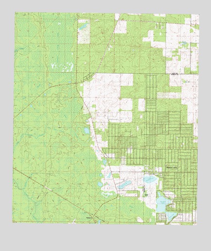
Tidewater, FL USGS Topographic Map
Click on map above to begin viewing in our Map Viewer.

This topographic map contains these locations and features:
Feature Name Type Latitude Longitude GNIS ID View Map
Big Wolf ArborSwampN29.2305°W82.5959°278768View Map
Bonable LakeLakeN29.1380°W82.5238°279195View Map
Coffee CreekSwampN29.1694°W82.6021°280627View Map
Crow Rookery SloughSwampN29.1800°W82.5932°307381View Map
Cypress PrairieLakeN29.1435°W82.5359°281240View Map
Halfway PondLakeN29.2329°W82.5092°283614View Map
Little Bonable LakeLakeN29.1517°W82.5317°285619View Map
Marion County Public Library System Herman B Oberman Public LibraryBuildingN29.1361°W82.5156°2448778View Map
Race PondLakeN29.2422°W82.5784°289424View Map
Rainbow Lakes Estates Fire Department Station 2BuildingN29.1549°W82.5292°2644350View Map
Sand PondLakeN29.1486°W82.5492°290559View Map
Sand Pond CemeteryCemeteryN29.1519°W82.5482°290579View Map
Sand SloughSwampN29.1361°W82.5479°290585View Map
Sapling BranchStreamN29.1450°W82.6182°290668View Map
TidewaterPopulated PlaceN29.1289°W82.5701°294946View Map
Tiger LakeLakeN29.1306°W82.5177°292282View Map
Wings FieldAirportN29.2392°W82.5456°309976View Map

Note: Coordinates in the location and feature list above are referenced to NAD83 datum.


Copyright (C) 2008-2024 Ryan Niemi / Sunset Dynamics ... All Rights Reserved