TopoQuest Logo
Do you find TopoQuest useful?
Help keep TopoQuest running and adding new maps/features by donating!
Bitcoin:  19c7KJd3qBynnjoSw5npx9KScwjBe4ifkT
Litecoin:  LXs6TkuXGGXo1vDsWCkWVdjQX94eUKd6ui
Home View Maps Find Maps Find Places Resources & Links


Blue House Mountain, Arizona Topographic Map

USGS Map Title: Blue House Mountain, AZ
USGS Map MRC: 33110H5
DRG (GeoTIFF) Download: o33110h5.tif


Neighboring USGS Topographic Map Quads:


  Oak Creek Ranch, AZ  
34110A6
 

  Spotted Mountain, AZ  
34110A5
 

  Cibecue, AZ  
34110A4
 

  Double Buttes, AZ  
33110H6
 

  Blue House Mountain, AZ  
33110H5
 

  Cibecue Peak, AZ  
33110H4
 

  Picacho Colorado, AZ  
33110G6
 

  Mule Hoof Bend, AZ  
33110G5
 

  Beckers Butte, AZ  
33110G4


Map MRC Location:

N34°
W111°
N34°
W110°
H8 H7 H6 H5 H4 H3 H2 H1
G8 G7 G6 G5 G4 G3 G2 G1
F8 F7 F6 F5 F4 F3 F2 F1
E8 E7 E6 E5 E4 E3 E2 E1
D8 D7 D6 D5 D4 D3 D2 D1
C8 C7 C6 C5 C4 C3 C2 C1
B8 B7 B6 B5 B4 B3 B2 B1
A8 A7 A6 A5 A4 A3 A2 A1
N33°
W111°
N33°
W110°

Blue House Mountain, AZ USGS 1:24K Topographic Map Preview:
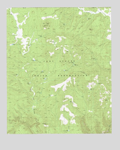
Blue House Mountain, AZ USGS Topographic Map
Click on map above to begin viewing in our Map Viewer.

This topographic map contains these locations and features:
Feature Name Type Latitude Longitude GNIS ID View Map
Bear Butte TankReservoirN33.9362°W110.5565°24166View Map
Bear MountainSummitN33.9353°W110.5354°1131View Map
Black HillSummitN33.9781°W110.5246°24167View Map
Blue House MountainSummitN33.9828°W110.5779°1704View Map
Blue House SpringSpringN33.9713°W110.5836°24168View Map
Brown Cabin TankReservoirN33.9639°W110.5659°1990View Map
Bull Tank Number OneReservoirN33.9885°W110.5284°24169View Map
Cement Trough CanyonValleyN33.9950°W110.5126°406View Map
Checker TankReservoirN33.9256°W110.5987°24170View Map
Crow TankReservoirN33.9835°W110.5559°24171View Map
Deer Canyon SpringSpringN33.9492°W110.5198°24172View Map
Dixon TankReservoirN33.9635°W110.6185°24173View Map
Dry TankReservoirN33.9625°W110.5975°24174View Map
Grease Bucket TankReservoirN33.9156°W110.5848°24175View Map
Hole Canyon TankReservoirN33.8925°W110.5526°5884View Map
Lower Hole Canyon TankReservoirN33.8782°W110.5519°24176View Map
Mescal TankReservoirN33.9431°W110.5448°24177View Map
Navajo SpringSpringN33.9081°W110.5057°24178View Map
Navajo Tank Number OneReservoirN33.9247°W110.5164°24179View Map
Navajo Tank Number TwoReservoirN33.9186°W110.5263°24180View Map
Rock House ButteSummitN33.8848°W110.5790°10406View Map
Rock House TankReservoirN33.8995°W110.5943°24181View Map
Ruins TankReservoirN33.9133°W110.5734°24182View Map
Sam CanyonValleyN33.9984°W110.6223°10793View Map
Sheep TankReservoirN33.9560°W110.5517°24183View Map
South Bear Butte TankReservoirN33.9066°W110.5505°24184View Map
Stanley Trap TankReservoirN33.9933°W110.6188°24185View Map
Tin House TankReservoirN33.9478°W110.5924°12477View Map
Upper Bear Butte TankReservoirN33.9456°W110.5459°24186View Map
Upper Willow TankReservoirN33.9371°W110.5832°24187View Map
West Tin House TankReservoirN33.9336°W110.6126°24188View Map
Willow TankReservoirN33.9295°W110.5807°13874View Map

Note: Coordinates in the location and feature list above are referenced to NAD83 datum.


Copyright (C) 2008-2024 Ryan Niemi / Sunset Dynamics ... All Rights Reserved