TopoQuest Logo
Do you find TopoQuest useful?
Help keep TopoQuest running and adding new maps/features by donating!
Bitcoin:  19c7KJd3qBynnjoSw5npx9KScwjBe4ifkT
Litecoin:  LXs6TkuXGGXo1vDsWCkWVdjQX94eUKd6ui
Home View Maps Find Maps Find Places Resources & Links


Toad Mountain, Minnesota Topographic Map

USGS Map Title: Toad Mountain, MN
USGS Map MRC: 46095G5
DRG (GeoTIFF) Download: o46095g5.tif


Neighboring USGS Topographic Map Quads:


  Flat Lake, MN  
46095H6
 

  Height of Land Lake, MN  
46095H5
 

  Ponsford, MN  
46095H4
 

  Rochert, MN  
46095G6
 

  Toad Mountain, MN  
46095G5
 

  Evergreen, MN  
46095G4
 

  Frazee, MN  
46095F6
 

  Little Pine Lake, MN  
46095F5
 

  New York Mills NW, MN  
46095F4


Map MRC Location:

N47°
W96°
N47°
W95°
H8 H7 H6 H5 H4 H3 H2 H1
G8 G7 G6 G5 G4 G3 G2 G1
F8 F7 F6 F5 F4 F3 F2 F1
E8 E7 E6 E5 E4 E3 E2 E1
D8 D7 D6 D5 D4 D3 D2 D1
C8 C7 C6 C5 C4 C3 C2 C1
B8 B7 B6 B5 B4 B3 B2 B1
A8 A7 A6 A5 A4 A3 A2 A1
N46°
W96°
N46°
W95°

Toad Mountain, MN USGS 1:24K Topographic Map Preview:
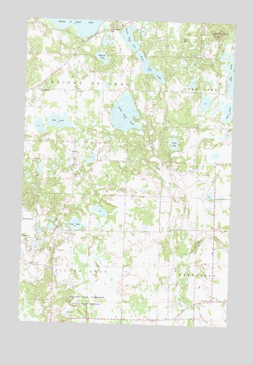
Toad Mountain, MN USGS Topographic Map
Click on map above to begin viewing in our Map Viewer.

This topographic map contains these locations and features:
Feature Name Type Latitude Longitude GNIS ID View Map
Ballard LakeLakeN46.8595°W95.5798°639604View Map
Birchmere Resort and CampgroundLocaleN46.8597°W95.5678°2108642View Map
Church of the Wildwood CemeteryCemeteryN46.8744°W95.5708°2108252View Map
Collett CreekStreamN46.7550°W95.5250°639157View Map
Dead Horse CreekStreamN46.7766°W95.5320°642676View Map
Engel Dairy FarmLocaleN46.8261°W95.5250°2674538View Map
Goose LakeLakeN46.8250°W95.5351°644256View Map
Jarvis Post Office (historical)Post OfficeN46.8658°W95.5903°2108596View Map
Little Toad LakeReservoirN46.8364°W95.5653°646951View Map
Little Toad Lake CampgroundLocaleN46.8375°W95.5528°2108643View Map
Little Toad Lake DamDamN46.8300°W95.5453°1775916View Map
Lizzy LakeLakeN46.7905°W95.5933°646977View Map
Local Post Office (historical)Post OfficeN46.8708°W95.5750°2108403View Map
Mud LakeLakeN46.8328°W95.6047°648320View Map
North Twin LakeLakeN46.8678°W95.5638°648706View Map
Saint John's Lutheran CemeteryCemeteryN46.8450°W95.6150°2108251View Map
Saint Johns ChurchChurchN46.8450°W95.6159°650722View Map
Saint Paul's CemeteryCemeteryN46.7611°W95.5097°2108254View Map
Saint Pauls ChurchChurchN46.7605°W95.5098°651000View Map
Silver Birch SchoolSchoolN46.8705°W95.5748°652023View Map
Silver Leaf Township State Game RefugeParkN46.7583°W95.5861°2108280View Map
South Twin LakeLakeN46.8557°W95.5510°652351View Map
Toad MountainSummitN46.8694°W95.5120°653219View Map
Township of Silver LeafCivilN46.7595°W95.6056°665617View Map

Note: Coordinates in the location and feature list above are referenced to NAD83 datum.


Copyright (C) 2008-2024 Ryan Niemi / Sunset Dynamics ... All Rights Reserved