TopoQuest Logo
Do you find TopoQuest useful?
Help keep TopoQuest running and adding new maps/features by donating!
Bitcoin:  19c7KJd3qBynnjoSw5npx9KScwjBe4ifkT
Litecoin:  LXs6TkuXGGXo1vDsWCkWVdjQX94eUKd6ui
Home View Maps Find Maps Find Places Resources & Links


Rochert, Minnesota Topographic Map

USGS Map Title: Rochert, MN
USGS Map MRC: 46095G6
DRG (GeoTIFF) Download: o46095g6.tif


Neighboring USGS Topographic Map Quads:


  Richwood, MN  
46095H7
 

  Flat Lake, MN  
46095H6
 

  Height of Land Lake, MN  
46095H5
 

  Detroit Lakes, MN  
46095G7
 

  Rochert, MN  
46095G6
 

  Toad Mountain, MN  
46095G5
 

  Vergas, MN  
46095F7
 

  Frazee, MN  
46095F6
 

  Little Pine Lake, MN  
46095F5


Map MRC Location:

N47°
W96°
N47°
W95°
H8 H7 H6 H5 H4 H3 H2 H1
G8 G7 G6 G5 G4 G3 G2 G1
F8 F7 F6 F5 F4 F3 F2 F1
E8 E7 E6 E5 E4 E3 E2 E1
D8 D7 D6 D5 D4 D3 D2 D1
C8 C7 C6 C5 C4 C3 C2 C1
B8 B7 B6 B5 B4 B3 B2 B1
A8 A7 A6 A5 A4 A3 A2 A1
N46°
W96°
N46°
W95°

Rochert, MN USGS 1:24K Topographic Map Preview:
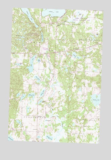
Rochert, MN USGS Topographic Map
Click on map above to begin viewing in our Map Viewer.

This topographic map contains these locations and features:
Feature Name Type Latitude Longitude GNIS ID View Map
Alvin LakeLakeN46.8515°W95.6334°639315View Map
Big Rock LakeLakeN46.7878°W95.7074°640118View Map
Chilton CemeteryCemeteryN46.7613°W95.7114°641157View Map
Chilton LakeLakeN46.7501°W95.7473°641158View Map
Chilton SchoolSchoolN46.7733°W95.7106°641160View Map
Cotton Lake Diversion DamDamN46.8683°W95.6887°1777266View Map
Dretsch Family Memorial CemeteryCemeteryN46.7903°W95.6486°2108237View Map
Elbow LakeLakeN46.7930°W95.7195°643228View Map
Fox LakeLakeN46.8263°W95.7114°643863View Map
Howe LakeLakeN46.8223°W95.7213°645263View Map
Hubbel PondLakeN46.8656°W95.6654°645269View Map
Hubbel Pond DamDamN46.8600°W95.7003°1777264View Map
Hubbel Pond Game RefugeParkN46.8622°W95.6817°645270View Map
Hungry LakeLakeN46.7913°W95.6314°645290View Map
Irish LakeLakeN46.8472°W95.7362°645449View Map
Jones LakeLakeN46.7699°W95.6993°645730View Map
Lake Region ChurchChurchN46.8383°W95.6570°646384View Map
Mennonite CemeteryCemeteryN46.8383°W95.6569°2108249View Map
Mount Olive CemeteryCemeteryN46.8441°W95.6300°648179View Map
Neuner LakeLakeN46.8219°W95.7399°648499View Map
Pearce LakeLakeN46.7955°W95.7055°649209View Map
Perch LakeLakeN46.8483°W95.7079°649290View Map
Pickerel LakeLakeN46.8744°W95.7329°649380View Map
Pinewood ChapelChurchN46.8708°W95.6362°649509View Map
Rice LakeLakeN46.8094°W95.7127°650014View Map
Riverside SchoolSchoolN46.8358°W95.6981°650147View Map
Riverview Terrace Mobile Home ParkPopulated PlaceN46.8314°W95.7119°2108281View Map
RochertPopulated PlaceN46.8600°W95.6878°650178View Map
Rochert Post Office (historical)Post OfficeN46.8600°W95.6875°2108740View Map
School Number 51SchoolN46.8247°W95.6375°651675View Map
Senjen CemeteryCemeteryN46.8705°W95.6369°2108248View Map
Township of BurlingtonCivilN46.7607°W95.7330°663706View Map
Township of ErieCivilN46.8470°W95.7317°664107View Map
Trieglaff LakeLakeN46.7541°W95.6936°653276View Map
Wettles LakeLakeN46.8304°W95.6597°654052View Map

Note: Coordinates in the location and feature list above are referenced to NAD83 datum.


Copyright (C) 2008-2025 Ryan Niemi / Sunset Dynamics ... All Rights Reserved