TopoQuest Logo
Do you find TopoQuest useful?
Help keep TopoQuest running and adding new maps/features by donating!
Bitcoin:  19c7KJd3qBynnjoSw5npx9KScwjBe4ifkT
Litecoin:  LXs6TkuXGGXo1vDsWCkWVdjQX94eUKd6ui
Home View Maps Find Maps Find Places Resources & Links


Blue Mountain, Texas Topographic Map

USGS Map Title: Blue Mountain, TX
USGS Map MRC: 30104E1
DRG (GeoTIFF) Download: o30104e1.tif


Neighboring USGS Topographic Map Quads:


  Mount Livermore, TX  
30104F2
 

  Mount Locke, TX  
30104F1
 

  Casket Mountain, TX  
30103F8
 

  Paradise Mountain, TX  
30104E2
 

  Blue Mountain, TX  
30104E1
 

  Fort Davis, TX  
30103E8
 

  Burro Draw, TX  
30104D2
 

  Smith Hills, TX  
30104D1
 

  Mano Prieto Mountain, TX  
30103D8


Map MRC Location:

N31°
W105°
N31°
W104°
H8 H7 H6 H5 H4 H3 H2 H1
G8 G7 G6 G5 G4 G3 G2 G1
F8 F7 F6 F5 F4 F3 F2 F1
E8 E7 E6 E5 E4 E3 E2 E1
D8 D7 D6 D5 D4 D3 D2 D1
C8 C7 C6 C5 C4 C3 C2 C1
B8 B7 B6 B5 B4 B3 B2 B1
A8 A7 A6 A5 A4 A3 A2 A1
N30°
W105°
N30°
W104°

Blue Mountain, TX USGS 1:24K Topographic Map Preview:
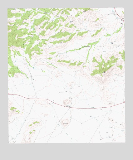
Blue Mountain, TX USGS Topographic Map
Click on map above to begin viewing in our Map Viewer.

This topographic map contains these locations and features:
Feature Name Type Latitude Longitude GNIS ID View Map
Blue MountainSummitN30.5652°W104.0227°1352480View Map
Blue Mountain SchoolSchoolN30.5510°W104.0582°1352482View Map
Bull Pasture HillsSummitN30.5218°W104.0166°1353249View Map
Carpenter MountainSummitN30.5185°W104.0657°1353846View Map
Davis Mountain Resort Volunteer Fire DepartmentBuildingN30.6249°W104.0930°2551904View Map
Deer MountainSummitN30.6127°W104.0321°1355862View Map
Devil TankReservoirN30.5924°W104.0151°1355950View Map
Jones CanyonValleyN30.6001°W104.0149°1360379View Map
Limpia MountainSummitN30.6221°W104.0407°1361208View Map
Lower Jones WindmillLocaleN30.6104°W104.0024°1361920View Map
Merrill ForkStreamN30.5110°W104.0027°1362636View Map
Miguel TankReservoirN30.5896°W104.0081°1362819View Map
Ninemile HillSummitN30.5368°W104.0166°1363897View Map
Point of Rocks Roadside ParkLocaleN30.5346°W104.0641°1365496View Map
Santana TankReservoirN30.6167°W104.0701°1367764View Map
Upper Jones WindmillLocaleN30.5896°W104.0441°1370515View Map
Webster TankReservoirN30.6127°W104.0583°1370978View Map

Note: Coordinates in the location and feature list above are referenced to NAD83 datum.


Copyright (C) 2008-2024 Ryan Niemi / Sunset Dynamics ... All Rights Reserved