TopoQuest Logo
Do you find TopoQuest useful?
Help keep TopoQuest running and adding new maps/features by donating!
Bitcoin:  19c7KJd3qBynnjoSw5npx9KScwjBe4ifkT
Litecoin:  LXs6TkuXGGXo1vDsWCkWVdjQX94eUKd6ui
Home View Maps Find Maps Find Places Resources & Links


Tony, Wisconsin Topographic Map

USGS Map Title: Tony, WI
USGS Map MRC: 45090D8
DRG (GeoTIFF) Download: o45090d8.tif


Neighboring USGS Topographic Map Quads:


  Exeland SE, WI  
45091E1
 

  Big Falls Dam, WI  
45090E8
 

  Ingram, WI  
45090E7
 

  Ladysmith, WI  
45091D1
 

  Tony, WI  
45090D8
 

  Sheldon NE, WI  
45090D7
 

  Ladysmith SE, WI  
45091C1
 

  Sheldon, WI  
45090C8
 

  Jump River, WI  
45090C7


Map MRC Location:

N46°
W91°
N46°
W90°
H8 H7 H6 H5 H4 H3 H2 H1
G8 G7 G6 G5 G4 G3 G2 G1
F8 F7 F6 F5 F4 F3 F2 F1
E8 E7 E6 E5 E4 E3 E2 E1
D8 D7 D6 D5 D4 D3 D2 D1
C8 C7 C6 C5 C4 C3 C2 C1
B8 B7 B6 B5 B4 B3 B2 B1
A8 A7 A6 A5 A4 A3 A2 A1
N45°
W91°
N45°
W90°

Tony, WI USGS 1:24K Topographic Map Preview:
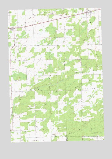
Tony, WI USGS Topographic Map
Click on map above to begin viewing in our Map Viewer.

This topographic map contains these locations and features:
Feature Name Type Latitude Longitude GNIS ID View Map
Bear CreekStreamN45.4280°W90.9057°1561362View Map
Crazy Horse CreekStreamN45.3864°W90.8962°1563516View Map
Flambeau Charter SchoolSchoolN45.4547°W90.9936°2713209View Map
Flambeau Elementary SchoolSchoolN45.4547°W90.9932°2713348View Map
Flambeau High SchoolSchoolN45.4546°W90.9930°1867782View Map
Flambeau Junior High SchoolSchoolN45.4547°W90.9937°2713420View Map
Glen FloraPopulated PlaceN45.4958°W90.8940°1565559View Map
Glen Flora Elementary SchoolSchoolN45.4980°W90.8910°1867788View Map
Grow TownhallBuildingN45.4364°W90.9974°1867792View Map
Middle Fork Main CreekStreamN45.4569°W90.9054°1569417View Map
North Fork Main CreekStreamN45.4566°W90.9054°1570436View Map
Oak Grove School (historical)SchoolN45.4447°W90.9974°1867823View Map
Progressive School (historical)SchoolN45.4527°W90.9690°1867831View Map
South Fork Main CreekStreamN45.4041°W90.9968°1580459View Map
TonyPopulated PlaceN45.4830°W90.9926°1575507View Map
Town of GrowCivilN45.4232°W90.9865°1583329View Map
Village of Glen FloraCivilN45.4970°W90.8935°1583283View Map
Village of TonyCivilN45.4803°W90.9972°1584286View Map
Whitetail AcademySchoolN45.4835°W90.9948°2713291View Map

Note: Coordinates in the location and feature list above are referenced to NAD83 datum.


Copyright (C) 2008-2025 Ryan Niemi / Sunset Dynamics ... All Rights Reserved