TopoQuest Logo
Do you find TopoQuest useful?
Help keep TopoQuest running and adding new maps/features by donating!
Bitcoin:  19c7KJd3qBynnjoSw5npx9KScwjBe4ifkT
Litecoin:  LXs6TkuXGGXo1vDsWCkWVdjQX94eUKd6ui
Home View Maps Find Maps Find Places Resources & Links


Sheldon, Wisconsin Topographic Map

USGS Map Title: Sheldon, WI
USGS Map MRC: 45090C8
DRG (GeoTIFF) Download: o45090c8.tif


Neighboring USGS Topographic Map Quads:


  Ladysmith, WI  
45091D1
 

  Tony, WI  
45090D8
 

  Sheldon NE, WI  
45090D7
 

  Ladysmith SE, WI  
45091C1
 

  Sheldon, WI  
45090C8
 

  Jump River, WI  
45090C7
 

  Holcombe, WI  
45091B1
 

  Ruby, WI  
45090B8
 

  Gilman, WI  
45090B7


Map MRC Location:

N46°
W91°
N46°
W90°
H8 H7 H6 H5 H4 H3 H2 H1
G8 G7 G6 G5 G4 G3 G2 G1
F8 F7 F6 F5 F4 F3 F2 F1
E8 E7 E6 E5 E4 E3 E2 E1
D8 D7 D6 D5 D4 D3 D2 D1
C8 C7 C6 C5 C4 C3 C2 C1
B8 B7 B6 B5 B4 B3 B2 B1
A8 A7 A6 A5 A4 A3 A2 A1
N45°
W91°
N45°
W90°

Sheldon, WI USGS 1:24K Topographic Map Preview:
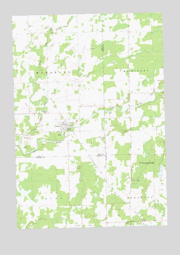
Sheldon, WI USGS Topographic Map
Click on map above to begin viewing in our Map Viewer.

This topographic map contains these locations and features:
Feature Name Type Latitude Longitude GNIS ID View Map
Alder CreekStreamN45.3275°W90.9735°1560740View Map
Baughman School (historical)SchoolN45.3639°W90.9032°1833624View Map
DonaldPopulated PlaceN45.2525°W90.8971°1564049View Map
Donald CemeteryCemeteryN45.2522°W90.9104°1564050View Map
Linden Christian SchoolSchoolN45.3669°W90.9665°1568134View Map
Linden School (historical)SchoolN45.3614°W90.9660°1867807View Map
Little Jump RiverStreamN45.3039°W90.9951°1579688View Map
Marshall Center School (historical)SchoolN45.3316°W90.9876°1867814View Map
Mennonite ChurchChurchN45.3683°W90.9860°1569340View Map
Riverdale School (historical)SchoolN45.3139°W90.9037°1833662View Map
SheldonPopulated PlaceN45.3105°W90.9560°1574003View Map
Sheldon Elementary SchoolSchoolN45.3094°W90.9585°1867852View Map
Sheldon EstatesPopulated PlaceN45.3131°W90.9564°2611836View Map
Sheldon Fire Protection DistrictBuildingN45.3111°W90.9608°2696695View Map
Shoulder CreekStreamN45.3027°W90.9585°1574078View Map
Town of MarshallCivilN45.3360°W90.9877°1583664View Map
Village of SheldonCivilN45.3119°W90.9567°1584142View Map
Woodlawn CemeteryCemeteryN45.3180°W90.9726°1577004View Map

Note: Coordinates in the location and feature list above are referenced to NAD83 datum.


Copyright (C) 2008-2025 Ryan Niemi / Sunset Dynamics ... All Rights Reserved