TopoQuest Logo
Do you find TopoQuest useful?
Help keep TopoQuest running and adding new maps/features by donating!
Bitcoin:  19c7KJd3qBynnjoSw5npx9KScwjBe4ifkT
Litecoin:  LXs6TkuXGGXo1vDsWCkWVdjQX94eUKd6ui
Home View Maps Find Maps Find Places Resources & Links


Tranquillon Mountain, California Topographic Map

USGS Map Title: Tranquillon Mountain, CA
USGS Map MRC: 34120E5
DRG (GeoTIFF) Download: o34120e5.tif


Neighboring USGS Topographic Map Quads:


  Surf, CA  
34120F5
 

  Lompoc, CA  
34120F4
 

  Point Arguello, CA  
34120E6
 

  Tranquillon Mountain, CA  
34120E5
 

  Lompoc Hills, CA  
34120E4


  Point Conception, CA  
34120D4


Map MRC Location:

N35°
W121°
N35°
W120°
H8 H7 H6 H5 H4 H3 H2 H1
G8 G7 G6 G5 G4 G3 G2 G1
F8 F7 F6 F5 F4 F3 F2 F1
E8 E7 E6 E5 E4 E3 E2 E1
D8 D7 D6 D5 D4 D3 D2 D1
C8 C7 C6 C5 C4 C3 C2 C1
B8 B7 B6 B5 B4 B3 B2 B1
A8 A7 A6 A5 A4 A3 A2 A1
N34°
W121°
N34°
W120°

Tranquillon Mountain, CA USGS 1:24K Topographic Map Preview:
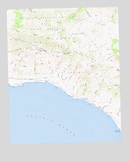
Tranquillon Mountain, CA USGS Topographic Map
Click on map above to begin viewing in our Map Viewer.

This topographic map contains these locations and features:
Feature Name Type Latitude Longitude GNIS ID View Map
Caņada Agua VivaValleyN34.5575°W120.5938°255410View Map
Caņada De Los LadronesValleyN34.5528°W120.5721°240149View Map
Caņada De Los SaucesValleyN34.5517°W120.5688°240151View Map
Caņada Del JolloruValleyN34.5361°W120.5349°240165View Map
Caņada Del MoridaValleyN34.5436°W120.5563°240166View Map
Caņada Del RodeoValleyN34.5569°W120.5810°240169View Map
Cypress RidgeRidgeN34.5764°W120.6182°241195View Map
Espada BluffCliffN34.5317°W120.5224°242063View Map
Jalama Beach County ParkParkN34.5108°W120.5004°269412View Map
Jalama CreekStreamN34.5111°W120.5027°243987View Map
LompocCivilN34.5969°W120.5627°245030View Map
Lompoc Air Force Station (historical)MilitaryN34.5658°W120.5014°2086562View Map
Long Horn CanyonValleyN34.5283°W120.5179°245075View Map
Oak MountainSummitN34.5519°W120.5024°246744View Map
Oil Well CanyonValleyN34.5611°W120.6216°246826View Map
Punta De La ConcepcionCivilN34.5678°W120.5668°247825View Map
Round HillSummitN34.5586°W120.5654°1661338View Map
SuddenLocaleN34.5400°W120.5399°250004View Map
Sudden CanyonValleyN34.5403°W120.5435°250005View Map
Sudden FlatsFlatN34.5583°W120.5821°250006View Map
Sudden PeakSummitN34.5655°W120.5010°250007View Map
The EspadaFlatN34.5325°W120.5185°250376View Map
Tranquillon MountainSummitN34.5833°W120.5607°255767View Map
Tranquillon RidgeRidgeN34.5844°W120.5802°250597View Map
Vandenberg Air Force BaseMilitaryN34.5590°W120.5452°2512497View Map
Vandenberg Air Force Base Fire Department Station 4BuildingN34.6125°W120.5699°2664753View Map
Water CanyonValleyN34.5492°W120.5616°251241View Map
Wild Horse FlatFlatN34.5844°W120.5916°251534View Map
Wild Horse PeakSummitN34.5858°W120.5860°1661690View Map

Note: Coordinates in the location and feature list above are referenced to NAD83 datum.


Copyright (C) 2008-2025 Ryan Niemi / Sunset Dynamics ... All Rights Reserved