TopoQuest Logo
Do you find TopoQuest useful?
Help keep TopoQuest running and adding new maps/features by donating!
Bitcoin:  19c7KJd3qBynnjoSw5npx9KScwjBe4ifkT
Litecoin:  LXs6TkuXGGXo1vDsWCkWVdjQX94eUKd6ui
Home View Maps Find Maps Find Places Resources & Links


Triple Peak, Wyoming Topographic Map

USGS Map Title: Triple Peak, WY
USGS Map MRC: 42110G5
DRG (GeoTIFF) Download: o42110g5.tif


Neighboring USGS Topographic Map Quads:


  Blind Bull Creek, WY  
42110H6
 

  Lookout Mountain, WY  
42110H5
 

  Prospect Peak, WY  
42110H4
 

  Park Creek, WY  
42110G6
 

  Triple Peak, WY  
42110G5
 

  Maki Creek, WY  
42110G4
 

  Box Canyon Creek, WY  
42110F6
 

  Mount Schidler, WY  
42110F5
 

  Red Castle Creek, WY  
42110F4


Map MRC Location:

N43°
W111°
N43°
W110°
H8 H7 H6 H5 H4 H3 H2 H1
G8 G7 G6 G5 G4 G3 G2 G1
F8 F7 F6 F5 F4 F3 F2 F1
E8 E7 E6 E5 E4 E3 E2 E1
D8 D7 D6 D5 D4 D3 D2 D1
C8 C7 C6 C5 C4 C3 C2 C1
B8 B7 B6 B5 B4 B3 B2 B1
A8 A7 A6 A5 A4 A3 A2 A1
N42°
W111°
N42°
W110°

Triple Peak, WY USGS 1:24K Topographic Map Preview:
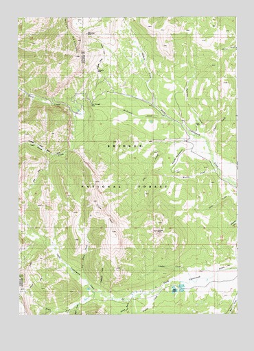
Triple Peak, WY USGS Topographic Map
Click on map above to begin viewing in our Map Viewer.

This topographic map contains these locations and features:
Feature Name Type Latitude Longitude GNIS ID View Map
Chase CreekStreamN42.8224°W110.5166°1598704View Map
Cottonwood MineMineN42.8683°W110.5857°1598943View Map
Cottonwood MineMineN42.8624°W110.5732°1726515View Map
Dry Basin CreekStreamN42.7649°W110.5874°1599320View Map
Eagle CreekStreamN42.7544°W110.5913°1599438View Map
Foster MeadowsFlatN42.8166°W110.5355°1599813View Map
Hardin CreekStreamN42.8110°W110.5110°1600203View Map
Hidden Basin CreekStreamN42.7558°W110.5632°1600312View Map
Kleinstick MineMineN42.8524°W110.5796°1600738View Map
Lander CreekStreamN42.7644°W110.5255°1600829View Map
Lander PeakSummitN42.7849°W110.5463°1600831View Map
McDougal CreekStreamN42.8327°W110.5410°1591320View Map
Mount McDougalSummitN42.8652°W110.5913°1601317View Map
New Cottonwood MineMineN42.8522°W110.5793°1746418View Map
Nylander CreekStreamN42.8247°W110.5191°1601882View Map
Ole CreekStreamN42.8252°W110.5252°1601916View Map
Sheep Creek Divide MineMineN42.8019°W110.5971°1726513View Map
Sjhoberg CreekStreamN42.8380°W110.5460°1602943View Map
Smith MineMineN42.8680°W110.5841°1726516View Map
Snowdrift CreekStreamN42.7599°W110.5791°1603034View Map
Soda LakeLakeN42.7602°W110.5366°1603050View Map
South Fork South Cottonwood CreekStreamN42.7591°W110.5818°1604475View Map
Tie-Hack CabinsLocaleN42.7549°W110.5641°1604511View Map
Trailer CreekStreamN42.7608°W110.5446°1603747View Map
Triple PeakSummitN42.7927°W110.5796°1603771View Map
Triplet VentsSpringN42.7928°W110.5789°1848606View Map

Note: Coordinates in the location and feature list above are referenced to NAD83 datum.


Copyright (C) 2008-2025 Ryan Niemi / Sunset Dynamics ... All Rights Reserved