TopoQuest Logo
Do you find TopoQuest useful?
Help keep TopoQuest running and adding new maps/features by donating!
Bitcoin:  19c7KJd3qBynnjoSw5npx9KScwjBe4ifkT
Litecoin:  LXs6TkuXGGXo1vDsWCkWVdjQX94eUKd6ui
Home View Maps Find Maps Find Places Resources & Links


Blind Bull Creek, Wyoming Topographic Map

USGS Map Title: Blind Bull Creek, WY
USGS Map MRC: 42110H6
DRG (GeoTIFF) Download: o42110h6.tif


Neighboring USGS Topographic Map Quads:


  Deer Creek, WY  
43110A7
 

  Pickle Pass, WY  
43110A6
 

  Hoback Peak, WY  
43110A5
 

  Man Peak, WY  
42110H7
 

  Blind Bull Creek, WY  
42110H6
 

  Lookout Mountain, WY  
42110H5
 

  Rock Lake Peak, WY  
42110G7
 

  Park Creek, WY  
42110G6
 

  Triple Peak, WY  
42110G5


Map MRC Location:

N43°
W111°
N43°
W110°
H8 H7 H6 H5 H4 H3 H2 H1
G8 G7 G6 G5 G4 G3 G2 G1
F8 F7 F6 F5 F4 F3 F2 F1
E8 E7 E6 E5 E4 E3 E2 E1
D8 D7 D6 D5 D4 D3 D2 D1
C8 C7 C6 C5 C4 C3 C2 C1
B8 B7 B6 B5 B4 B3 B2 B1
A8 A7 A6 A5 A4 A3 A2 A1
N42°
W111°
N42°
W110°

Blind Bull Creek, WY USGS 1:24K Topographic Map Preview:
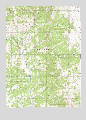
Blind Bull Creek, WY USGS Topographic Map
Click on map above to begin viewing in our Map Viewer.

This topographic map contains these locations and features:
Feature Name Type Latitude Longitude GNIS ID View Map
Alpine MineMineN42.9624°W110.6457°1726504View Map
Anderson CreekStreamN42.9610°W110.7485°1597749View Map
Black CanyonValleyN42.8880°W110.7044°1598205View Map
Blind Bull CreekStreamN42.9449°W110.7207°1598245View Map
Blind Bull LakeLakeN42.9403°W110.6347°1598246View Map
Blind Bull MineMineN42.9513°W110.6271°1598247View Map
Box Y RanchLocaleN42.9216°W110.7196°1598345View Map
Deadhorse CreekStreamN42.9030°W110.7099°1599152View Map
Deadman CreekStreamN42.9610°W110.7271°1599157View Map
Deadman Gulch MineMineN42.9791°W110.6466°1726505View Map
Henderson CreekStreamN42.9591°W110.7499°1600293View Map
Little Blind Bull CreekStreamN42.9458°W110.7038°1600954View Map
Meadow CreekStreamN42.9135°W110.7096°1601325View Map
Meadow Creek Guard StationLocaleN42.9133°W110.7110°1601329View Map
Meadows Forest Service FacilityLocaleN42.9127°W110.7127°1608787View Map
Moffat CreekStreamN42.8966°W110.7063°1601507View Map
North Fork Deadman CreekStreamN42.9747°W110.7063°1601758View Map
Old Blind Bull MineMineN42.9502°W110.6313°1726506View Map
South Fork Meadow CreekStreamN42.9105°W110.7249°1603156View Map
Telephone HollowValleyN42.9769°W110.7057°1603550View Map
The ElbowBendN42.9591°W110.7310°1603598View Map
Trail CreekStreamN42.9223°W110.7117°2785632View Map
Vail MineMineN42.9766°W110.6424°1603899View Map
West MineMineN42.9502°W110.6860°1726507View Map

Note: Coordinates in the location and feature list above are referenced to NAD83 datum.


Copyright (C) 2008-2025 Ryan Niemi / Sunset Dynamics ... All Rights Reserved