TopoQuest Logo
Do you find TopoQuest useful?
Help keep TopoQuest running and adding new maps/features by donating!
Bitcoin:  19c7KJd3qBynnjoSw5npx9KScwjBe4ifkT
Litecoin:  LXs6TkuXGGXo1vDsWCkWVdjQX94eUKd6ui
Home View Maps Find Maps Find Places Resources & Links


Tripoli, Iowa Topographic Map

USGS Map Title: Tripoli, IA
USGS Map MRC: 42092G3
DRG (GeoTIFF) Download: o42092g3.tif


Neighboring USGS Topographic Map Quads:


  Tripoli NW, IA  
42092H4
 

  Frederika, IA  
42092H3
 

  Fredericksburg, IA  
42092H2
 

  Bremer, IA  
42092G4
 

  Tripoli, IA  
42092G3
 

  Sumner SW, IA  
42092G2
 

  Waverly, IA  
42092F4
 

  Denver, IA  
42092F3
 

  Readlyn, IA  
42092F2


Map MRC Location:

N43°
W93°
N43°
W92°
H8 H7 H6 H5 H4 H3 H2 H1
G8 G7 G6 G5 G4 G3 G2 G1
F8 F7 F6 F5 F4 F3 F2 F1
E8 E7 E6 E5 E4 E3 E2 E1
D8 D7 D6 D5 D4 D3 D2 D1
C8 C7 C6 C5 C4 C3 C2 C1
B8 B7 B6 B5 B4 B3 B2 B1
A8 A7 A6 A5 A4 A3 A2 A1
N42°
W93°
N42°
W92°

Tripoli, IA USGS 1:24K Topographic Map Preview:
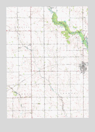
Tripoli, IA USGS Topographic Map
Click on map above to begin viewing in our Map Viewer.

This topographic map contains these locations and features:
Feature Name Type Latitude Longitude GNIS ID View Map
Alcock CemeteryCemeteryN42.8632°W92.3381°454118View Map
Bremer CountyCivilN42.7746°W92.3181°465198View Map
Bremer County HomeBuildingN42.7664°W92.3249°463301View Map
Chapin ParkParkN42.8080°W92.2582°1948323View Map
City of TripoliCivilN42.8083°W92.2579°2397056View Map
County Farm CemeteryCemeteryN42.7666°W92.3252°1948376View Map
Faith CemeteryCemeteryN42.8207°W92.2590°456528View Map
Faith United Church of ChristChurchN42.8055°W92.2582°1948389View Map
Frederika Township CemeteryCemeteryN42.8614°W92.2568°463650View Map
Grace Lutheran ChurchChurchN42.8075°W92.2596°1948388View Map
Le Roy Township CemeteryCemeteryN42.8616°W92.2563°1948452View Map
Leo Aero Ranch Landing Strip (historical)AirportN42.8744°W92.3016°1948493View Map
Maple Hills Country ClubLocaleN42.8028°W92.3174°1948378View Map
North ParkParkN42.8080°W92.2582°1948324View Map
Old TripoliPopulated PlaceN42.8261°W92.2655°465354View Map
Phillipston Post Office (historical)Post OfficeN42.8416°W92.3252°1948281View Map
Ringneck Wildlife AreaParkN42.8466°W92.3196°1948267View Map
Saint Johannes ChurchChurchN42.8291°W92.3563°460991View Map
Saint Johns United Church of Christ CemeteryCemeteryN42.8287°W92.3557°1948449View Map
Saint Pauls ChurchChurchN42.7558°W92.3374°461305View Map
Saint Pauls Evangelical Lutheran ChurchChurchN42.8028°W92.2630°1948387View Map
Saint Pauls Lutheran CemeteryCemeteryN42.8327°W92.3382°1948450View Map
SeigelPopulated PlaceN42.8400°W92.3560°464109View Map
Seigel Post Office (historical)Post OfficeN42.8400°W92.3560°1948278View Map
Siegel Saint Paul ChurchChurchN42.8322°W92.3377°461602View Map
South ParkParkN42.8080°W92.2582°1948325View Map
Synder Access Recreation AreaParkN42.8266°W92.2516°462163View Map
Township of FrederikaCivilN42.8616°W92.2870°467867View Map
Township of FremontCivilN42.7740°W92.2584°467873View Map
TripoliPopulated PlaceN42.8080°W92.2582°462329View Map
Tripoli (historical)LocaleN42.8094°W92.2560°1948386View Map
Tripoli City HallBuildingN42.8125°W92.2585°1948385View Map
Tripoli Elementary SchoolSchoolN42.7999°W92.2615°1948390View Map
Tripoli Fire DepartmentBuildingN42.8088°W92.2553°1948382View Map
Tripoli LibraryBuildingN42.8083°W92.2585°1948379View Map
Tripoli Middle / High SchoolSchoolN42.8010°W92.2605°2719746View Map
Tripoli Nursing HomeHospitalN42.8039°W92.2621°1948383View Map
Tripoli Police DepartmentBuildingN42.8083°W92.2585°1948381View Map
Tripoli Post OfficePost OfficeN42.8083°W92.2585°1948384View Map
Tripoli Recreation CenterBuildingN42.8083°W92.2585°1948380View Map
Walling Cemetery (historical)CemeteryN42.8555°W92.3085°1948451View Map

Note: Coordinates in the location and feature list above are referenced to NAD83 datum.


Copyright (C) 2008-2024 Ryan Niemi / Sunset Dynamics ... All Rights Reserved