TopoQuest Logo
Do you find TopoQuest useful?
Help keep TopoQuest running and adding new maps/features by donating!
Bitcoin:  19c7KJd3qBynnjoSw5npx9KScwjBe4ifkT
Litecoin:  LXs6TkuXGGXo1vDsWCkWVdjQX94eUKd6ui
Home View Maps Find Maps Find Places Resources & Links


Fredericksburg, Iowa Topographic Map

USGS Map Title: Fredericksburg, IA
USGS Map MRC: 42092H2
DRG (GeoTIFF) Download: o42092h2.tif


Neighboring USGS Topographic Map Quads:


  New Hampton, IA  
43092A3
 

  Lawler, IA  
43092A2
 

  Waucoma, IA  
43092A1
 

  Frederika, IA  
42092H3
 

  Fredericksburg, IA  
42092H2
 

  Alpha, IA  
42092H1
 

  Tripoli, IA  
42092G3
 

  Sumner SW, IA  
42092G2
 

  Sumner, IA  
42092G1


Map MRC Location:

N43°
W93°
N43°
W92°
H8 H7 H6 H5 H4 H3 H2 H1
G8 G7 G6 G5 G4 G3 G2 G1
F8 F7 F6 F5 F4 F3 F2 F1
E8 E7 E6 E5 E4 E3 E2 E1
D8 D7 D6 D5 D4 D3 D2 D1
C8 C7 C6 C5 C4 C3 C2 C1
B8 B7 B6 B5 B4 B3 B2 B1
A8 A7 A6 A5 A4 A3 A2 A1
N42°
W93°
N42°
W92°

Fredericksburg, IA USGS 1:24K Topographic Map Preview:
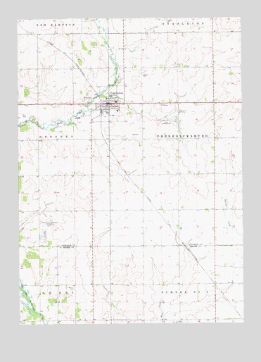
Fredericksburg, IA USGS Topographic Map
Click on map above to begin viewing in our Map Viewer.

This topographic map contains these locations and features:
Feature Name Type Latitude Longitude GNIS ID View Map
Chickasaw Ambulance FredericksburgBuildingN42.9643°W92.2004°2599902View Map
Church of the BrethrenChurchN42.9650°W92.1707°1948615View Map
City of FredericksburgCivilN42.9646°W92.1964°2394815View Map
Countryside Chiropractic ClinicHospitalN42.9650°W92.1988°1948606View Map
FredericksburgPopulated PlaceN42.9653°W92.1996°456750View Map
Fredericksburg (historical)LocaleN42.9611°W92.2035°1948601View Map
Fredericksburg Elementary SchoolSchoolN42.9622°W92.1943°1948614View Map
Fredericksburg Family Health CenterHospitalN42.9591°W92.1991°1948607View Map
Fredericksburg Farmers Co-op ElevatorLocaleN42.9658°W92.2030°1948605View Map
Fredericksburg Fire DepartmentBuildingN42.9646°W92.1853°2577169View Map
Fredericksburg Municipal HallBuildingN42.9653°W92.2002°1948604View Map
Fredericksburg Post OfficePost OfficeN42.9653°W92.1980°1948602View Map
Fredericksburg Wildlife AreaParkN42.9958°W92.1641°1948506View Map
Hawkeye Buffalo RanchLocaleN42.9166°W92.2385°1948600View Map
Hillcrest Baptist ChurchChurchN42.9625°W92.1930°1948609View Map
Klotz Landing Field (historical)AirportN42.9580°W92.1668°1948647View Map
Maple Grove CemeteryCemeteryN42.9617°W92.1609°458775View Map
Marsh CreekStreamN42.9686°W92.2043°465383View Map
McFarland Hereford Farm Landing Strip (historical)AirportN42.9161°W92.2335°1948648View Map
Mentor CemeteryCemeteryN42.8897°W92.2194°458991View Map
Mentor Post Office (historical)Post OfficeN42.8916°W92.2085°466457View Map
Peace United Church of ChristChurchN42.9628°W92.2071°1948611View Map
Plum Creek Country ClubLocaleN42.9666°W92.2132°465889View Map
Rose Hill CemeteryCemeteryN42.9744°W92.1935°460801View Map
Saint Fredericks Catholic ChurchChurchN42.9650°W92.1966°1948610View Map
Saint Pauls Lutheran ChurchChurchN42.9639°W92.1988°1948612View Map
Split Rock County ParkParkN42.9103°W92.2363°461854View Map
Split Rock LakeReservoirN42.9100°W92.2402°463465View Map
Split Rock Lake DamDamN42.9100°W92.2402°463466View Map
Sumner - Fredericksburg Middle SchoolSchoolN42.9659°W92.1955°1948613View Map
Sunrise Guest HomeHospitalN42.9600°W92.1974°1948608View Map
Township of FredericksburgCivilN42.9504°W92.1403°467866View Map
Upham Memorial LibraryBuildingN42.9653°W92.2002°1948603View Map
West CemeteryCemeteryN42.9602°W92.2137°462833View Map
Zion CemeteryCemeteryN42.8758°W92.1610°463263View Map

Note: Coordinates in the location and feature list above are referenced to NAD83 datum.


Copyright (C) 2008-2025 Ryan Niemi / Sunset Dynamics ... All Rights Reserved