TopoQuest Logo
Do you find TopoQuest useful?
Help keep TopoQuest running and adding new maps/features by donating!
Bitcoin:  19c7KJd3qBynnjoSw5npx9KScwjBe4ifkT
Litecoin:  LXs6TkuXGGXo1vDsWCkWVdjQX94eUKd6ui
Home View Maps Find Maps Find Places Resources & Links


Bluemont, Virginia Topographic Map

USGS Map Title: Bluemont, VA
USGS Map MRC: 39077A7
DRG (GeoTIFF) Download: o39077a7.tif


Neighboring USGS Topographic Map Quads:


  Berryville, VA  
39077B8
 

  Round Hill, VA  
39077B7
 

  Purcellville, VA  
39077B6
 

  Ashby Gap, VA  
39077A8
 

  Bluemont, VA  
39077A7
 

  Lincoln, VA  
39077A6
 

  Upperville, VA  
38077H8
 

  Rectortown, VA  
38077H7
 

  Middleburg, VA  
38077H6


Map MRC Location:

N40°
W78°
N40°
W77°
H8 H7 H6 H5 H4 H3 H2 H1
G8 G7 G6 G5 G4 G3 G2 G1
F8 F7 F6 F5 F4 F3 F2 F1
E8 E7 E6 E5 E4 E3 E2 E1
D8 D7 D6 D5 D4 D3 D2 D1
C8 C7 C6 C5 C4 C3 C2 C1
B8 B7 B6 B5 B4 B3 B2 B1
A8 A7 A6 A5 A4 A3 A2 A1
N39°
W78°
N39°
W77°

Bluemont, VA USGS 1:24K Topographic Map Preview:
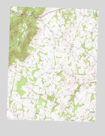
Bluemont, VA USGS Topographic Map
Click on map above to begin viewing in our Map Viewer.

This topographic map contains these locations and features:
Feature Name Type Latitude Longitude GNIS ID View Map
AirmontPopulated PlaceN39.0848°W77.7869°1477063View Map
Archbold DamDamN39.0234°W77.8414°1490257View Map
Archbold LakeReservoirN39.0243°W77.8439°1490258View Map
Austins Grove ChurchChurchN39.0648°W77.8297°1462630View Map
Ayreshire FarmLocaleN39.0109°W77.8742°1749545View Map
Banneker Elementary SchoolSchoolN39.0037°W77.7881°1462768View Map
Bearden ParkParkN39.1109°W77.8542°1690533View Map
Black Oak RidgeRidgeN39.0979°W77.7580°1463493View Map
BloomfieldPopulated PlaceN39.0534°W77.8206°1492591View Map
BluemontPopulated PlaceN39.1112°W77.8339°1492596View Map
Bluemont Community CenterBuildingN39.1094°W77.8292°2374073View Map
Bluemont Historic DistrictParkN39.1112°W77.8344°1749549View Map
Bluemont Post OfficePost OfficeN39.1101°W77.8322°1749550View Map
Bluemont United Methodist ChurchChurchN39.1093°W77.8308°1749551View Map
Butchers BranchStreamN39.0809°W77.7914°1464171View Map
Dishmans CornerLocaleN39.0229°W77.7722°1749553View Map
Dog BranchStreamN39.0404°W77.7728°1465863View Map
Ebenezer CemeteryCemeteryN39.0590°W77.8108°1749555View Map
Ebenezer ChurchChurchN39.0584°W77.8111°1466161View Map
Ebenezer Methodist ChurchChurchN39.1146°W77.8672°1690578View Map
Five Oaks CornerLocaleN39.0034°W77.7708°1749557View Map
Flying Horse Farm BalloonportAirportN39.0515°W77.7775°1498828View Map
Foxcroft SchoolSchoolN39.0110°W77.7536°1466837View Map
Golden Dreams Therapeutic Riding CenterLocaleN39.0324°W77.7653°2516939View Map
Good Shepherd ChurchChurchN39.1168°W77.8592°1467217View Map
Horse Shoe CurvePopulated PlaceN39.1204°W77.8583°1802675View Map
HowardsvillePopulated PlaceN39.0379°W77.8386°1477426View Map
Leiths CornerLocaleN39.0362°W77.7519°1749560View Map
LeithtownPopulated PlaceN39.0134°W77.7589°1477484View Map
LittletownPopulated PlaceN39.0612°W77.8425°1749562View Map
LongviewPopulated PlaceN39.1182°W77.7705°1749563View Map
Meadow Grove Farm DamDamN39.0668°W77.8181°1502300View Map
Meadow Grove Farm LakeReservoirN39.0674°W77.8173°1490296View Map
Mount Zion Old School Baptist ChurchChurchN39.0048°W77.7856°1471158View Map
Murphys CornerPopulated PlaceN39.1062°W77.8244°1749571View Map
Old WelbournePopulated PlaceN39.0112°W77.8192°1749574View Map
PaxsonPopulated PlaceN39.0959°W77.8075°1749575View Map
Pine GrovePopulated PlaceN39.1193°W77.8653°1802676View Map
Pine Grove School (historical)SchoolN39.1182°W77.8633°1690650View Map
Powells GrovePopulated PlaceN39.0893°W77.7828°1749578View Map
Powells Grove School (historical)SchoolN39.0890°W77.7828°1749579View Map
Precision Dynamics LakeReservoirN39.1102°W77.7680°1490270View Map
Precision Dynamics Lake DamDamN39.1118°W77.7647°1490269View Map
Randolph CornerPopulated PlaceN39.0290°W77.8286°1477660View Map
Rayborn DamDamN39.0118°W77.7747°1490288View Map
Rayborn LakeReservoirN39.0119°W77.7759°1490289View Map
Rock HillPopulated PlaceN39.0659°W77.8283°1477690View Map
Rock Hill School (historical)SchoolN39.0648°W77.8308°1749580View Map
Round TopSummitN39.1184°W77.7933°1493510View Map
Saint LouisPopulated PlaceN39.0015°W77.7928°1477712View Map
Sleeter LakeReservoirN39.1239°W77.7619°1490268View Map
Sleeter Lake DamDamN39.1229°W77.7603°1490267View Map
Snickers GapGapN39.1157°W77.8453°1474809View Map
South Fork CemeteryCemeteryN39.0265°W77.8019°1474851View Map
TrappPopulated PlaceN39.0582°W77.8656°1493716View Map
Trappe CrossroadsLocaleN39.0562°W77.8544°1749584View Map
UnisonPopulated PlaceN39.0351°W77.7906°1477830View Map
Unison School (historical)SchoolN39.0398°W77.8033°1749585View Map
Unison United Methodist ChurchChurchN39.0343°W77.7931°1749586View Map
WelbournePopulated PlaceN39.0029°W77.8131°1749587View Map
White PumpPopulated PlaceN39.0726°W77.7558°1749588View Map
WillisvillePopulated PlaceN39.0073°W77.8342°1493809View Map
Willisville CrossroadsLocaleN39.0171°W77.8539°1749589View Map
Wynkoop Mobile Home ParkPopulated PlaceN39.1190°W77.8686°1690708View Map

Note: Coordinates in the location and feature list above are referenced to NAD83 datum.


Copyright (C) 2008-2024 Ryan Niemi / Sunset Dynamics ... All Rights Reserved