TopoQuest Logo
Do you find TopoQuest useful?
Help keep TopoQuest running and adding new maps/features by donating!
Bitcoin:  19c7KJd3qBynnjoSw5npx9KScwjBe4ifkT
Litecoin:  LXs6TkuXGGXo1vDsWCkWVdjQX94eUKd6ui
Home View Maps Find Maps Find Places Resources & Links


Tryon South, Oklahoma Topographic Map

USGS Map Title: Tryon South, OK
USGS Map MRC: 35096G8
DRG (GeoTIFF) Download: o35096g8.tif


Neighboring USGS Topographic Map Quads:


  Perkins, OK  
35097H1
 

  Tryon North, OK  
35096H8
 

  Cushing, OK  
35096H7
 

  Carney, OK  
35097G1
 

  Tryon South, OK  
35096G8
 

  Kendrick, OK  
35096G7
 

  Wellston, OK  
35097F1
 

  Chandler, OK  
35096F8
 

  Davenport, OK  
35096F7


Map MRC Location:

N36°
W97°
N36°
W96°
H8 H7 H6 H5 H4 H3 H2 H1
G8 G7 G6 G5 G4 G3 G2 G1
F8 F7 F6 F5 F4 F3 F2 F1
E8 E7 E6 E5 E4 E3 E2 E1
D8 D7 D6 D5 D4 D3 D2 D1
C8 C7 C6 C5 C4 C3 C2 C1
B8 B7 B6 B5 B4 B3 B2 B1
A8 A7 A6 A5 A4 A3 A2 A1
N35°
W97°
N35°
W96°

Tryon South, OK USGS 1:24K Topographic Map Preview:
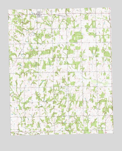
Tryon South, OK USGS Topographic Map
Click on map above to begin viewing in our Map Viewer.

This topographic map contains these locations and features:
Feature Name Type Latitude Longitude GNIS ID View Map
AndersonPopulated PlaceN35.8264°W96.9903°1100177View Map
Iowa-Sac and Fox Tribal Jurisdiction Statistical Area (historical)CensusN35.8084°W96.9253°1925065View Map
Melton Airport (historical)AirportN35.8442°W96.9823°1102700View Map
North Bellcow CreekStreamN35.7553°W96.9889°1095913View Map
Northwest Lincoln DivisionCivilN35.8629°W96.9892°1937806View Map
Oknoname 037034 DamDamN35.8417°W96.8920°1753251View Map
Oknoname 037034 ReservoirReservoirN35.8417°W96.8920°1753252View Map
Oknoname 08116 DamDamN35.8284°W96.8970°1753033View Map
Oknoname 08116 ReservoirReservoirN35.8290°W96.8981°1753034View Map
Pleasant Ridge CemeteryCemeteryN35.7689°W96.9324°2704483View Map
Pleasant Ridge ChurchChurchN35.7687°W96.9322°1096746View Map
Rock Spring CemeteryCemeteryN35.7900°W96.9467°1097360View Map
Township of OtoeCivilN35.7695°W96.9725°1824910View Map
Township of UnionCivilN35.7695°W96.8975°1824911View Map
TryonPopulated PlaceN35.8698°W96.9639°1098993View Map
Tryon CemeteryCemeteryN35.8703°W96.9739°2681659View Map
Tryon Elementary SchoolSchoolN35.8703°W96.9656°1819388View Map
Tryon Fire DepartmentBuildingN35.8703°W96.9648°2656917View Map
Tryon Police DepartmentBuildingN35.8703°W96.9648°2757917View Map
Union ChurchChurchN35.7965°W96.8847°1099160View Map
Valley Queen CemeteryCemeteryN35.8412°W96.9217°1099207View Map

Note: Coordinates in the location and feature list above are referenced to NAD83 datum.


Copyright (C) 2008-2024 Ryan Niemi / Sunset Dynamics ... All Rights Reserved