TopoQuest Logo
Do you find TopoQuest useful?
Help keep TopoQuest running and adding new maps/features by donating!
Bitcoin:  19c7KJd3qBynnjoSw5npx9KScwjBe4ifkT
Litecoin:  LXs6TkuXGGXo1vDsWCkWVdjQX94eUKd6ui
Home View Maps Find Maps Find Places Resources & Links


Tuckahoe, New Jersey Topographic Map

USGS Map Title: Tuckahoe, NJ
USGS Map MRC: 39074C7
DRG (GeoTIFF) Download: o39074c7.tif


Neighboring USGS Topographic Map Quads:


  Five Points, NJ  
39074D8
 

  Dorothy, NJ  
39074D7
 

  Mays Landing, NJ  
39074D6
 

  Port Elizabeth, NJ  
39074C8
 

  Tuckahoe, NJ  
39074C7
 

  Marmora, NJ  
39074C6
 

  Heislerville, NJ  
39074B8
 

  Woodbine, NJ  
39074B7
 

  Sea Isle City, NJ  
39074B6


Map MRC Location:

N40°
W75°
N40°
W74°
H8 H7 H6 H5 H4 H3 H2 H1
G8 G7 G6 G5 G4 G3 G2 G1
F8 F7 F6 F5 F4 F3 F2 F1
E8 E7 E6 E5 E4 E3 E2 E1
D8 D7 D6 D5 D4 D3 D2 D1
C8 C7 C6 C5 C4 C3 C2 C1
B8 B7 B6 B5 B4 B3 B2 B1
A8 A7 A6 A5 A4 A3 A2 A1
N39°
W75°
N39°
W74°

Tuckahoe, NJ USGS 1:24K Topographic Map Preview:
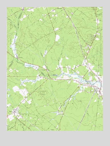
Tuckahoe, NJ USGS Topographic Map
Click on map above to begin viewing in our Map Viewer.

This topographic map contains these locations and features:
Feature Name Type Latitude Longitude GNIS ID View Map
Back RunStreamN39.2868°W74.7857°874453View Map
BelleplainPopulated PlaceN39.2687°W74.8666°874648View Map
Belleplain Census Designated PlaceCensusN39.2662°W74.8672°2629044View Map
Belleplain Emergency Corps Medical TransportBuildingN39.2722°W74.8628°2659753View Map
Belleplain State ForestForestN39.2893°W74.8271°874649View Map
Belleplain Volunteer Fire CompanyBuildingN39.2695°W74.8657°2401844View Map
Buck Hill StationLocaleN39.3229°W74.7738°883637View Map
City of Estell ManorCivilN39.3587°W74.7751°885212View Map
Corbin CityPopulated PlaceN39.3034°W74.7557°875650View Map
Five Acre PondLakeN39.3388°W74.8063°882939View Map
Green BranchStreamN39.3526°W74.8608°876767View Map
Head of RiverLocaleN39.3118°W74.8224°877025View Map
Hunters MillPopulated PlaceN39.3237°W74.8604°877286View Map
MarshallvillePopulated PlaceN39.2965°W74.7685°878150View Map
McNeals BranchStreamN39.3065°W74.8169°878229View Map
Mill CreekStreamN39.2995°W74.7715°878350View Map
OakvillePopulated PlaceN39.3621°W74.7566°878926View Map
Pole Bridge BranchStreamN39.3237°W74.8270°879401View Map
Sharps BranchStreamN39.3618°W74.8598°880513View Map
SteelmantownPopulated PlaceN39.2668°W74.8016°880869View Map
Tarkiln BrookStreamN39.3077°W74.8282°881091View Map
TuckahoePopulated PlaceN39.2901°W74.7538°881277View Map
Tuckahoe Post OfficePost OfficeN39.2907°W74.7541°2781505View Map
Tuckahoe Volunteer Fire CompanyBuildingN39.2884°W74.7536°2401605View Map
Warners MillPopulated PlaceN39.3140°W74.8063°882914View Map
Warners Mill PondReservoirN39.3156°W74.8066°882700View Map
Warners Mill StreamStreamN39.3075°W74.8032°881540View Map
WBSS-FM (Millville)TowerN39.3209°W74.7710°885097View Map

Note: Coordinates in the location and feature list above are referenced to NAD83 datum.


Copyright (C) 2008-2025 Ryan Niemi / Sunset Dynamics ... All Rights Reserved