TopoQuest Logo
Do you find TopoQuest useful?
Help keep TopoQuest running and adding new maps/features by donating!
Bitcoin:  19c7KJd3qBynnjoSw5npx9KScwjBe4ifkT
Litecoin:  LXs6TkuXGGXo1vDsWCkWVdjQX94eUKd6ui
Home View Maps Find Maps Find Places Resources & Links


Tucson SW, Arizona Topographic Map

USGS Map Title: Tucson SW, AZ
USGS Map MRC: 32110A8
DRG (GeoTIFF) Download: o32110a8.tif


Neighboring USGS Topographic Map Quads:


  Cat Mountain, AZ  
32111B1
 

  Tucson, AZ  
32110B8
 

  Tucson East, AZ  
32110B7
 

  San Xavier Mission, AZ  
32111A1
 

  Tucson SW, AZ  
32110A8
 

  Tucson SE, AZ  
32110A7
 

  Twin Buttes, AZ  
31111H1
 

  Sahuarita, AZ  
31110H8
 

  Corona De Tucson, AZ  
31110H7


Map MRC Location:

N33°
W111°
N33°
W110°
H8 H7 H6 H5 H4 H3 H2 H1
G8 G7 G6 G5 G4 G3 G2 G1
F8 F7 F6 F5 F4 F3 F2 F1
E8 E7 E6 E5 E4 E3 E2 E1
D8 D7 D6 D5 D4 D3 D2 D1
C8 C7 C6 C5 C4 C3 C2 C1
B8 B7 B6 B5 B4 B3 B2 B1
A8 A7 A6 A5 A4 A3 A2 A1
N32°
W111°
N32°
W110°

Tucson SW, AZ USGS 1:24K Topographic Map Preview:
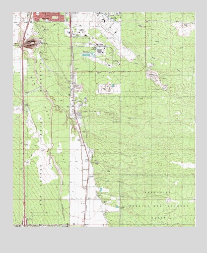
Tucson SW, AZ USGS Topographic Map
Click on map above to begin viewing in our Map Viewer.

This topographic map contains these locations and features:
Feature Name Type Latitude Longitude GNIS ID View Map
Arizona Prarie Mobile Home ParkPopulated PlaceN32.0707°W110.9596°2622749View Map
Cadillac Mobile Home ParkPopulated PlaceN32.0492°W110.9526°2622728View Map
El Camino Mobile ParkPopulated PlaceN32.0844°W110.9597°2622768View Map
Faith Assembly of GodChurchN32.1217°W110.9636°2623091View Map
Grancen Railroad StationBuildingN32.1209°W110.9601°15380View Map
KNST-AM (Tucson)TowerN32.0537°W110.9470°43364View Map
KQTL-AM (Sahuarita)TowerN32.0345°W110.9465°45103View Map
Las Palmes Mobile Home ParkPopulated PlaceN32.1241°W110.9626°2622774View Map
Los Reales Industrial ParkLocaleN32.1210°W110.8858°2622354View Map
Martinez HillSummitN32.1065°W110.9881°7744View Map
Mission View Club Estates Mobile Home ParkPopulated PlaceN32.1183°W110.9725°2622696View Map
Papago InterchangeCrossingN32.0706°W110.9929°15510View Map
Pima Community College Aviation Technology CenterSchoolN32.1205°W110.9590°2545055View Map
Pima Mine InterchangeCrossingN32.0015°W110.9923°15526View Map
Rancho de MartinezCivilN32.1062°W110.9973°9946View Map
Rural - Metro Fire Department Station 81BuildingN32.0895°W110.9566°2672726View Map
San Xavier InterchangeCrossingN32.1067°W110.9929°15569View Map
SummitPopulated PlaceN32.0670°W110.9515°1853167View Map
Summit Census Designated PlaceCensusN32.0657°W110.9487°2410018View Map
Summit View Elementary SchoolSchoolN32.0663°W110.9437°2544995View Map
Tucson International AirportAirportN32.1204°W110.9378°15645View Map

Note: Coordinates in the location and feature list above are referenced to NAD83 datum.


Copyright (C) 2008-2024 Ryan Niemi / Sunset Dynamics ... All Rights Reserved