TopoQuest Logo
Do you find TopoQuest useful?
Help keep TopoQuest running and adding new maps/features by donating!
Bitcoin:  19c7KJd3qBynnjoSw5npx9KScwjBe4ifkT
Litecoin:  LXs6TkuXGGXo1vDsWCkWVdjQX94eUKd6ui
Home View Maps Find Maps Find Places Resources & Links


Tule Mesa, Arizona Topographic Map

USGS Map Title: Tule Mesa, AZ
USGS Map MRC: 34111C7
DRG (GeoTIFF) Download: o34111c7.tif


Neighboring USGS Topographic Map Quads:


  Arnold Mesa, AZ  
34111D8
 

  Horner Mountain, AZ  
34111D7
 

  Hackberry Mountain, AZ  
34111D6
 

  Dugas, AZ  
34111C8
 

  Tule Mesa, AZ  
34111C7
 

  Verde Hot Springs, AZ  
34111C6
 

  Brooklyn Peak, AZ  
34111B8
 

  Bloody Basin, AZ  
34111B7
 

  Wet Bottom Mesa, AZ  
34111B6


Map MRC Location:

N35°
W112°
N35°
W111°
H8 H7 H6 H5 H4 H3 H2 H1
G8 G7 G6 G5 G4 G3 G2 G1
F8 F7 F6 F5 F4 F3 F2 F1
E8 E7 E6 E5 E4 E3 E2 E1
D8 D7 D6 D5 D4 D3 D2 D1
C8 C7 C6 C5 C4 C3 C2 C1
B8 B7 B6 B5 B4 B3 B2 B1
A8 A7 A6 A5 A4 A3 A2 A1
N34°
W112°
N34°
W111°

Tule Mesa, AZ USGS 1:24K Topographic Map Preview:
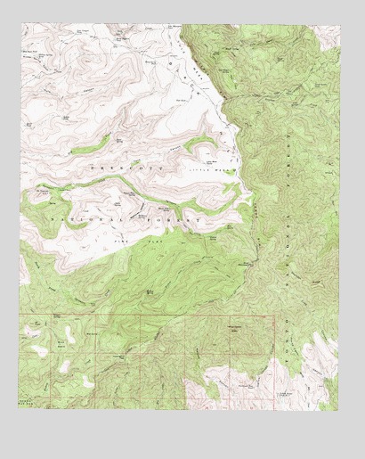
Tule Mesa, AZ USGS Topographic Map
Click on map above to begin viewing in our Map Viewer.

This topographic map contains these locations and features:
Feature Name Type Latitude Longitude GNIS ID View Map
Beehouse CanyonValleyN34.3184°W111.8271°26184View Map
Beehouse SpringSpringN34.3127°W111.8298°26185View Map
Bishop SpringSpringN34.2882°W111.8259°26358View Map
Black Alder SpringSpringN34.3148°W111.8170°26365View Map
Brush SpringSpringN34.3672°W111.7960°26814View Map
Brush WaterSpringN34.3121°W111.8679°41110View Map
Buck BasinBasinN34.2709°W111.8593°26858View Map
Buck Basin TankReservoirN34.2712°W111.8596°38279View Map
Canyon WaterSpringN34.3318°W111.8587°41112View Map
Chalk SpringSpringN34.3163°W111.8388°27488View Map
Christmas Tree TankReservoirN34.2575°W111.7836°27619View Map
CloverleafLocaleN34.2995°W111.8029°2056664View Map
Cold Water SpringSpringN34.3600°W111.7940°27806View Map
Coldwater Tank Number TwoReservoirN34.3635°W111.7502°27810View Map
Dans SpringSpringN34.3371°W111.8383°28274View Map
Double T RanchLocaleN34.3209°W111.8607°28566View Map
Duck SpringSpringN34.3636°W111.7757°28653View Map
Hidden SpringSpringN34.2807°W111.8622°29940View Map
High SpringSpringN34.3657°W111.7981°29968View Map
Hoop-em-up TankReservoirN34.3622°W111.8223°30096View Map
Horse Pasture TankReservoirN34.3698°W111.8390°30160View Map
IM PeakSummitN34.2775°W111.8696°30314View Map
Lime SpringSpringN34.3492°W111.7672°30968View Map
Little MesaSummitN34.3278°W111.8010°31098View Map
Little Mesa TanksReservoirN34.3299°W111.8033°31100View Map
Lower Bishop SpringSpringN34.2650°W111.8485°38591View Map
Lower Cedar Tank Number TwoReservoirN34.3740°W111.7866°41076View Map
Lower Tule WaterSpringN34.3557°W111.8624°41073View Map
Mikes CabinLocaleN34.2842°W111.8474°31849View Map
Mikes SpringSpringN34.2844°W111.8480°41102View Map
Mockingbird PassGapN34.2667°W111.8335°31942View Map
Mount ThomasSummitN34.3198°W111.8671°35276View Map
MT RanchLocaleN34.3273°W111.7524°31426View Map
Mud SpringSpringN34.2744°W111.8445°32118View Map
Nelson Place SpringSpringN34.3199°W111.8304°32283View Map
Nelson Trail Number One Hundred Fifty NineTrailN34.2917°W111.8151°38658View Map
Oak WaterSpringN34.3084°W111.8647°41109View Map
One Eighth SpringSpringN34.3165°W111.8643°38299View Map
Pine FlatFlatN34.3045°W111.8293°32932View Map
Pine Flat TrailTrailN34.3128°W111.8413°32941View Map
Pine MountainSummitN34.2973°W111.7857°32953View Map
Pine Mountain WildernessReserveN34.2847°W111.8057°41979View Map
Pine SpringSpringN34.3089°W111.7949°32972View Map
Quail TankReservoirN34.3414°W111.8736°9850View Map
Rabbit SpringSpringN34.2911°W111.8599°41108View Map
Road TankReservoirN34.3681°W111.8502°38754View Map
Rodeer SpringSpringN34.2961°W111.8413°41107View Map
Saddle TankReservoirN34.3440°W111.8593°33936View Map
Skeleton RidgeRidgeN34.2914°W111.7579°34487View Map
Slide SpringSpringN34.2898°W111.8543°41103View Map
Tank CanyonValleyN34.3261°W111.8365°35128View Map
The CedarsWoodsN34.3531°W111.7701°35216View Map
Thistle TankReservoirN34.3573°W111.8374°38875View Map
Tule Canyon TankReservoirN34.3716°W111.8542°35505View Map
Tule MesaSummitN34.3709°W111.8143°35507View Map
Tule Mountain TankReservoirN34.3735°W111.8194°35508View Map
Tule SpringSpringN34.3554°W111.8605°41074View Map
Tule TankReservoirN34.3501°W111.8106°35511View Map
Verde RimCliffN34.3639°W111.8085°35766View Map
Verde Rim TrailTrailN34.2870°W111.7938°35767View Map
Verde Saddle TankReservoirN34.3554°W111.7610°35769View Map
West WaterSpringN34.2896°W111.8693°41104View Map
Willow SpringSpringN34.3064°W111.8016°36256View Map
Willow Spring TankReservoirN34.3642°W111.8695°36271View Map
Yellow Jacket MesaSummitN34.2767°W111.7918°36455View Map
Yellow Jacket Tank Number TwoReservoirN34.2553°W111.7742°36467View Map

Note: Coordinates in the location and feature list above are referenced to NAD83 datum.


Copyright (C) 2008-2024 Ryan Niemi / Sunset Dynamics ... All Rights Reserved