TopoQuest Logo
Do you find TopoQuest useful?
Help keep TopoQuest running and adding new maps/features by donating!
Bitcoin:  19c7KJd3qBynnjoSw5npx9KScwjBe4ifkT
Litecoin:  LXs6TkuXGGXo1vDsWCkWVdjQX94eUKd6ui
Home View Maps Find Maps Find Places Resources & Links


Dugas, Arizona Topographic Map

USGS Map Title: Dugas, AZ
USGS Map MRC: 34111C8
DRG (GeoTIFF) Download: o34111c8.tif


Neighboring USGS Topographic Map Quads:


  Estler Peak, AZ  
34112D1
 

  Arnold Mesa, AZ  
34111D8
 

  Horner Mountain, AZ  
34111D7
 

  Cordes Junction, AZ  
34112C1
 

  Dugas, AZ  
34111C8
 

  Tule Mesa, AZ  
34111C7
 

  Joes Hill, AZ  
34112B1
 

  Brooklyn Peak, AZ  
34111B8
 

  Bloody Basin, AZ  
34111B7


Map MRC Location:

N35°
W112°
N35°
W111°
H8 H7 H6 H5 H4 H3 H2 H1
G8 G7 G6 G5 G4 G3 G2 G1
F8 F7 F6 F5 F4 F3 F2 F1
E8 E7 E6 E5 E4 E3 E2 E1
D8 D7 D6 D5 D4 D3 D2 D1
C8 C7 C6 C5 C4 C3 C2 C1
B8 B7 B6 B5 B4 B3 B2 B1
A8 A7 A6 A5 A4 A3 A2 A1
N34°
W112°
N34°
W111°

Dugas, AZ USGS 1:24K Topographic Map Preview:
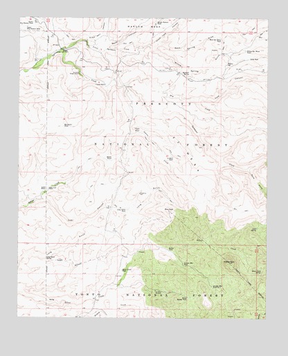
Dugas, AZ USGS Topographic Map
Click on map above to begin viewing in our Map Viewer.

This topographic map contains these locations and features:
Feature Name Type Latitude Longitude GNIS ID View Map
22 MesaSummitN34.3028°W111.9022°35647View Map
Blue Rock DamDamN34.3661°W111.8754°41075View Map
Blue Rock TankReservoirN34.3661°W111.8753°26532View Map
Boundary CorralLocaleN34.3323°W111.9852°40994View Map
Burmister TankReservoirN34.3302°W111.9780°27016View Map
Cabin SpringSpringN34.2879°W111.8810°27150View Map
Canyon WaterSpringN34.3623°W111.9371°40997View Map
Chalk Tank CanyonValleyN34.3620°W111.9335°27493View Map
Clays Well CanyonValleyN34.3667°W111.9660°27696View Map
Cordes Lakes-Mayer DivisionCivilN34.2621°W111.9080°1934951View Map
Cow CanyonValleyN34.2995°W111.9888°28080View Map
Dry CreekStreamN34.3473°W111.9474°28625View Map
Dry Creek Spring Number OneSpringN34.3488°W111.9448°38421View Map
Dry Creek Spring Number TwoSpringN34.3411°W111.9129°38422View Map
Dry Creek WaterSpringN34.3347°W111.8814°40992View Map
DugasPopulated PlaceN34.3620°W111.9785°28668View Map
Granite Mountain TankReservoirN34.2728°W111.9174°29483View Map
Granite Mountain Tank Number TwoReservoirN34.2633°W111.9026°29484View Map
Granite PeakSummitN34.2734°W111.8943°29488View Map
Grapevine WellWellN34.3023°W111.9396°29536View Map
Graveyard SpringSpringN34.3378°W111.9368°41000View Map
Hidden SpringSpringN34.3070°W111.8868°40993View Map
Highball SpringSpringN34.3527°W111.9153°29969View Map
Holdin Pasture TankReservoirN34.3735°W111.9316°30054View Map
Indian Creek Pipeline TroughsLocaleN34.3164°W111.9471°43531View Map
Indian Creek RanchLocaleN34.3039°W111.9854°30336View Map
Indian Creek Trail SpringSpringN34.3033°W111.9869°41025View Map
Jacks TankReservoirN34.3582°W111.8851°30478View Map
Little Sycamore CreekStreamN34.3611°W111.9807°31136View Map
Long Gulch CorralLocaleN34.2759°W111.9893°41026View Map
Long Gulch SpringSpringN34.2756°W111.9862°31241View Map
Long Gulch TankReservoirN34.2953°W111.9460°31242View Map
Lower Dry Pasture TankReservoirN34.3736°W111.9940°31354View Map
Lower WaterSpringN34.3034°W111.9868°31386View Map
Marlow MesaSummitN34.3709°W111.9277°31518View Map
McRae TankReservoirN34.2781°W111.9248°31689View Map
Mesa CorralLocaleN34.3228°W111.9335°40990View Map
Mesa TankReservoirN34.3169°W111.9229°31731View Map
Middle WaterSpringN34.3160°W111.9538°31831View Map
Mud SpringSpringN34.2842°W111.8929°38653View Map
North Bishop TankReservoirN34.2588°W111.9148°32346View Map
Old Mine WindmillLocaleN34.2614°W111.9313°32510View Map
Pot Hole TankReservoirN34.2992°W111.8957°38714View Map
Reno CanyonValleyN34.3625°W111.9571°33574View Map
Reno SpringSpringN34.3628°W111.9366°40999View Map
Rice PeakSummitN34.2950°W111.9249°33597View Map
Rock SeepSpringN34.3245°W111.9185°38759View Map
Rock SpringSpringN34.3670°W111.8926°40998View Map
Rock Spring DrawValleyN34.3642°W111.9310°33731View Map
Rock Spring Draw TankReservoirN34.3668°W111.9006°33732View Map
Silver Creek SpringSpringN34.2696°W111.8783°34436View Map
Silver Creek TankReservoirN34.2699°W111.9483°34437View Map
South Prong Sycamore CreekStreamN34.3117°W111.8863°34681View Map
South TankReservoirN34.2800°W111.9671°38828View Map
Sycamore Ranger StationLocaleN34.3517°W111.9702°35042View Map
Sycamore SubstationLocaleN34.3611°W111.9596°38860View Map
T Anchor RanchLocaleN34.3473°W111.9577°35068View Map
Tule CanyonValleyN34.3398°W111.9113°35502View Map
Tule Creek Seep Number OneSpringN34.3345°W111.8985°40991View Map
Tule Number Two WaterSpringN34.3508°W111.8752°41113View Map
Twenty Two Mesa SeepSpringN34.3264°W111.9215°38897View Map
Upper Dry Pasture TankReservoirN34.3711°W111.9972°35683View Map
Upper WaterSpringN34.3276°W111.9399°35728View Map
Willow SpringSpringN34.3553°W111.8961°36257View Map
Willow Spring GulchValleyN34.3620°W111.9335°36269View Map
Willow Spring Wash TankReservoirN34.3620°W111.8867°36275View Map

Note: Coordinates in the location and feature list above are referenced to NAD83 datum.


Copyright (C) 2008-2024 Ryan Niemi / Sunset Dynamics ... All Rights Reserved