TopoQuest Logo
Do you find TopoQuest useful?
Help keep TopoQuest running and adding new maps/features by donating!
Bitcoin:  19c7KJd3qBynnjoSw5npx9KScwjBe4ifkT
Litecoin:  LXs6TkuXGGXo1vDsWCkWVdjQX94eUKd6ui
Home View Maps Find Maps Find Places Resources & Links


Turlington, Texas Topographic Map

USGS Map Title: Turlington, TX
USGS Map MRC: 31096F1
DRG (GeoTIFF) Download: o31096f1.tif


Neighboring USGS Topographic Map Quads:


  Stewards Mill, TX  
31096G2
 

  Young, TX  
31096G1
 

  Yard, TX  
31095G8
 

  Fairfield, TX  
31096F2
 

  Turlington, TX  
31096F1
 

  Butler, TX  
31095F8
 

  Dew, TX  
31096E2
 

  Lanely, TX  
31096E1
 

  Keechi, TX  
31095E8


Map MRC Location:

N32°
W97°
N32°
W96°
H8 H7 H6 H5 H4 H3 H2 H1
G8 G7 G6 G5 G4 G3 G2 G1
F8 F7 F6 F5 F4 F3 F2 F1
E8 E7 E6 E5 E4 E3 E2 E1
D8 D7 D6 D5 D4 D3 D2 D1
C8 C7 C6 C5 C4 C3 C2 C1
B8 B7 B6 B5 B4 B3 B2 B1
A8 A7 A6 A5 A4 A3 A2 A1
N31°
W97°
N31°
W96°

Turlington, TX USGS 1:24K Topographic Map Preview:
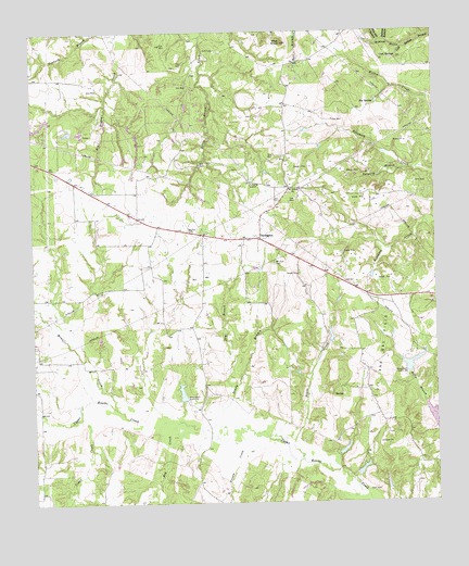
Turlington, TX USGS Topographic Map
Click on map above to begin viewing in our Map Viewer.

This topographic map contains these locations and features:
Feature Name Type Latitude Longitude GNIS ID View Map
Antioch ChurchChurchN31.7079°W96.0447°1351200View Map
Big SpringSpringN31.7311°W96.0187°1352143View Map
Blackbird LakeReservoirN31.6476°W96.0014°1864132View Map
Blackbird Lake DamDamN31.6485°W96.0002°1864131View Map
Cedar CreekStreamN31.6474°W96.1116°1373011View Map
Cold SpringsSpringN31.7431°W96.0114°1354754View Map
Day CemeteryCemeteryN31.7416°W96.0775°1355729View Map
Dowdy BranchStreamN31.6429°W96.0575°1356227View Map
Dry BranchStreamN31.6546°W96.0627°1356279View Map
Folsom CreekStreamN31.6421°W96.0605°1373745View Map
Hog CreekStreamN31.6466°W96.0802°1374090View Map
Hogshead LakeReservoirN31.6336°W96.0239°1864128View Map
Hogshead Lake DamDamN31.6335°W96.0252°1864127View Map
Mims CreekStreamN31.6504°W96.1002°1362935View Map
Morse LakeReservoirN31.6611°W96.0089°1855584View Map
Morse Lake DamDamN31.6602°W96.0086°1855583View Map
Mount Zion CemeteryCemeteryN31.6888°W96.0489°1363338View Map
Mount Zion ParkParkN31.6971°W96.0744°1363372View Map
Negro CreekStreamN31.6363°W96.0425°1363653View Map
Pilot KnobSummitN31.7468°W96.0464°1365244View Map
Pin Oak BranchStreamN31.7474°W96.0161°1375452View Map
Richards LakeReservoirN31.6542°W96.0791°1855586View Map
Richards Lake DamDamN31.6518°W96.0786°1855585View Map
Sistern BranchStreamN31.7474°W96.0144°1376136View Map
Tanbark BranchStreamN31.7493°W96.0980°1369577View Map
Tanyard BranchStreamN31.7135°W96.0094°1369606View Map
TurlingtonPopulated PlaceN31.6949°W96.0544°1380685View Map
Waldrom BranchStreamN31.7460°W96.0097°1370746View Map
Wilson LakeReservoirN31.6385°W96.0319°1864126View Map
Wilson Lake DamDamN31.6385°W96.0319°1864125View Map

Note: Coordinates in the location and feature list above are referenced to NAD83 datum.


Copyright (C) 2008-2025 Ryan Niemi / Sunset Dynamics ... All Rights Reserved