TopoQuest Logo
Do you find TopoQuest useful?
Help keep TopoQuest running and adding new maps/features by donating!
Bitcoin:  19c7KJd3qBynnjoSw5npx9KScwjBe4ifkT
Litecoin:  LXs6TkuXGGXo1vDsWCkWVdjQX94eUKd6ui
Home View Maps Find Maps Find Places Resources & Links


Twelvemile Pond, Pennsylvania Topographic Map

USGS Map Title: Twelvemile Pond, PA
USGS Map MRC: 41075B1
DRG (GeoTIFF) Download: o41075b1.tif


Neighboring USGS Topographic Map Quads:


  Promised Land, PA  
41075C2
 

  Pecks Pond, PA  
41075C1
 

  Edgemere, PA  
41074C8
 

  Skytop, PA  
41075B2
 

  Twelvemile Pond, PA  
41075B1
 

  Lake Maskenozha, PA  
41074B8
 

  East Stroudsburg, PA  
41075A2
 

  Bushkill, PA  
41075A1
 

  Flatbrookville, NJ  
41074A8


Map MRC Location:

N42°
W76°
N42°
W75°
H8 H7 H6 H5 H4 H3 H2 H1
G8 G7 G6 G5 G4 G3 G2 G1
F8 F7 F6 F5 F4 F3 F2 F1
E8 E7 E6 E5 E4 E3 E2 E1
D8 D7 D6 D5 D4 D3 D2 D1
C8 C7 C6 C5 C4 C3 C2 C1
B8 B7 B6 B5 B4 B3 B2 B1
A8 A7 A6 A5 A4 A3 A2 A1
N41°
W76°
N41°
W75°

Twelvemile Pond, PA USGS 1:24K Topographic Map Preview:
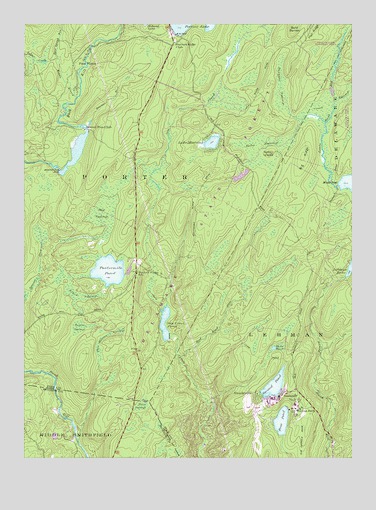
Twelvemile Pond, PA USGS Topographic Map
Click on map above to begin viewing in our Map Viewer.

This topographic map contains these locations and features:
Feature Name Type Latitude Longitude GNIS ID View Map
Bald BarrenSummitN41.2495°W75.0213°1168623View Map
Bald Barren TrailTrailN41.2495°W75.0196°1205711View Map
Beaver PondReservoirN41.2136°W75.1047°1195351View Map
Beaver RunStreamN41.2220°W75.0988°1169028View Map
Beaver Run ClubLocaleN41.2198°W75.1013°1169045View Map
Beaver Run DamDamN41.2079°W75.1110°1169047View Map
Ben Hanna SwampSwampN41.1599°W75.0941°1169222View Map
Big RidgeRidgeN41.2115°W75.0182°1169553View Map
Big SwampSwampN41.1968°W75.0938°1169601View Map
Bobs String SwampSwampN41.2305°W75.1206°1197905View Map
Bushkill Post OfficePost OfficeN41.1277°W75.0077°2780047View Map
East Spring RunStreamN41.2398°W75.1118°1173877View Map
Elbow SwampSwampN41.1716°W75.1032°1174075View Map
First Forest Tree PlantingForestN41.2129°W75.0830°1205712View Map
First PondLakeN41.1357°W75.0265°1174792View Map
Flat RidgeRidgeN41.2498°W75.0138°1174884View Map
Forest ParkPopulated PlaceN41.1393°W75.0182°1174980View Map
Forest Park Post Office (historical)Post OfficeN41.1393°W75.0182°2027109View Map
Hunters RangeLocaleN41.1812°W75.0818°1197904View Map
Hunters Range SchoolSchoolN41.1784°W75.0813°1177614View Map
Lake MinisinkLakeN41.2159°W75.0531°1181338View Map
Lake Minisink DamDamN41.2151°W75.0563°1208984View Map
Lehman Lake DamDamN41.1768°W75.0013°1195321View Map
Maskenozha Lake DamDamN41.1584°W75.0663°1195310View Map
Middle Branch Bush KillStreamN41.2290°W75.1043°1181004View Map
Mishawaka ClubLocaleN41.1590°W75.0691°1197903View Map
Nebo IslandIslandN41.2126°W75.0313°1182203View Map
Nebo SwampSwampN41.2156°W75.0349°1182204View Map
Old Mill DamDamN41.2218°W75.1099°1208842View Map
Painter SwampSwampN41.2314°W75.0265°1183210View Map
Pine FlatsPopulated PlaceN41.2406°W75.1018°1183788View Map
Porters Lake ClubLocaleN41.2448°W75.0671°1213333View Map
Red Rock RunStreamN41.1537°W75.0655°1184780View Map
SandyvillePopulated PlaceN41.1431°W75.0355°1186972View Map
Saw Creek Club DamDamN41.1601°W75.0696°1195311View Map
Saw Creek PondReservoirN41.1639°W75.0710°1187017View Map
Second PondReservoirN41.1460°W75.0294°1187214View Map
Second Pond DamDamN41.1418°W75.0330°1195299View Map
TamimentPopulated PlaceN41.1423°W75.0271°1189253View Map
Tamiment Resort Golf CourseLocaleN41.1395°W75.0374°1206582View Map
Tamiment Ski AreaLocaleN41.1343°W75.0146°1206581View Map
Taylor CreekStreamN41.2398°W75.1118°1189302View Map
Third PondLakeN41.1567°W75.0296°1189460View Map
Tims SwampSwampN41.1403°W75.0798°1189577View Map
Township of PorterCivilN41.2242°W75.0773°1216964View Map
Turner SwampSwampN41.1626°W75.1034°1189962View Map
Twelve Mile Pond DamDamN41.1784°W75.0863°1195324View Map
Twelvemile PondLakeN41.1789°W75.0925°1189996View Map

Note: Coordinates in the location and feature list above are referenced to NAD83 datum.


Copyright (C) 2008-2025 Ryan Niemi / Sunset Dynamics ... All Rights Reserved