TopoQuest Logo
Do you find TopoQuest useful?
Help keep TopoQuest running and adding new maps/features by donating!
Bitcoin:  19c7KJd3qBynnjoSw5npx9KScwjBe4ifkT
Litecoin:  LXs6TkuXGGXo1vDsWCkWVdjQX94eUKd6ui
Home View Maps Find Maps Find Places Resources & Links


Twin Oaks, Louisiana Topographic Map

USGS Map Title: Twin Oaks, LA
USGS Map MRC: 32091H7
DRG (GeoTIFF) Download: o32091h7.tif


Neighboring USGS Topographic Map Quads:


  Crossett South, AR  
33091A8
 

  Berlin, AR  
33091A7
 

  Wilmot SW, AR  
33091A6
 

  Beekman, LA  
32091H8
 

  Twin Oaks, LA  
32091H7
 

  Bonita, LA  
32091H6
 

  Bastrop, LA  
32091G8
 

  Mer Rouge, LA  
32091G7
 

  Bonita SW, LA  
32091G6


Map MRC Location:

N33°
W92°
N33°
W91°
H8 H7 H6 H5 H4 H3 H2 H1
G8 G7 G6 G5 G4 G3 G2 G1
F8 F7 F6 F5 F4 F3 F2 F1
E8 E7 E6 E5 E4 E3 E2 E1
D8 D7 D6 D5 D4 D3 D2 D1
C8 C7 C6 C5 C4 C3 C2 C1
B8 B7 B6 B5 B4 B3 B2 B1
A8 A7 A6 A5 A4 A3 A2 A1
N32°
W92°
N32°
W91°

Twin Oaks, LA USGS 1:24K Topographic Map Preview:
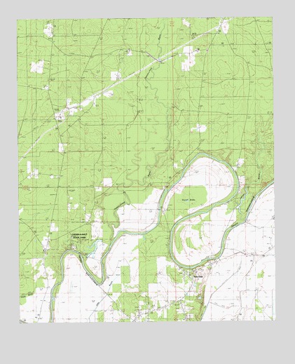
Twin Oaks, LA USGS Topographic Map
Click on map above to begin viewing in our Map Viewer.

This topographic map contains these locations and features:
Feature Name Type Latitude Longitude GNIS ID View Map
Bartholomew ChurchChurchN32.8824°W91.8001°532323View Map
Beekman Lookout TowerTowerN32.9296°W91.8515°558741View Map
Bethel Baptist ChurchChurchN32.9049°W91.8629°553620View Map
Brodnax (historical)Populated PlaceN32.8840°W91.7965°546671View Map
Caney BayouStreamN32.9135°W91.7712°533728View Map
Causey (historical)Populated PlaceN32.9518°W91.8543°546674View Map
Causey CemeteryCemeteryN32.9687°W91.8287°533829View Map
Chemin A Haut Lake DamDamN32.9085°W91.8318°556862View Map
Chemin-A-Haut BayouStreamN32.9062°W91.8307°47720View Map
Chemin-A-Haut State ParkParkN32.9101°W91.8451°533894View Map
Concord ChurchChurchN32.9832°W91.8629°534077View Map
Harrell BrakeSwampN32.9279°W91.7907°535536View Map
Holly Green ChurchChurchN32.9201°W91.8535°535721View Map
Kelly CemeteryCemeteryN32.9168°W91.8444°536163View Map
Morehouse Brake (historical)SwampN32.8879°W91.7765°537199View Map
Neamon CemeteryCemeteryN32.9221°W91.8340°537533View Map
New Light ChurchChurchN32.9029°W91.8629°537605View Map
Nunn Brake (historical)SwampN32.9132°W91.7543°537764View Map
Parish Governing Authority District 1CivilN32.9300°W91.7979°1929747View Map
Plantersville (historical)Populated PlaceN32.8835°W91.7779°1630662View Map
Tillou ChurchChurchN32.9862°W91.7826°539937View Map
Tipton (historical)Populated PlaceN32.9174°W91.8590°546733View Map
Travis AirportAirportN32.9717°W91.8309°2676794View Map
Twin OaksPopulated PlaceN32.8926°W91.7904°543742View Map
Vester BridgeBridgeN32.9212°W91.8060°540154View Map
Ward NineCivilN32.9760°W91.7565°545136View Map
Ward SevenCivilN32.8754°W91.7976°545134View Map

Note: Coordinates in the location and feature list above are referenced to NAD83 datum.


Copyright (C) 2008-2025 Ryan Niemi / Sunset Dynamics ... All Rights Reserved