TopoQuest Logo
Do you find TopoQuest useful?
Help keep TopoQuest running and adding new maps/features by donating!
Bitcoin:  19c7KJd3qBynnjoSw5npx9KScwjBe4ifkT
Litecoin:  LXs6TkuXGGXo1vDsWCkWVdjQX94eUKd6ui
Home View Maps Find Maps Find Places Resources & Links


Beekman, Louisiana Topographic Map

USGS Map Title: Beekman, LA
USGS Map MRC: 32091H8
DRG (GeoTIFF) Download: o32091h8.tif


Neighboring USGS Topographic Map Quads:


  Felsenthal Dam, AR  
33092A1
 

  Crossett South, AR  
33091A8
 

  Berlin, AR  
33091A7
 

  Fish Lake, LA  
32092H1
 

  Beekman, LA  
32091H8
 

  Twin Oaks, LA  
32091H7
 

  Harrell Lake, LA  
32092G1
 

  Bastrop, LA  
32091G8
 

  Mer Rouge, LA  
32091G7


Map MRC Location:

N33°
W92°
N33°
W91°
H8 H7 H6 H5 H4 H3 H2 H1
G8 G7 G6 G5 G4 G3 G2 G1
F8 F7 F6 F5 F4 F3 F2 F1
E8 E7 E6 E5 E4 E3 E2 E1
D8 D7 D6 D5 D4 D3 D2 D1
C8 C7 C6 C5 C4 C3 C2 C1
B8 B7 B6 B5 B4 B3 B2 B1
A8 A7 A6 A5 A4 A3 A2 A1
N32°
W92°
N32°
W91°

Beekman, LA USGS 1:24K Topographic Map Preview:
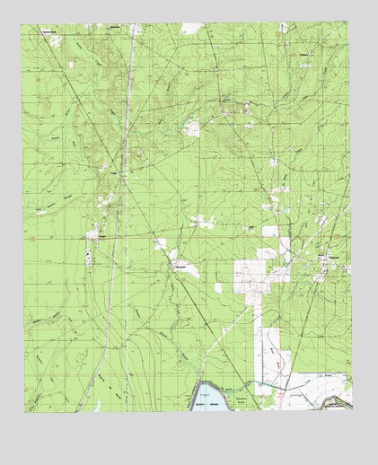
Beekman, LA USGS Topographic Map
Click on map above to begin viewing in our Map Viewer.

This topographic map contains these locations and features:
Feature Name Type Latitude Longitude GNIS ID View Map
BeekmanPopulated PlaceN32.9237°W91.8843°546882View Map
Beekman Gas and Oil FieldOilfieldN32.9299°W91.8926°553576View Map
Beekman Junior High SchoolSchoolN32.9249°W91.8868°546668View Map
Beekman Volunteer Fire Department Ward 2BuildingN32.9236°W91.8850°2672968View Map
Braxton BranchStreamN32.8968°W91.9435°546885View Map
Couters NeckPopulated PlaceN32.9965°W91.9921°546890View Map
De Butte CreekStreamN32.8846°W91.9335°546948View Map
Georgia Pacific Wildlife Management AreaParkN32.8779°W91.9751°546702View Map
Groom SlashStreamN32.9637°W91.9926°546897View Map
Holly BranchStreamN32.9654°W91.9576°546899View Map
HumphreysPopulated PlaceN32.9968°W91.9662°546901View Map
Lick BranchStreamN32.9051°W91.9879°546910View Map
Little CreekStreamN32.9740°W91.9035°546911View Map
NaffPopulated PlaceN32.9351°W91.9185°546917View Map
Pine Grove ChurchChurchN32.9940°W91.9537°555657View Map
Pratt BrakeCanalN32.8851°W91.8799°546921View Map
RobinsonPopulated PlaceN32.9890°W91.8901°546925View Map
RogersPopulated PlaceN32.9315°W91.9760°546926View Map
Snake CreekStreamN32.9743°W91.9810°54971View Map
Squeeler BrakeSwampN32.8780°W91.9173°546949View Map
StevensonPopulated PlaceN32.9210°W91.9432°546935View Map
Stevenson CemeteryCemeteryN32.9558°W91.9523°546936View Map
Stevenson Lookout TowerTowerN32.8968°W91.9624°558828View Map
Sunrise ChurchChurchN32.9657°W91.9051°546937View Map
VaughnPopulated PlaceN32.9521°W91.9632°546941View Map
Ward BrakeCanalN32.8835°W91.9149°546943View Map
Ward TwoCivilN32.9379°W91.9254°546951View Map
White Oak SloughStreamN32.8915°W91.9379°546945View Map

Note: Coordinates in the location and feature list above are referenced to NAD83 datum.


Copyright (C) 2008-2025 Ryan Niemi / Sunset Dynamics ... All Rights Reserved