TopoQuest Logo
Do you find TopoQuest useful?
Help keep TopoQuest running and adding new maps/features by donating!
Bitcoin:  19c7KJd3qBynnjoSw5npx9KScwjBe4ifkT
Litecoin:  LXs6TkuXGGXo1vDsWCkWVdjQX94eUKd6ui
Home View Maps Find Maps Find Places Resources & Links


Board Camp, Arkansas Topographic Map

USGS Map Title: Board Camp, AR
USGS Map MRC: 34094E1
DRG (GeoTIFF) Download: o34094e1.tif


Neighboring USGS Topographic Map Quads:


  Acorn, AR  
34094F2
 

  Y City, AR  
34094F1
 

  Buck Knob, AR  
34093F8
 

  Mena, AR  
34094E2
 

  Board Camp, AR  
34094E1
 

  Pine Ridge, AR  
34093E8
 

  Eagle Mountain, AR  
34094D2
 

  Nichols Mountain, AR  
34094D1
 

  Big Fork, AR  
34093D8


Map MRC Location:

N35°
W95°
N35°
W94°
H8 H7 H6 H5 H4 H3 H2 H1
G8 G7 G6 G5 G4 G3 G2 G1
F8 F7 F6 F5 F4 F3 F2 F1
E8 E7 E6 E5 E4 E3 E2 E1
D8 D7 D6 D5 D4 D3 D2 D1
C8 C7 C6 C5 C4 C3 C2 C1
B8 B7 B6 B5 B4 B3 B2 B1
A8 A7 A6 A5 A4 A3 A2 A1
N34°
W95°
N34°
W94°

Board Camp, AR USGS 1:24K Topographic Map Preview:
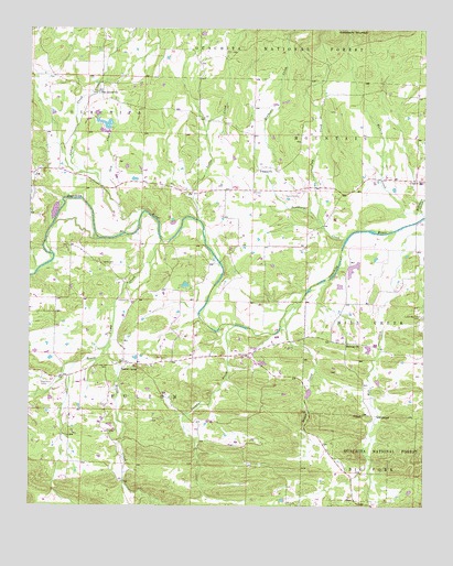
Board Camp, AR USGS Topographic Map
Click on map above to begin viewing in our Map Viewer.

This topographic map contains these locations and features:
Feature Name Type Latitude Longitude GNIS ID View Map
Board CampPopulated PlaceN34.5379°W94.0955°70745View Map
Board Camp Assembly of God ChurchChurchN34.5368°W94.0863°64102View Map
Board Camp Baptist ChurchChurchN34.5384°W94.0955°63159View Map
Board Camp CemeteryCemeteryN34.5351°W94.1041°63160View Map
Board Camp CreekStreamN34.5698°W94.0835°70746View Map
Board Camp Post OfficePost OfficeN34.5374°W94.0892°2781839View Map
Board Camp Primitive Baptist ChurchChurchN34.5359°W94.1044°63161View Map
Board Camp School (historical)SchoolN34.5376°W94.0902°63162View Map
Board Camp Station Fire District 8BuildingN34.5373°W94.0942°2116166View Map
Boggy CreekStreamN34.5540°W94.0394°70754View Map
Cedar CreekStreamN34.5773°W94.0888°71070View Map
Concord Baptist ChurchChurchN34.5887°W94.1213°63178View Map
Concord CemeteryCemeteryN34.5886°W94.1221°63179View Map
Dairy LakeReservoirN34.5915°W94.0988°80641View Map
Dairy Lake DamDamN34.5918°W94.1002°80640View Map
Forbis LakeReservoirN34.6000°W94.1008°81080View Map
Forbis Lake DamDamN34.6001°W94.0985°81079View Map
Gap CreekStreamN34.5782°W94.0972°71720View Map
Goldsberry MountainSummitN34.6248°W94.0288°71781View Map
High Point CampLocaleN34.5329°W94.1213°72008View Map
InkPopulated PlaceN34.5873°W94.1241°72147View Map
Ink Station Fire District 12BuildingN34.5896°W94.1239°2116617View Map
J and B LakeReservoirN34.5630°W94.0225°81082View Map
J and B Lake DamDamN34.5634°W94.0252°81081View Map
Liberty CemeteryCemeteryN34.5638°W94.1024°72320View Map
Loftis CreekStreamN34.5748°W94.0721°72441View Map
Lower Big Fork CemeteryCemeteryN34.5500°W94.0009°72512View Map
Macks CreekStreamN34.5426°W94.0999°72533View Map
Midway Freewill Baptist ChurchChurchN34.5426°W94.0246°77656View Map
Pine GrovePopulated PlaceN34.6084°W94.1041°63245View Map
Pine Grove Church of ChristChurchN34.6082°W94.1038°78010View Map
Polk CreekStreamN34.5745°W94.0330°73152View Map
Robinson CreekStreamN34.5762°W94.0005°73322View Map
Southern CreekStreamN34.5701°W94.0252°73657View Map
Sulphur CreekStreamN34.5473°W94.0596°73768View Map
Township of FultonCivilN34.5170°W94.0943°68991View Map
Turbin CreekStreamN34.5770°W94.0010°73899View Map
YocanaPopulated PlaceN34.5876°W94.0544°63292View Map
Yocana Baptist ChurchChurchN34.5884°W94.0533°78822View Map
Yocana CemeteryCemeteryN34.5813°W94.0404°74225View Map

Note: Coordinates in the location and feature list above are referenced to NAD83 datum.


Copyright (C) 2008-2024 Ryan Niemi / Sunset Dynamics ... All Rights Reserved