TopoQuest Logo
Do you find TopoQuest useful?
Help keep TopoQuest running and adding new maps/features by donating!
Bitcoin:  19c7KJd3qBynnjoSw5npx9KScwjBe4ifkT
Litecoin:  LXs6TkuXGGXo1vDsWCkWVdjQX94eUKd6ui
Home View Maps Find Maps Find Places Resources & Links


Eagle Mountain, Arkansas Topographic Map

USGS Map Title: Eagle Mountain, AR
USGS Map MRC: 34094D2
DRG (GeoTIFF) Download: o34094d2.tif


Neighboring USGS Topographic Map Quads:


  Potter, AR  
34094E3
 

  Mena, AR  
34094E2
 

  Board Camp, AR  
34094E1
 

  Vandervoort, AR  
34094D3
 

  Eagle Mountain, AR  
34094D2
 

  Nichols Mountain, AR  
34094D1
 

  Wickes, AR  
34094C3
 

  Baker Springs, AR  
34094C2
 

  Umpire, AR  
34094C1


Map MRC Location:

N35°
W95°
N35°
W94°
H8 H7 H6 H5 H4 H3 H2 H1
G8 G7 G6 G5 G4 G3 G2 G1
F8 F7 F6 F5 F4 F3 F2 F1
E8 E7 E6 E5 E4 E3 E2 E1
D8 D7 D6 D5 D4 D3 D2 D1
C8 C7 C6 C5 C4 C3 C2 C1
B8 B7 B6 B5 B4 B3 B2 B1
A8 A7 A6 A5 A4 A3 A2 A1
N34°
W95°
N34°
W94°

Eagle Mountain, AR USGS 1:24K Topographic Map Preview:
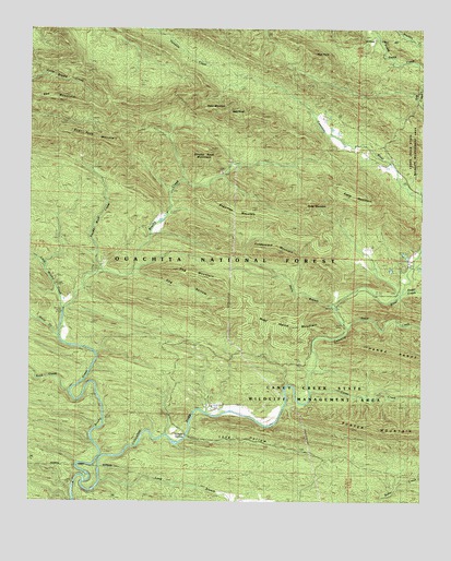
Eagle Mountain, AR USGS Topographic Map
Click on map above to begin viewing in our Map Viewer.

This topographic map contains these locations and features:
Feature Name Type Latitude Longitude GNIS ID View Map
Baker MountainSummitN34.4837°W94.1958°70492View Map
Bald KnobSummitN34.4784°W94.1872°70494View Map
Bee MountainSummitN34.4815°W94.2402°70604View Map
Boar Tusk MountainSummitN34.4698°W94.2233°70744View Map
Brushy CreekStreamN34.3812°W94.2322°70858View Map
Caney CreekStreamN34.4040°W94.1602°70997View Map
Dog HollowValleyN34.4348°W94.2177°71400View Map
Dog MountainSummitN34.4326°W94.1902°71401View Map
Eagle MountainSummitN34.4543°W94.1430°71487View Map
Fodderstack MountainSummitN34.4404°W94.1727°71650View Map
Gillham SpringsSpringN34.3924°W94.1994°71753View Map
High PointSummitN34.4929°W94.1599°72007View Map
Holly BranchStreamN34.4276°W94.1538°72047View Map
Holly CreekStreamN34.4184°W94.2408°63206View Map
Little Brushy CreekStreamN34.4251°W94.2397°72372View Map
Long BranchStreamN34.3807°W94.2274°72463View Map
Long HollowValleyN34.3923°W94.1985°72474View Map
Polk CountyCivilN34.4858°W94.2281°69175View Map
Rock CreekStreamN34.4046°W94.2372°73334View Map
Rocky MountainSummitN34.4557°W94.1597°73364View Map
Short CreekStreamN34.4207°W94.1494°73568View Map
Smoke Rock CreekStreamN34.4359°W94.2274°73627View Map
Smoke Rock MountainSummitN34.4684°W94.1933°73628View Map
Sugar CreekStreamN34.4304°W94.1316°73753View Map
Sugartree MountainSummitN34.4529°W94.1891°73764View Map
West Hanna MountainSummitN34.4209°W94.1674°74072View Map

Note: Coordinates in the location and feature list above are referenced to NAD83 datum.


Copyright (C) 2008-2024 Ryan Niemi / Sunset Dynamics ... All Rights Reserved