TopoQuest Logo
Do you find TopoQuest useful?
Help keep TopoQuest running and adding new maps/features by donating!
Bitcoin:  19c7KJd3qBynnjoSw5npx9KScwjBe4ifkT
Litecoin:  LXs6TkuXGGXo1vDsWCkWVdjQX94eUKd6ui
Home View Maps Find Maps Find Places Resources & Links


Union Hill, Alabama Topographic Map

USGS Map Title: Union Hill, AL
USGS Map MRC: 34087H2
DRG (GeoTIFF) Download: o34087h2.tif


Neighboring USGS Topographic Map Quads:


  Bonnertown, TN  
35087A3
 

  Appleton, TN  
35087A2
 

  Aspen Hill, TN  
35087A1
 

  Lexington, AL  
34087H3
 

  Union Hill, AL  
34087H2
 

  Salem, AL  
34087H1
 

  Rogersville, AL  
34087G3
 

  Cairo, AL  
34087G2
 

  Ripley, AL  
34087G1


Map MRC Location:

N35°
W88°
N35°
W87°
H8 H7 H6 H5 H4 H3 H2 H1
G8 G7 G6 G5 G4 G3 G2 G1
F8 F7 F6 F5 F4 F3 F2 F1
E8 E7 E6 E5 E4 E3 E2 E1
D8 D7 D6 D5 D4 D3 D2 D1
C8 C7 C6 C5 C4 C3 C2 C1
B8 B7 B6 B5 B4 B3 B2 B1
A8 A7 A6 A5 A4 A3 A2 A1
N34°
W88°
N34°
W87°

Union Hill, AL USGS 1:24K Topographic Map Preview:
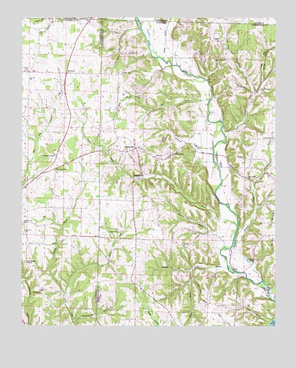
Union Hill, AL USGS Topographic Map
Click on map above to begin viewing in our Map Viewer.

This topographic map contains these locations and features:
Feature Name Type Latitude Longitude GNIS ID View Map
Band Mill SpringSpringN34.9012°W87.1360°113437View Map
Bassham Church (historical)ChurchN34.9668°W87.1367°137793View Map
Belue BranchStreamN34.8754°W87.2467°113901View Map
Bethel (historical)Populated PlaceN34.9773°W87.2278°145066View Map
Bethel Memorial Baptist ChurchChurchN34.9781°W87.2275°114086View Map
Beulah ChurchChurchN34.9679°W87.1917°114192View Map
Bridgeforth BranchStreamN34.9473°W87.1558°114903View Map
Cairo School (historical)SchoolN34.8776°W87.1506°138657View Map
Carrigar School (historical)SchoolN34.9140°W87.1739°138658View Map
Carriger Church of ChristChurchN34.9079°W87.1708°151719View Map
Cherry GrovePopulated PlaceN34.9140°W87.2028°156172View Map
Cherry Grove School (historical)SchoolN34.9134°W87.2031°138662View Map
Corder SpringSpringN34.9404°W87.1278°149154View Map
Craig ChapelChurchN34.9509°W87.1261°116806View Map
Daly BranchStreamN34.9854°W87.1867°117027View Map
Dee BranchStreamN34.8762°W87.2234°145139View Map
Deerlick BranchStreamN34.8873°W87.2289°117207View Map
Dobbins BranchStreamN34.9159°W87.1439°117323View Map
Doctor D E Jackson Memorial Hospital (historical)HospitalN34.9904°W87.1536°137825View Map
Dublin BranchStreamN34.8768°W87.1275°117605View Map
East Fork Scarce Grease BranchStreamN34.9690°W87.1353°117764View Map
Elledge CemeteryCemeteryN34.9567°W87.1586°163671View Map
Enon ChurchChurchN34.9437°W87.1845°118001View Map
Enon DamDamN34.9501°W87.1767°132067View Map
Evans CemeteryCemeteryN34.9276°W87.1911°118068View Map
Gin BranchStreamN34.9070°W87.1497°118978View Map
Good SpringsPopulated PlaceN34.9473°W87.1942°151794View Map
Good Springs School (historical)SchoolN34.9479°W87.1939°149141View Map
Good Springs Volunteer Fire DepartmentBuildingN34.9480°W87.1913°2683319View Map
Gray SpringSpringN34.9448°W87.1744°119299View Map
Hester Chapel CemeteryCemeteryN34.9826°W87.1492°163676View Map
Hesters Chapel Church of ChristChurchN34.9831°W87.1495°120008View Map
Hickory RidgeRidgeN34.9376°W87.1686°141184View Map
Hulsey BranchStreamN34.9823°W87.1772°120543View Map
LesterPopulated PlaceN34.9906°W87.1533°121506View Map
Lester Post OfficePost OfficeN34.9909°W87.1536°166631View Map
Maple SwampSwampN34.8818°W87.1876°122269View Map
McConnell BranchStreamN34.9951°W87.1914°122490View Map
McCravy CemeteryCemeteryN34.9851°W87.1975°152270View Map
McGowan BranchStreamN34.8979°W87.1656°122553View Map
Mechanic BranchStreamN34.9079°W87.1461°152295View Map
Mitchell CemeteryCemeteryN34.9448°W87.2333°142106View Map
Mitchell ChapelChurchN34.9443°W87.2336°152349View Map
Mount RozellPopulated PlaceN34.9351°W87.1403°123379View Map
New Georgia (historical)Populated PlaceN34.9012°W87.2475°142120View Map
New Georgia Church of ChristChurchN34.9009°W87.2484°152620View Map
New Georgia School (historical)SchoolN34.9009°W87.2489°159014View Map
Oak Grove CemeteryCemeteryN34.9465°W87.1911°137880View Map
Old Union ChurchChurchN34.9381°W87.2334°152803View Map
Powell SchoolSchoolN34.9784°W87.2470°125229View Map
Ridgway MillPopulated PlaceN34.9354°W87.1922°156968View Map
Rockford School (historical)SchoolN34.9765°W87.1467°154161View Map
Salem DivisionCivilN34.9244°W87.1352°165852View Map
Scarce GreasePopulated PlaceN34.9706°W87.1325°157021View Map
Scarce Grease BranchStreamN34.9514°W87.1494°126458View Map
Shack BranchStreamN34.9668°W87.1581°126572View Map
Smith HollowValleyN34.9690°W87.1353°127030View Map
Stinnet BranchStreamN34.8981°W87.1483°127412View Map
Stinnett HollowValleyN34.8987°W87.1528°141204View Map
Sugar (historical)Populated PlaceN34.9981°W87.2183°142214View Map
Todd CemeteryCemeteryN34.9434°W87.1428°127748View Map
Todd LakeReservoirN34.9501°W87.1767°132066View Map
Town of LesterCivilN34.9877°W87.1515°2406007View Map
Union HillPopulated PlaceN34.9773°W87.2006°157190View Map
Union Hill CemeteryCemeteryN34.9843°W87.2133°137913View Map
Union Hill ChurchChurchN34.9770°W87.2033°137914View Map
Union School (historical)SchoolN34.9376°W87.2334°142240View Map
Watkins Mill (historical)LocaleN34.8926°W87.2495°142249View Map
Webster HollowValleyN34.8768°W87.2234°128690View Map
Westmoreland (historical)Populated PlaceN34.9459°W87.2139°142257View Map

Note: Coordinates in the location and feature list above are referenced to NAD83 datum.


Copyright (C) 2008-2024 Ryan Niemi / Sunset Dynamics ... All Rights Reserved