TopoQuest Logo
Do you find TopoQuest useful?
Help keep TopoQuest running and adding new maps/features by donating!
Bitcoin:  19c7KJd3qBynnjoSw5npx9KScwjBe4ifkT
Litecoin:  LXs6TkuXGGXo1vDsWCkWVdjQX94eUKd6ui
Home View Maps Find Maps Find Places Resources & Links


Vaughn, Alabama Topographic Map

USGS Map Title: Vaughn, AL
USGS Map MRC: 31087A7
DRG (GeoTIFF) Download: o31087a7.tif


Neighboring USGS Topographic Map Quads:


  Bilbo Island, AL  
31087B8
 

  Tensaw, AL  
31087B7
 

  Blacksher, AL  
31087B6
 

  Stiggins Lake, AL  
31087A8
 

  Vaughn, AL  
31087A7
 

  Perdido, AL  
31087A6
 

  The Basin, AL  
30087H8
 

  Bay Minette North, AL  
30087H7
 

  Dyas, AL  
30087H6


Map MRC Location:

N32°
W88°
N32°
W87°
H8 H7 H6 H5 H4 H3 H2 H1
G8 G7 G6 G5 G4 G3 G2 G1
F8 F7 F6 F5 F4 F3 F2 F1
E8 E7 E6 E5 E4 E3 E2 E1
D8 D7 D6 D5 D4 D3 D2 D1
C8 C7 C6 C5 C4 C3 C2 C1
B8 B7 B6 B5 B4 B3 B2 B1
A8 A7 A6 A5 A4 A3 A2 A1
N31°
W88°
N31°
W87°

Vaughn, AL USGS 1:24K Topographic Map Preview:
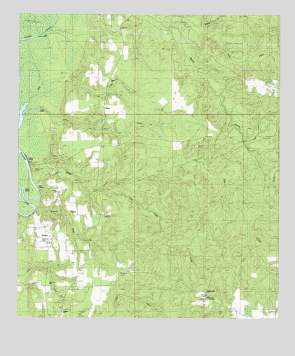
Vaughn, AL USGS Topographic Map
Click on map above to begin viewing in our Map Viewer.

This topographic map contains these locations and features:
Feature Name Type Latitude Longitude GNIS ID View Map
Beard CreekStreamN31.1196°W87.8014°113693View Map
Ben May Fire TowerTowerN31.0066°W87.7855°164333View Map
Caanon ChurchChurchN31.0518°W87.8561°134518View Map
Coon NeckCapeN31.0505°W87.8728°116565View Map
Deans Chapel ChurchChurchN31.0021°W87.7514°134545View Map
Farris CreekStreamN31.0855°W87.8717°118212View Map
Gopher HillLocaleN31.0110°W87.7847°134587View Map
Halls CreekStreamN31.0543°W87.8675°119598View Map
Hills Mills (historical)LocaleN31.0563°W87.8647°149391View Map
Hubbard LandingLocaleN31.0627°W87.8706°156504View Map
Island LandingLocaleN31.0524°W87.8650°156517View Map
Lancaster CemeteryCemeteryN31.0421°W87.8486°121363View Map
LathamPopulated PlaceN31.0849°W87.8342°156583View Map
Latham United Methodist ChurchChurchN31.0982°W87.8314°155130View Map
Little Halls CreekStreamN31.0527°W87.8355°121795View Map
Mariah BranchStreamN31.0699°W87.7514°152225View Map
Nelson LandingLocaleN31.0857°W87.8636°156774View Map
Old Island LandingLocaleN31.1174°W87.8608°156834View Map
Philip CreekStreamN31.1205°W87.7886°124677View Map
Rabun Volunteer Fire Department Station 2BuildingN31.0955°W87.7523°2691557View Map
Red Hill CreekStreamN31.0888°W87.8700°125486View Map
Richerson CemeteryCemeteryN31.0132°W87.8603°125606View Map
Richerson CemeteryCemeteryN31.0146°W87.8603°134680View Map
Robinsons Mill (historical)LocaleN31.0460°W87.8661°149405View Map
Stockton DivisionCivilN31.1128°W87.7862°161597View Map
Stockton Presbyterian ChurchChurchN31.0024°W87.8530°155259View Map
Stockton SchoolSchoolN31.0105°W87.8497°127419View Map
Stockton United Methodist ChurchChurchN31.0041°W87.8530°154572View Map
Stockton Volunteer Fire DepartmentBuildingN31.0145°W87.8471°2330990View Map
VaughnPopulated PlaceN31.0299°W87.8611°128419View Map
Vaughn Junior High SchoolSchoolN31.0311°W87.8599°149414View Map
Watson CreekStreamN31.0449°W87.8667°128640View Map
Watsons Mill (historical)LocaleN31.0343°W87.8475°149415View Map
Wolf CreekStreamN31.0732°W87.7675°129154View Map
Zion Foundation ChurchChurchN31.0321°W87.8611°134739View Map

Note: Coordinates in the location and feature list above are referenced to NAD83 datum.


Copyright (C) 2008-2025 Ryan Niemi / Sunset Dynamics ... All Rights Reserved