TopoQuest Logo
Do you find TopoQuest useful?
Help keep TopoQuest running and adding new maps/features by donating!
Bitcoin:  19c7KJd3qBynnjoSw5npx9KScwjBe4ifkT
Litecoin:  LXs6TkuXGGXo1vDsWCkWVdjQX94eUKd6ui
Home View Maps Find Maps Find Places Resources & Links


Venice, Louisiana Topographic Map

USGS Map Title: Venice, LA
USGS Map MRC: 29089C3
DRG (GeoTIFF) Download: o29089c3.tif


Neighboring USGS Topographic Map Quads:


  Coquille Point, LA  
29089D4
 

  Taylor Pass, LA  
29089D3
 

  Breton Islands, LA  
29089D2
 

  Triumph, LA  
29089C4
 

  Venice, LA  
29089C3


  Pilottown, LA  
29089B3
 

  Pass a Loutre West, LA  
29089B2


Map MRC Location:

N30°
W90°
N30°
W89°
H8 H7 H6 H5 H4 H3 H2 H1
G8 G7 G6 G5 G4 G3 G2 G1
F8 F7 F6 F5 F4 F3 F2 F1
E8 E7 E6 E5 E4 E3 E2 E1
D8 D7 D6 D5 D4 D3 D2 D1
C8 C7 C6 C5 C4 C3 C2 C1
B8 B7 B6 B5 B4 B3 B2 B1
A8 A7 A6 A5 A4 A3 A2 A1
N29°
W90°
N29°
W89°

Venice, LA USGS 1:24K Topographic Map Preview:
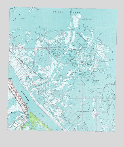
Venice, LA USGS Topographic Map
Click on map above to begin viewing in our Map Viewer.

This topographic map contains these locations and features:
Feature Name Type Latitude Longitude GNIS ID View Map
Air Logistics HeliportAirportN29.3019°W89.3745°1632995View Map
Alexis BayBayN29.3205°W89.3376°532106View Map
Baptiste Collette BayouChannelN29.2969°W89.3387°532309View Map
Benneys BayBayN29.2847°W89.3390°532942View Map
Block 47 Oil and Gas FieldOilfieldN29.3649°W89.2859°533220View Map
Buras BayouGutN29.2580°W89.2828°533549View Map
Carencro BayBayN29.3449°W89.3645°533763View Map
Chevron USA Incorporated Seaplane BaseAirportN29.2605°W89.3548°1632971View Map
Coast Guard Station VeniceMilitaryN29.2555°W89.3561°2512146View Map
Conoco Incorporated Venice HeliportAirportN29.2594°W89.3551°1632977View Map
Cronin Mobile Home ParkPopulated PlaceN29.2738°W89.3565°2600828View Map
Denesse PassBayN29.3115°W89.3084°534501View Map
Emeline PassBayN29.3140°W89.2919°534818View Map
Era Helicopters Venice Base HeliportAirportN29.2874°W89.3678°1632983View Map
Full Gospel ChurchChurchN29.2649°W89.3606°535138View Map
Grand BayBayN29.3672°W89.3695°535305View Map
Grand Bay Oil FieldOilfieldN29.3286°W89.3067°535306View Map
Grand Bay Receiving Station HeliportAirportN29.3124°W89.2906°1632973View Map
Grand Bay Seaplane BaseAirportN29.3119°W89.2917°1632991View Map
Jack BayBayN29.3697°W89.3470°535972View Map
Kimbel PassBayN29.3242°W89.2981°536187View Map
Lookout PassBayN29.3371°W89.2965°536727View Map
Main PassBayN29.3277°W89.3124°536855View Map
Marathon Venice HeliportAirportN29.2861°W89.3639°1632984View Map
OrchardPopulated PlaceN29.2688°W89.3545°543558View Map
Phi Venice HeliportAirportN29.2669°W89.3417°1632975View Map
Plaquemines Parish Fire District 5 Boothville Venice Fire DepartmentBuildingN29.2805°W89.3595°2332539View Map
Shell Venice Terminal HeliportAirportN29.2708°W89.3545°1632982View Map
The JumpGapN29.2719°W89.3492°539851View Map
VenicePopulated PlaceN29.2772°W89.3548°558337View Map
Venice Census Designated PlaceCensusN29.2875°W89.3637°2583551View Map
Venice Post OfficePost OfficeN29.2822°W89.3623°1632343View Map
Wilder FlatsFlatN29.2586°W89.3126°558721View Map
Yaratich BayouGutN29.2788°W89.2542°540561View Map
Yaratich BendGutN29.2858°W89.2653°540562View Map

Note: Coordinates in the location and feature list above are referenced to NAD83 datum.


Copyright (C) 2008-2025 Ryan Niemi / Sunset Dynamics ... All Rights Reserved