TopoQuest Logo
Do you find TopoQuest useful?
Help keep TopoQuest running and adding new maps/features by donating!
Bitcoin:  19c7KJd3qBynnjoSw5npx9KScwjBe4ifkT
Litecoin:  LXs6TkuXGGXo1vDsWCkWVdjQX94eUKd6ui
Home View Maps Find Maps Find Places Resources & Links


Vermilion West, Ohio Topographic Map

USGS Map Title: Vermilion West, OH
USGS Map MRC: 41082D4
DRG (GeoTIFF) Download: o41082d4.tif


Neighboring USGS Topographic Map Quads:


  Huron, OH  
41082D5
 

  Vermilion West, OH  
41082D4
 

  Vermilion East, OH  
41082D3
 

  Milan, OH  
41082C5
 

  Berlin Heights, OH  
41082C4
 

  Kipton, OH  
41082C3


Map MRC Location:

N42°
W83°
N42°
W82°
H8 H7 H6 H5 H4 H3 H2 H1
G8 G7 G6 G5 G4 G3 G2 G1
F8 F7 F6 F5 F4 F3 F2 F1
E8 E7 E6 E5 E4 E3 E2 E1
D8 D7 D6 D5 D4 D3 D2 D1
C8 C7 C6 C5 C4 C3 C2 C1
B8 B7 B6 B5 B4 B3 B2 B1
A8 A7 A6 A5 A4 A3 A2 A1
N41°
W83°
N41°
W82°

Vermilion West, OH USGS 1:24K Topographic Map Preview:
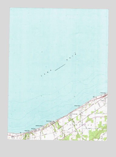
Vermilion West, OH USGS Topographic Map
Click on map above to begin viewing in our Map Viewer.

This topographic map contains these locations and features:
Feature Name Type Latitude Longitude GNIS ID View Map
Ashmont (historical)Populated PlaceN41.3762°W82.4399°1049989View Map
Ashmont Post Office (historical)Post OfficeN41.3764°W82.4402°1984048View Map
Beulah BeachPopulated PlaceN41.3920°W82.4421°1048520View Map
Beulah Beach Census Designated PlaceCensusN41.3919°W82.4429°2628865View Map
Beulah Beach Post Office (historical)Post OfficeN41.3925°W82.4416°1984064View Map
Bluebird BeachPopulated PlaceN41.4187°W82.3788°1048529View Map
Ceylon JunctionLocaleN41.3781°W82.4921°1049988View Map
Chappel CreekStreamN41.3937°W82.4416°1065957View Map
Colonial VillaPopulated PlaceN41.3792°W82.4875°2514329View Map
Cranberry CreekStreamN41.3831°W82.4721°1039441View Map
Cuddleback CemeteryCemeteryN41.4064°W82.4071°1806256View Map
Darby CreekStreamN41.4125°W82.3982°1039578View Map
Darby Place Mobile Home ParkPopulated PlaceN41.4147°W82.3922°2514326View Map
Grace ChurchChurchN41.4131°W82.3904°1079950View Map
Harbourtown Mobile Home CommunityPopulated PlaceN41.3931°W82.4294°2514323View Map
Heidelberg BeachPopulated PlaceN41.3878°W82.4543°1048831View Map
MitiwangaPopulated PlaceN41.3839°W82.4646°1065040View Map
Mitiwanga Census Designated PlaceCensusN41.3812°W82.4659°2628935View Map
Mitiwanga Post Office (historical)Post OfficeN41.3848°W82.4652°1926726View Map
Orchard BeachPopulated PlaceN41.4064°W82.4093°1049041View Map
Portland CourtPopulated PlaceN41.4139°W82.3944°2514335View Map
Ruggles BeachPopulated PlaceN41.3820°W82.4752°1065255View Map
Sherod CreekStreamN41.4173°W82.3882°1046201View Map
Sherod ParkParkN41.4153°W82.3885°1046202View Map
Sugar CreekStreamN41.3998°W82.4249°1046797View Map
Township of VermilionCivilN41.3838°W82.4031°1086071View Map
Vacationland Mobile Home ParkPopulated PlaceN41.3803°W82.4836°2514325View Map
Vermilion Golf CourseLocaleN41.4031°W82.4093°1049974View Map
Volunteer BayPopulated PlaceN41.3987°W82.4202°1049281View Map
Waterwood HeliportAirportN41.3892°W82.4502°1083079View Map
Willoway NurseryBuildingN41.3817°W82.4647°2651855View Map

Note: Coordinates in the location and feature list above are referenced to NAD83 datum.


Copyright (C) 2008-2025 Ryan Niemi / Sunset Dynamics ... All Rights Reserved