TopoQuest Logo
Do you find TopoQuest useful?
Help keep TopoQuest running and adding new maps/features by donating!
Bitcoin:  19c7KJd3qBynnjoSw5npx9KScwjBe4ifkT
Litecoin:  LXs6TkuXGGXo1vDsWCkWVdjQX94eUKd6ui
Home View Maps Find Maps Find Places Resources & Links


Vermillion, South Dakota Topographic Map

USGS Map Title: Vermillion, SD
USGS Map MRC: 42096G8
DRG (GeoTIFF) Download: o42096g8.tif


Neighboring USGS Topographic Map Quads:


  Gayville NE, SD  
42097H1
 

  Hub City, SD  
42096H8
 

  Alsen, SD  
42096H7
 

  Meckling, SD  
42097G1
 

  Vermillion, SD  
42096G8
 

  Vermillion SE, SD  
42096G7
 

  Obert, NE  
42097F1
 

  Maskell, NE  
42096F8
 

  Burbank, SD  
42096F7


Map MRC Location:

N43°
W97°
N43°
W96°
H8 H7 H6 H5 H4 H3 H2 H1
G8 G7 G6 G5 G4 G3 G2 G1
F8 F7 F6 F5 F4 F3 F2 F1
E8 E7 E6 E5 E4 E3 E2 E1
D8 D7 D6 D5 D4 D3 D2 D1
C8 C7 C6 C5 C4 C3 C2 C1
B8 B7 B6 B5 B4 B3 B2 B1
A8 A7 A6 A5 A4 A3 A2 A1
N42°
W97°
N42°
W96°

Vermillion, SD USGS 1:24K Topographic Map Preview:
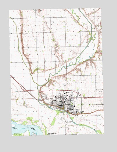
Vermillion, SD USGS Topographic Map
Click on map above to begin viewing in our Map Viewer.

This topographic map contains these locations and features:
Feature Name Type Latitude Longitude GNIS ID View Map
Aalfs AuditoriumBuildingN42.7832°W96.9245°2727130View Map
Akeley-Lawrence Science CenterSchoolN42.7842°W96.9288°2727114View Map
Al Neuharth Media CenterSchoolN42.7859°W96.9287°2727106View Map
Arts and Sciences BuildingSchoolN42.7829°W96.9229°2727127View Map
Austin SchoolSchoolN42.7831°W96.9356°1253730View Map
Beacom HallSchoolN42.7853°W96.9275°2727107View Map
Beede HallBuildingN42.7871°W96.9208°2727103View Map
Belbas CenterSchoolN42.7842°W96.9252°2727118View Map
Bluff View CemeteryCemeteryN42.7714°W96.9056°1253983View Map
Brookman HallBuildingN42.7831°W96.9286°2727134View Map
Burgess HallBuildingN42.7846°W96.9222°2727125View Map
Burr HouseSchoolN42.7869°W96.9240°2727099View Map
Busy Bend School (historical)SchoolN42.7833°W96.9698°1264492View Map
Center for Disabilities BuildingSchoolN42.7844°W96.9238°2727120View Map
Center Point SchoolSchoolN42.8667°W96.8792°1265151View Map
Churchill-Haines LaboratorySchoolN42.7847°W96.9266°2727113View Map
City of VermillionCivilN42.7825°W96.9244°1267613View Map
Clay County CourthouseBuildingN42.7800°W96.9358°2712626View Map
Clay County JailBuildingN42.7799°W96.9358°2755653View Map
Clay County Sheriff's OfficeBuildingN42.7799°W96.9358°2755618View Map
Clay Creek CemeteryCemeteryN42.8515°W96.9790°1265159View Map
Cook HouseSchoolN42.7823°W96.9226°2727128View Map
Coyote VillageBuildingN42.7889°W96.9259°2727094View Map
Cypress CourtsBuildingN42.7851°W96.9223°2727112View Map
Dakota HallSchoolN42.7840°W96.9228°2727122View Map
DakotaDomeLocaleN42.7912°W96.9280°2727087View Map
Danforth ChapelChurchN42.7841°W96.9257°2727117View Map
Davidson BuildingSchoolN42.7847°W96.9253°2727116View Map
Delzell Education CenterSchoolN42.7854°W96.9239°2727110View Map
East HallSchoolN42.7836°W96.9233°2727123View Map
Harold Davidson FieldAirportN42.7643°W96.9289°1259791View Map
I D Weeks LibraryBuildingN42.7853°W96.9257°2723783View Map
Jolly Elementary SchoolSchoolN42.7764°W96.9237°1265841View Map
Julian HallBuildingN42.7836°W96.9286°2727133View Map
KUSD-AM (Vermillion)TowerN42.7981°W96.9278°1259292View Map
Lee Medical BuildingSchoolN42.7821°W96.9280°2727136View Map
McFadden HallBuildingN42.7883°W96.9253°2727098View Map
McKusick Technology CenterSchoolN42.7831°W96.9228°2727126View Map
Mickelson HallBuildingN42.7873°W96.9218°2727101View Map
Muenster University CenterSchoolN42.7863°W96.9257°2727108View Map
National Music MuseumBuildingN42.7829°W96.9264°2727131View Map
Native American Cultural CenterSchoolN42.7824°W96.9255°2727132View Map
North Alabama Bend (historical)BendN42.7542°W96.9753°1263488View Map
Norton HallBuildingN42.7841°W96.9222°2727124View Map
Noteboom HallSchoolN42.7844°W96.9230°2727121View Map
Nygaard FieldLocaleN42.7911°W96.9216°2727138View Map
Old Main BuildingSchoolN42.7839°W96.9244°2727119View Map
Olson HallBuildingN42.7878°W96.9218°2727100View Map
Pardee LaboratorySchoolN42.7840°W96.9265°2727115View Map
Patterson HallSchoolN42.7863°W96.9234°2727109View Map
Prairie Bell SchoolSchoolN42.8236°W96.9634°1257192View Map
Prentis ParkParkN42.7808°W96.9181°1257224View Map
Redwood CourtsBuildingN42.7858°W96.9223°2727111View Map
Richardson HallBuildingN42.7879°W96.9208°2727102View Map
Saint Agnes Calvary CemeteryCemeteryN42.7715°W96.9074°2773624View Map
Saint Agnes Elementary SchoolSchoolN42.7749°W96.9179°1257558View Map
Sanford Hospital VermillionHospitalN42.7787°W96.9193°2610954View Map
Sanford School of MedicineSchoolN42.7821°W96.9280°2727137View Map
Slagle HallSchoolN42.7832°W96.9245°2727129View Map
South Dakota Union BuildingSchoolN42.7829°W96.9273°2727135View Map
Spirit MoundSummitN42.8745°W96.9589°1265382View Map
Spirit Mound CreekStreamN42.8131°W96.9348°2059142View Map
Township of Spirit MoundCivilN42.8663°W96.9835°1269087View Map
Township of VermillionCivilN42.7784°W96.9533°1269086View Map
University of South DakotaSchoolN42.7847°W96.9242°1258714View Map
University of South Dakota Law SchoolSchoolN42.7863°W96.9276°2727105View Map
University of South Dakota Police DepartmentBuildingN42.7847°W96.9252°2755614View Map
University of South Dakota Wellness CenterBuildingN42.7900°W96.9232°2727095View Map
VermillionPopulated PlaceN42.7794°W96.9292°1258745View Map
Vermillion / Clay County Ambulance ServiceBuildingN42.7881°W96.9297°2658990View Map
Vermillion City HallBuildingN42.7803°W96.9314°2725314View Map
Vermillion Fire Department Station 1BuildingN42.7881°W96.9295°2580905View Map
Vermillion Fire Department Station 2BuildingN42.7803°W96.9311°2580649View Map
Vermillion High SchoolSchoolN42.7783°W96.9145°2729720View Map
Vermillion Middle SchoolSchoolN42.7844°W96.9402°2729723View Map
Vermillion Police DepartmentBuildingN42.7800°W96.9361°2755486View Map
Vermillion Post OfficePost OfficeN42.7786°W96.9319°2712001View Map
Vermillion Public LibraryBuildingN42.7786°W96.9304°2723784View Map
W H Over MuseumBuildingN42.7918°W96.9251°2727088View Map
W H Over Museum LibraryBuildingN42.7918°W96.9251°2723785View Map
Wagner CenterSchoolN42.7916°W96.9304°2727104View Map
Warren M Lee Center for the Fine ArtsSchoolN42.7888°W96.9233°2727097View Map
West Paint School (historical)SchoolN42.8597°W96.9212°1264467View Map

Note: Coordinates in the location and feature list above are referenced to NAD83 datum.


Copyright (C) 2008-2024 Ryan Niemi / Sunset Dynamics ... All Rights Reserved