TopoQuest Logo
Do you find TopoQuest useful?
Help keep TopoQuest running and adding new maps/features by donating!
Bitcoin:  19c7KJd3qBynnjoSw5npx9KScwjBe4ifkT
Litecoin:  LXs6TkuXGGXo1vDsWCkWVdjQX94eUKd6ui
Home View Maps Find Maps Find Places Resources & Links


Vermillion Mesa, Colorado Topographic Map

USGS Map Title: Vermillion Mesa, CO
USGS Map MRC: 40108F6
DRG (GeoTIFF) Download: o40108f6.tif


Neighboring USGS Topographic Map Quads:


  Big Joe Basin, CO  
40108G7
 

  Irish Canyon, CO  
40108G6
 

  G Spring, CO  
40108G5
 

  Jack Springs, CO  
40108F7
 

  Vermillion Mesa, CO  
40108F6
 

  Sheephead Basin, CO  
40108F5
 

  Zenobia Peak, CO  
40108E7
 

  Greystone, CO  
40108E6
 

  Limestone Hill, CO  
40108E5


Map MRC Location:

N41°
W109°
N41°
W108°
H8 H7 H6 H5 H4 H3 H2 H1
G8 G7 G6 G5 G4 G3 G2 G1
F8 F7 F6 F5 F4 F3 F2 F1
E8 E7 E6 E5 E4 E3 E2 E1
D8 D7 D6 D5 D4 D3 D2 D1
C8 C7 C6 C5 C4 C3 C2 C1
B8 B7 B6 B5 B4 B3 B2 B1
A8 A7 A6 A5 A4 A3 A2 A1
N40°
W109°
N40°
W108°

Vermillion Mesa, CO USGS 1:24K Topographic Map Preview:
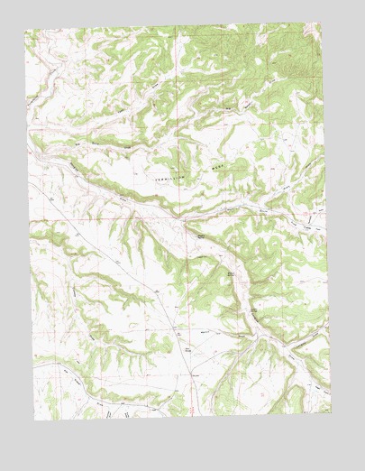
Vermillion Mesa, CO USGS Topographic Map
Click on map above to begin viewing in our Map Viewer.

This topographic map contains these locations and features:
Feature Name Type Latitude Longitude GNIS ID View Map
Big Bend DrawValleyN40.7108°W108.7469°170582View Map
Dry KnobSummitN40.6464°W108.6871°170568View Map
Hartman DrawValleyN40.6839°W108.6349°170574View Map
Hefley CabinLocaleN40.6858°W108.6409°171689View Map
Hughes CemeteryCemeteryN40.6761°W108.6809°170578View Map
Hughes FlatFlatN40.6841°W108.6318°170573View Map
Hughes SpringSpringN40.6827°W108.6807°170577View Map
Kraft DrawValleyN40.6914°W108.6547°170575View Map
Kurth DrawValleyN40.6283°W108.7119°170569View Map
Langley DrawValleyN40.6470°W108.6461°170566View Map
Loomis SpringSpringN40.6586°W108.6587°170571View Map
Martin DrawValleyN40.6537°W108.6560°170567View Map
Sager DrawValleyN40.6344°W108.6336°170565View Map
Talamantes CreekStreamN40.7275°W108.6682°169704View Map
Teds DrawValleyN40.7187°W108.7496°170581View Map
Thomas DrawValleyN40.6285°W108.7190°170570View Map
Vermillion MesaSummitN40.7014°W108.6826°170579View Map
West Boone DrawValleyN40.6868°W108.6917°170576View Map
Willow SpringSpringN40.6700°W108.6648°170572View Map

Note: Coordinates in the location and feature list above are referenced to NAD83 datum.


Copyright (C) 2008-2025 Ryan Niemi / Sunset Dynamics ... All Rights Reserved